Yoho National Park, Monday, 17-Jul
The whole day consisted of one hike. One long, steep hike. A bookend for our long, steep hike at Glacier National Park.
Having done our shorter hike the previous day, we were going to tackle the Iceline Trail. Our plan was to go up, get as near to the summit as we could, then return via the same route. Our plan.
The trail description said to park on the street near the hostel, but we completely missed seeing where the hostel was and ended up in the parking lot. We got ready, then started down towards the hostel (about ½ mile). Along the way, we saw some pretty good views of Takakkaw Falls.
We found the trailhead and started on a short stretch which would be the last level part of the trail we would see in a long time. The beginning is a long series of switchbacks which takes you up The President mountain, gaining about 1,700 feet in the first two miles. It actually wasn't too bad, since it was early in the hike, the weather was cool, and we were in the shade of the trees. On the way up, we got better views of Takakkaw Falls, other than the haze from fire smoke. It didn't take long before we were even with the top of the falls, then above.
There trail wasn't crowded, but we saw a good number of people. Mostly, they were passing us, since most were 20–30 years younger than we are (that's our story, and we're sticking to it).
We got above the tree line pretty quickly, but even though there was no cover, we were still not too warm. We saw a couple who were backpacking for a couple nights (perhaps staying in huts which are scattered around). The trail then became rocky, as if a field of scree had a part of it flattened into switchbacks so you could walk on it. It wasn't particularly difficult to hike on as long as you didn't rush.
We came upon a woman who was taking pictures, and she said that she had done the trail several years before, and was trying it again. She was staying at the hostel, and someone told her that the bridge was out, but you could still get across the river since it was ankle-to-knee deep. Even so, she was going to go past the summit and do a loop, but we were still thinking of turning around at the summit; by the time we got to that point, the two choices would be about the same amount of time. When we started up again, she suggested that we go ahead, saying she's part of a group of hikers who call themselves the Slow but Steady group. And indeed, we were going at a slightly quicker clip.
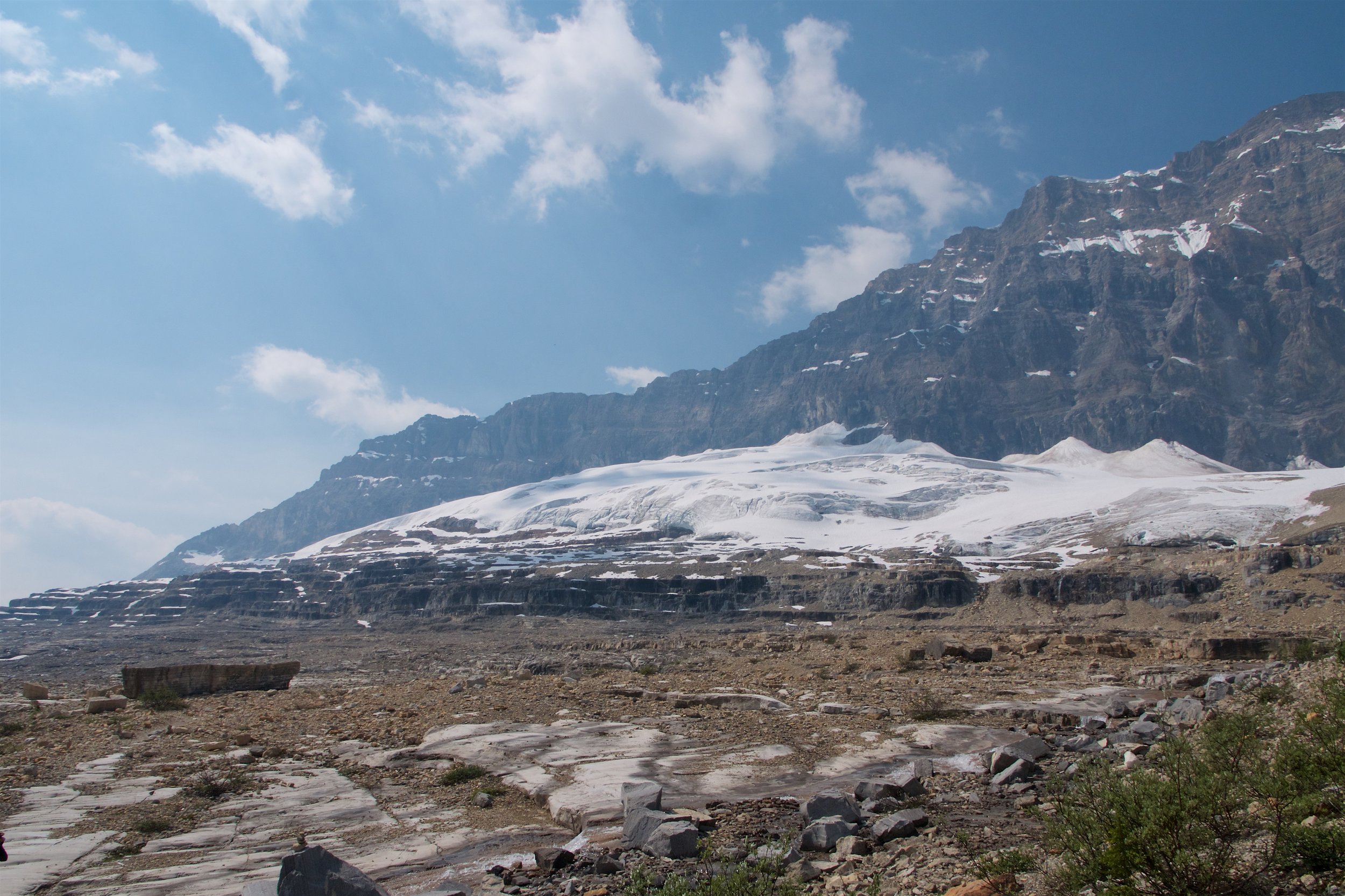
The scree turned into big, broken pieces of slate and other rock. The trail was hard to make out (but easier when we looked back to make sure we could find it), and there were several places we wandered off by a few feet, only to find it again. As we got near the summit, we saw the Celeste Lake Connector trail was closed due to a bridge washout (we had heard about that from the Visitor Information Centre), but knew we were close to the summit. A group of hikers were approaching from the other direction, so we asked about the trail and river, and they said there were no difficulties, but the Celeste Bridge was definitely not something you wanted to go on. We had heard going down the back way isn't as steep and an easier walk, so we made a spot decision to go that way instead of going back down the way we climbed.
As we got to the summit part of the trail, we saw that there was another trail that went up to the true summit. We passed on doing that segment, but went a few feet and had our lunch. It had been pretty windy for the previous half hour or so, but we found a place which wasn't so bad.
The next part of the hike took us over and between several glacial moraines, and we saw several small pools and patches of snow. We even needed to walk through some snow patches. We then started down, and before we knew it, we were back among trees.
Going down was indeed pretty gentle and the trail was in great condition, and we came up to the Stanley Mitchell Hut, where we rested and had some snacks. We also went across a couple bridges which were broken in the middle, but we could still use them.
A little further along, we came to where the Celeste Lake Connector rejoined the Iceline Trail, and it was easy to see the washed-out bridge. Quite dramatic.
Another mile or so down the path we made a turn back to the parking lot. Just after that we came to Laughing Falls, which was smaller than Takakkaw Falls, but we were much closer to it. As we started up again, we saw a guy who had passed us a couple times, wondering which way the trail went. Looking at the live map, it seemed we needed to cross the picture, going a bit up to a path which followed the river; he wasn't thrilled about doing any more uphill walking.
A bit further and we ran saw the Slow but Steady woman ahead on the trail. We looked at each other, figuring perhaps she had tried the Celeste Lake Connector. Indeed she did, and since the washed-out bridge is at the end of the connector, she didn't want to go all the way back. She went upstream a couple hundred yards and just forded the stream, but it was pretty deep (at least to her knees, if not deeper).
The rest of the hike was practically level, which was a good way to cool down after all the up and down. We new we were close when we started to see Takakkaw Falls again. When we were done, had hiked for about 7½ hours, and went a bit over 13 miles. Back into the car for the hour-long drive to the hostel. We were originally thinking of looking at the spiral train tunnel, but we were ready to head back.
We knew that once we got to the hostel, we wouldn't want to leave, so we stopped by the grocery store on the way back to get a few items. Then we went to the hostel, had dinner, cleaned up, and expended as little energy as possible for the rest of the evening.