Hikes - Sep/Oct 2020
We did a lot of hiking in September and October, with all but Snow Lake on a trip we took to the Mt. Baker area and Leavenworth. I only tracked the larger hikes, which is why there isn't distance/gain data or graphs for the short ones.
The hiking track tracks my heart rate, so the closer to red, the higher my pulse. The graph shows our altitude (the top one) and our pace (the bottom line). It also shows both distance (white numbers at the bottom) and where we were at the various hour markers (black numbers at the top).
I've added a bit of my normal travel commentary to some of the hikes.
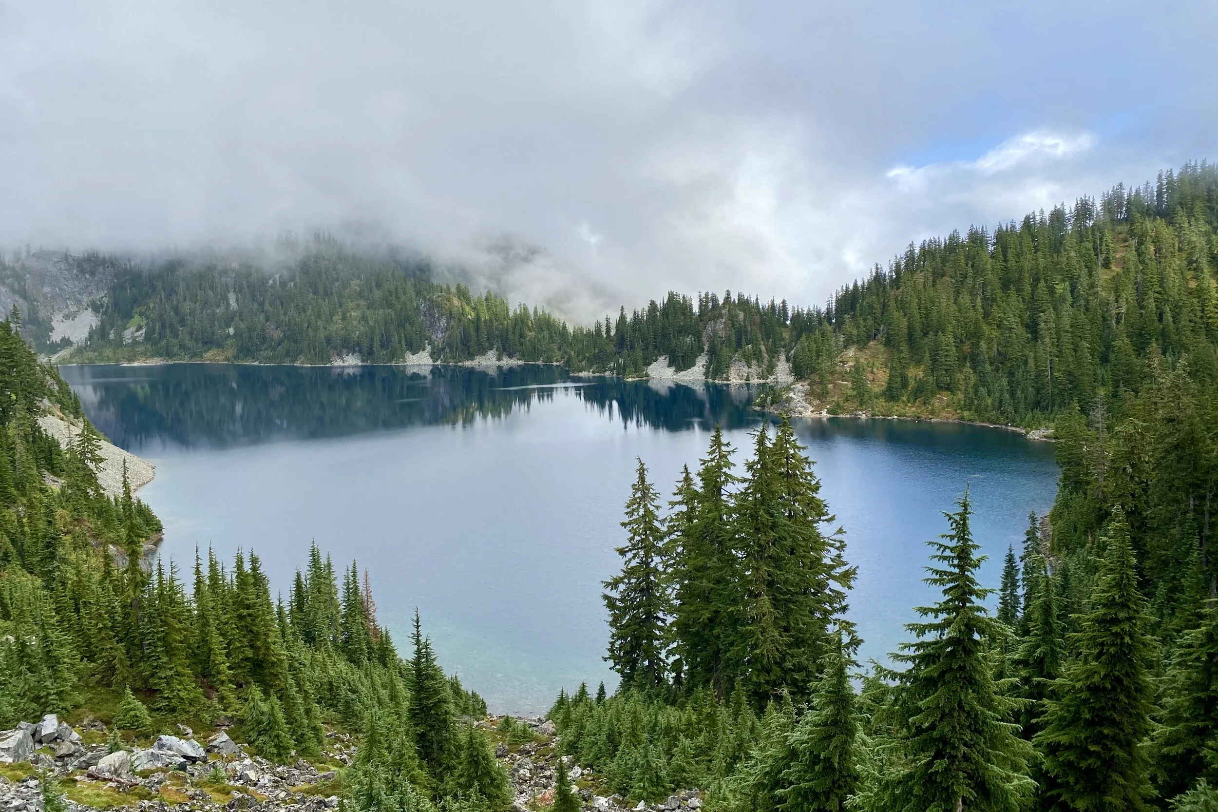
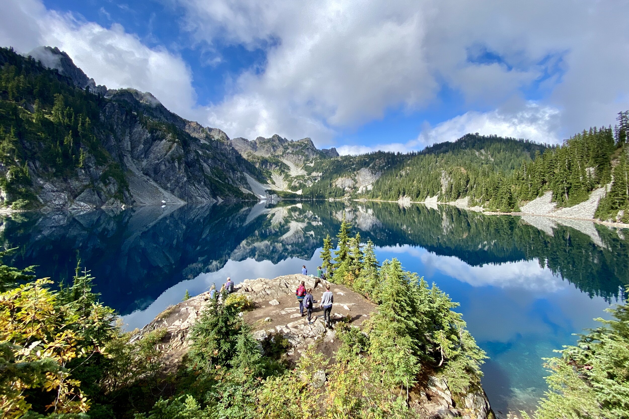
Snow Lake
Snow Lake—20-Sep-2020, 7.7 mi, 1,850 ft gain
Unlike Lake Serene where it gets steep and you go up stairs at the last push before the lake, Snow Lake gives you stairs in the beginning. That's the steepest part of the trail, which does continue to climb up to a saddle before descending about 400 feet to the lake. Fortunately, there was a bit of fog when we started out, so that helped keep us cool. There were also several huckleberries available for snacking.
At first, the water seems impossibly far down; we saw what looked like a narrow log over Rock Creek pretty far down, but as it ended up, it wasn't too difficult to get down, and the crossing wasn't as narrow when we actually got to it. We heard a waterfall, but the creek is where the lake drains, so the waterfall was pointing away from us; we couldn't get a look at it from above, either.
Several people were hanging out around the lake, but we had to only go a bit further (away from the lake for a bit then around a large mound before turning back to the shore) to find a spot to ourselves with a great view. The water was quite still, so the formations on the opposite shore made such perfect reflections they looked like a kaleidoscope.
Since we had come down quite a ways to get to the water, we had to go back up before making our descent back to the car.


Horseshoe Bend
Horseshoe Bend—28-Sep-2020, 3.7 mi, 640 ft gain
After having driven to the Mt. Baker area from Seattle, we were looking for a relatively short hike to stretch our legs. Settling on the Horseshoe Bend trail, we parked in the small lot on the Mt. Baker Highway and started out. We decided to use boots but opted to not take our poles, thinking there wouldn't be much up/down.
We were immediately next to the North Fork Nooksack River, and while the trail strayed inland a bit here and there, we were never very far from the water. The trail was a bit muddier and had steeper sections than we anticipated, but we still managed.
We didn't know what to expect when we got to the bend, but it ended up we were pretty high up with a lot of trees around us, so we couldn't get a good visual overview of the actual bend, although it was pretty easy to look at the river on either side of the horseshoe. We went down to the water and could see the center part of the horseshoe.
After making our way back to the car, we checked into our room, one of those tiny houses. The owner was quite chatty and seemed to approve of our hiking plans. She also offered a bunch of other things on the property we could do, but we guessed we would be too tired to do much of anything after hiking. We then got dinner and groceries; since we were driving, we took a lot of what we would need for a couple of days' worth of breakfast, as well as hiking food (normally we would need to shop for the entire breakfast).


Ptarmigan Ridge
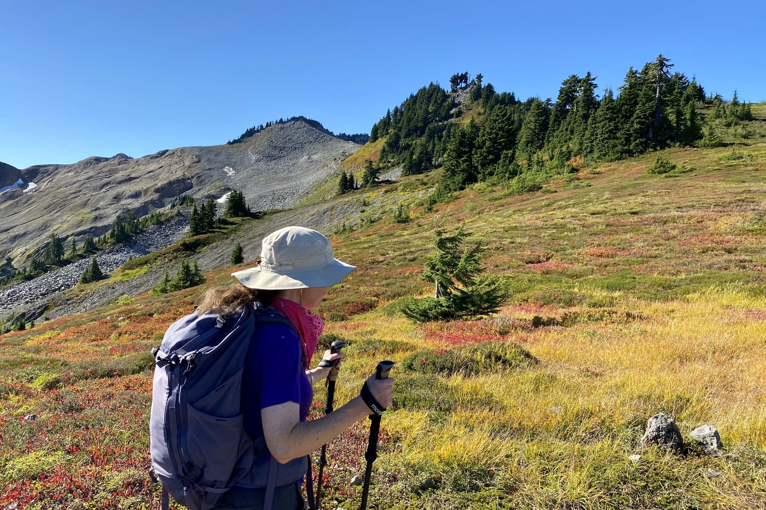
Ptarmigan Ridge—29-Sep-2020, 7.9 mi, 1,530 ft gain
The Ptarmigan Ridge hike starts at Artist Point at the end of Mt. Baker Road, so we headed up the windy road. When we got to Heather Meadows, there was a sign saying that the restrooms at the top weren't open, so we quickly pulled into the parking lot for the last open facilities. Right next to the parking lot is a pond which had great reflections, which was a nice treat.
There were plenty of parking spots once we got to Artist Point, which was nice. After getting our gear together, we found the trailhead and started out. Most of the first mile is along a slope above Rainbow Valley. Fall colors were out in full force, and looking up we got great views of Mt. Baker. We could also make out Coleman Pinnacle, which was going to be our destination.
After the first mile, we passed the junction where the Chain Lakes Trail goes in another direction, while we continued towards the ridge. Parts of the trail were a bit hard to find, but we eventually got going in the right direction and quickly lost a couple hundred feet of elevation. Not to worry, the trail got pretty steep after that, then became more reasonable. We ran into a couple other spots where the trail was hard to find, but it helped that there were several other people. Combined with the electronic map, we figured out which way we were supposed to go.
We ended up having lunch on a ridge which gave us a full view of Mt. Baker in front of us and Mt. Shuksan behind us.
Well-fed, we made the last push and before long we were at Coleman Pinnacle. After crossing a snow patch we were treated with a full view of Mt. Baker. The trail continued, but we figured it was a good point to turn around before it got really steep and narrow.
Even though the trail was mostly exposed and the day was clear, we didn't find ourselves getting too hot. We finished up our water about a quarter-mile from the car since we knew there was another bottle waiting for us.


Artist Point
Artist Point— 30-Sep-2020
Since we had done a major hike the day before, we decided to do a few smaller trails. The first started at Artist Point, so we made our way back up to the same parking lot, which was less crowded than the day before.
Even though our hike to Ptarmigan Ridge was under clear skies, smoke had rolled in overnight, presumably from the California fires. At least it was high enough up that it didn't impact the air quality, but it did reduce visibility. We could tell right away since Mt. Baker was relatively difficult to make out.
The trail went along a ridge out to Huntoon Point, where we got great views of Mt. Shuksan, even though it was hidden behind haze. There were surprisingly few people out there with us so we had undisturbed views. On the way back, we were able to make out the trail above Rainbow Valley and the snow patch we probably crossed at the base of Coleman Pinnacle. Looking at most of our hike made it seem impossibly far.


Fire and Ice Trail
Fire and Ice Trail—30-Sep-2020
We went back down to Heather Meadows to do the Fire and Ice Trail. There was a vacuum truck servicing the restrooms near the visitor center, so we quickly made our way down to the trail.
The trail takes its name from the signs which describe how the area was shaped by volcanic activity and glaciers. We got views of Upper and Lower Bagley Lakes, as well as part of the trail we would end up taking the next day.
The most interesting description was about andesite, which is the volcanic rock which forms columns as it cools. It's different from columnar basalt in that the shapes aren't as regular, and are of different sizes depending on how quickly the lava cooled. Andesite is high in silica, which gives it a low melting point.
The vacuum truck was still working when we finished the trail, so we made a quick exit.


Picture Lake
Picture Lake—30-Sep-2020
Continuing to work our way down the mountain, we headed to Picture Lake. Since it was that time of day, we grabbed our lunch and started walking along the path, looking for a good spot to eat.
We had caught glimpses of the lake as we drove by the day before, and walking around, there were no bad views. There was a small pier that looked like it would be a good spot, but a couple of people had set up portable chairs right in the middle, which didn't leave much socially-distant room on the benches on the sides. We went down the path a bit more and there was plenty of room.
The way the benches were arranged, we were able to sit towards the back of the viewpoint so we didn't block the views of other people who wandered by as we were eating. We had a full view of Mt. Shuksan, and the few, small ripples in the lake made a great reflection.
After we finished our lunch, we continued walking around the lake. Most of the way around, the path went away from the lake onto the road. Since we had parked right at the start of the path, we finished the loop, then continued to our next destination.


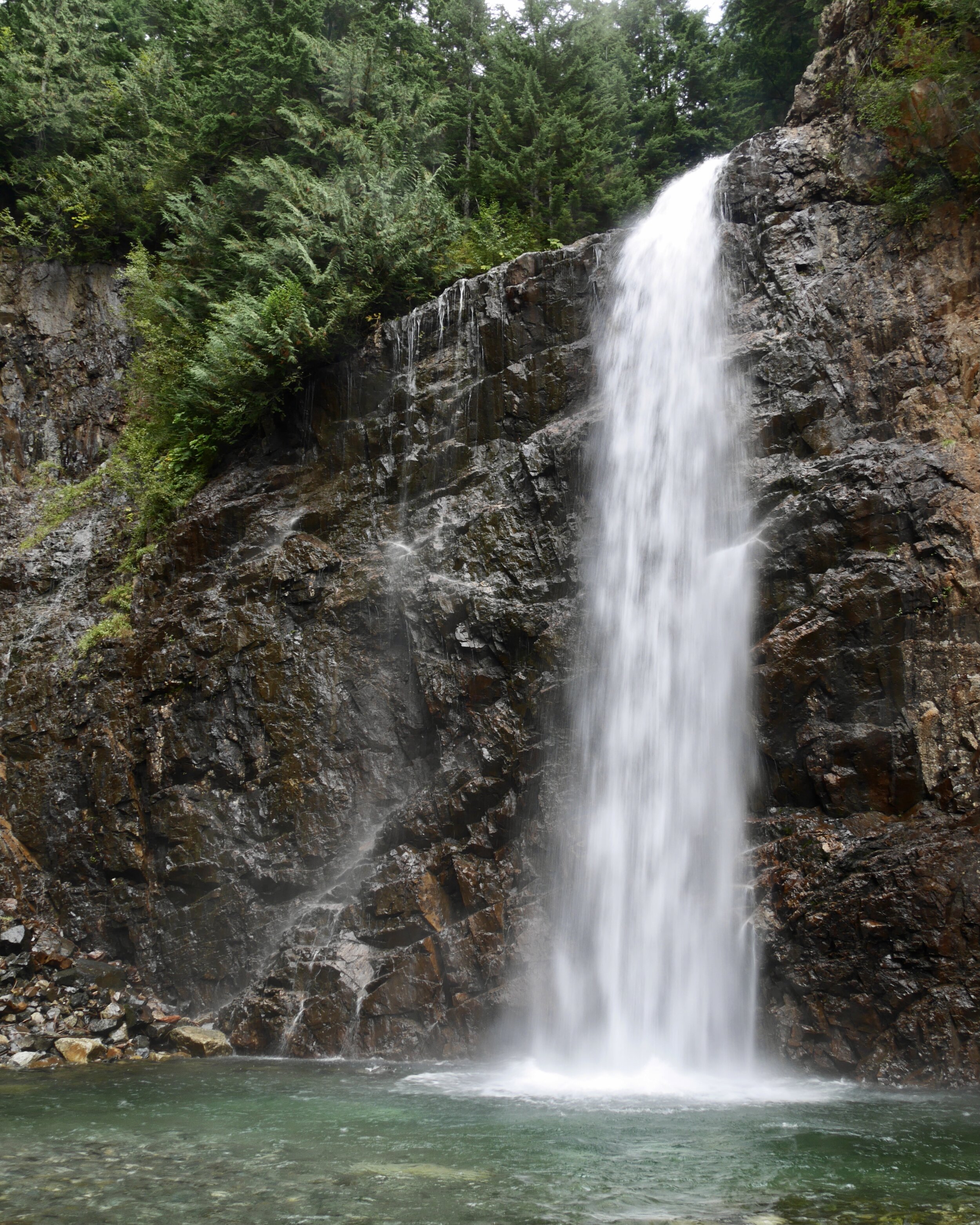
Nooksack Falls
Nooksack Falls—30-Sep-2020
We had passed our last stop of the day several times already since it's on the way to Artist Point. We had originally planned to go to Nooksack Falls after Horseshoe Bend, but the timing didn't work out. Fortunately, we had plenty of time on this day.
The falls are across the road from the parking lot, so it's not a far walk. There's a big sign with an old, fading photo of the falls. Since the rocks around the waterfall are steep, slick, and unstable, the sign warns that you won't be able to see the falls as well as in the photo.
There's a huge chain link fence marking off where you can go, but we were still able to get a pretty good view, although not quite down to the bottom. We were also able to walk around to see behind the top of the falls.
It was a quick stop, but worthwhile. A good way to cap the day.


Chain Lakes
Chain Lakes—1-Oct-2020, 7.8 mi, 1,840 ft gain
This was the most spectacular hike of our trip. Because the hike is a loop, there are several ways to do it. The most popular is probably to park at Artist Point, then do a clockwise loop by going out towards Ptarmigan Ridge, down to the chain lakes, up to Herman Saddle, down to Bagley Lakes, then up the Wild Goose Trail back to Artist Point. Another option is to do the same route but counterclockwise. We chose to start at Heather Meadows and go clockwise, which meant starting with the Wild Goose Trail and ending with Bagley Lakes.
We didn't leave particularly early, but even so, we were the first car in the Heather Meadows parking lot, at least the part near the picnic area (there were some cars in the lot down by the visitor center). Only one other car pulled in by the time we headed out.
The reason we chose our particular route was to get the steep stairs of Wild Goose Trail out of the way first. It's a bit more than ¾ of a mile with over 600 feet of gain with a lot of steep stairs. The trail is hard to find in some places, so large cairns are strategically placed to help.
Making it to Artist Point, we went onto familiar territory on the trail towards Ptarmigan Ridge. It was at this point we realized we forgot to display our pass; we were far enough along that we decided to just continue and see if they were checking for passes when we finished.
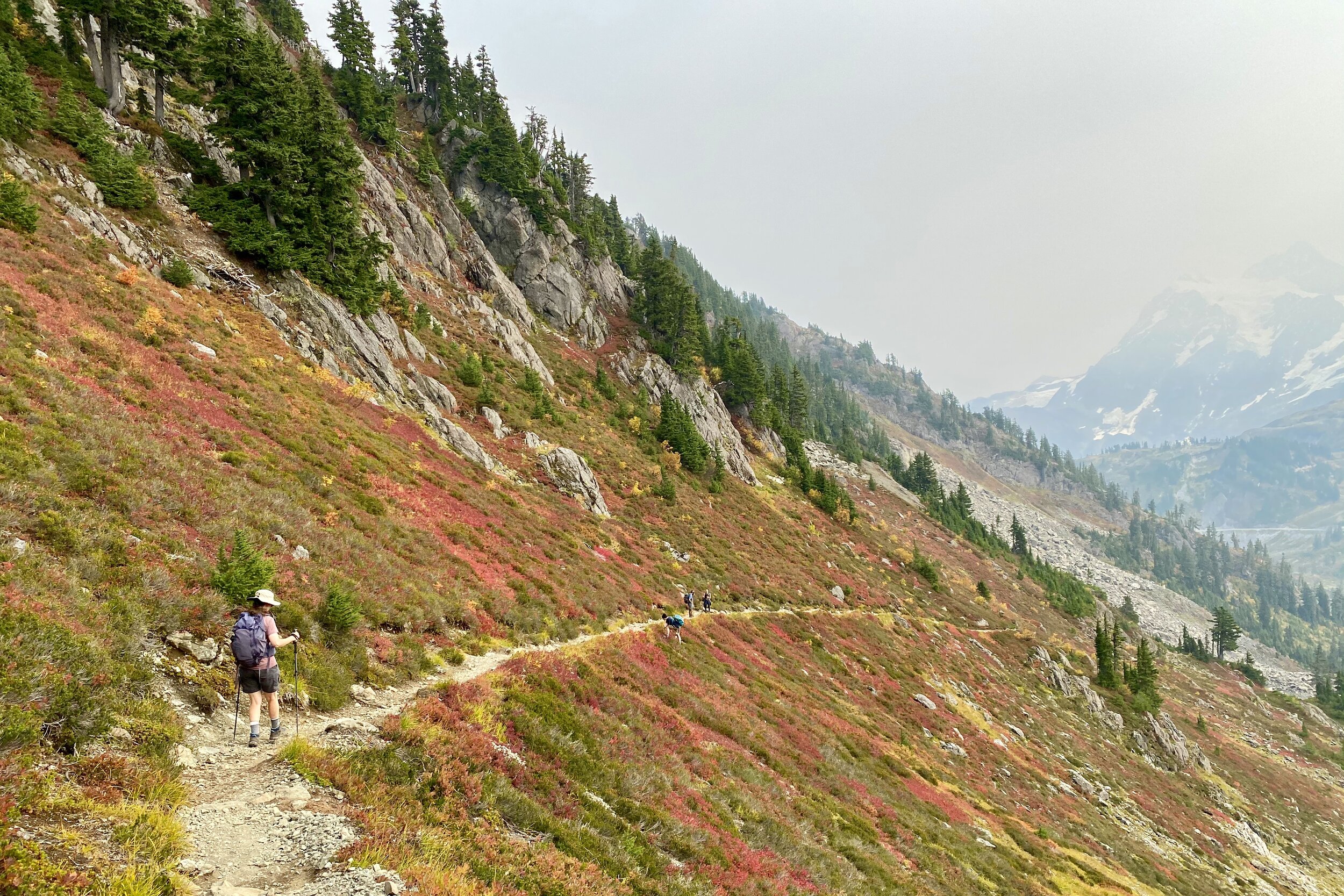
The view was different from the last time we were on that part of the trail since the smoky haze was still there. We took the turn towards the chain lakes and started losing elevation.
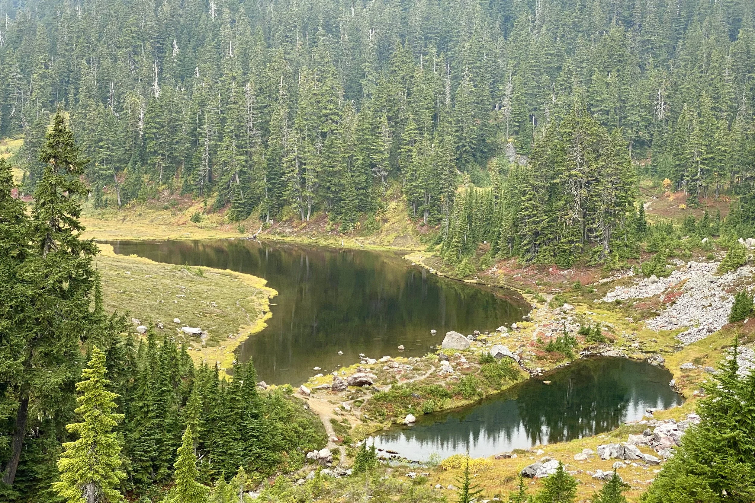
The first water we came across was Mazama Lake, which we spotted early on as we descended towards it. After a bit more climbing, we saw Iceberg Lake, the largest one we would see on the hike. The huckleberries were ripe and plentiful, so we spent quite a bit of time snacking.
Next up was Hayes Lake. It was about lunchtime, so we found a spot with a view and ate. There were more huckleberries, so we took it upon ourselves to compare them with ones earlier in the hike.
We started to climb again after lunch, making our way up to Herman Saddle. Up until the point we went across, we could still see Iceberg Lake. Just as we were leaving the lakes, we got a good look at Mt. Shuksan and started working our way down the Mazama Dome and Mt. Herman, to the tune of 1,200 feet down in about 1¼ miles. There were also huckleberries here, but because the shrubs were more exposed, they weren't as large.
After following the trail around a huge boulder field, we reached Upper Bagley Lake. We started going around it, then near the base of the lake there's a bridge which you can take to start heading back up to Heather Meadows. Instead of doing that, we followed the trail to the end of Upper Bagley Lake, along Bagley Creek, and around Lower Bagley Lake. The side we went down was like walking through a forest, while the other side looked more like a beach (complete with boardwalks). At the base of the lake is a small dam, which we crossed so we could return on the other side.
When we got back to the bridge across Upper Bagley Lake, we went onto it to take a look, then proceeded up to Heather Meadows. We made it back to the car, and fortunately, permits weren't checked while we were out. We took our good luck back to the room with us and spent the rest of the afternoon and evening recovering.


Blackbird Island
Blackbird Island Trail—2-Oct-2020
It was time to leave the tiny house and work our way to Leavenworth. As it ends up, we had a hard time getting cell data during the Mt. Baker part of the trip, and the WiFi was pretty spotty where we were staying. Probably the most solid signal was from the Heather Meadows parking lot, of all places.
Since we ended up going back to I-5 then onto Highway 2 to get to Leavenworth, we approached it from Stevens Pass. The drive was in the mountains until just about the edge of town, where the view opened up. Since we had a bunch of time before we could check into our room, we parked near downtown and had lunch and ice cream. We then worked our way to Waterfront Park and started walking along the trails.
The path almost immediately went to a bridge to Blackbird Island. We walked the length of the island along one of the trails, then crossed another bridge to the rest of the park. We found almost all the trails over there. In the middle of the trails is a huge pond which we could view from several sides by following different trails.
We crossed back to Blackbird Island, walking along the Wenatchee River. After crossing the final bridge, we continued on this part of the park, settling on a bench to relax a bit under the trees.
It was a short drive to where we were staying, a separate building in the back yard of the owner's home (the owner happened to be away that weekend). The house seems to be in a relatively new area that would fit into the Seattle suburbs. The WiFi was speedy and solid, and we had no issues with cell data, neither of which surprised us.


Colchuck Lake
Colchuck Lake—3-Oct-2020, 10.6 mi, 2,790 ft gain (8.6 mi, 2,500 ft gain from trailhead)
This was our last major hike of the trip. It was perhaps a bit ambitious to do longer hikes every other day, but since there were only three of them, we figured it would be OK.
Unlike other hikes on the trip, this one involved a few miles on an unpaved road with quite a few potholes. As we were getting close to the road, the road was packed with cars on both sides. We were hoping there was some sort of event rather than a lot of people wanting to go to the trailhead we were heading to. Fortunately, it didn't take long on the Forest Service Road before the cars were no longer densely parked.
Further along the road, someone flagged us down to warn us that there was a tow truck working on an overturned truck not much further down the road. Since a few cars had gone ahead of us, we decided to give it a shot, figuring the worst case is we turn around and find a different trail. As it ends up, by the time we got to the tow truck, they were letting cars by.
We knew there would be a lot of cars, and we went along for a while, then decided to turn around to grab the first spot we saw. After parking, we got our gear together and started going towards the trailhead. On the way, we saw a van that looked like its right front tire was completely off the road. We were wondering if they would be able to leave (looked like it was front-wheel drive) since the front bumper was just about touching the road.
After about a mile from the car, we reached the trailhead, filled out a registration form, then started on the trail.
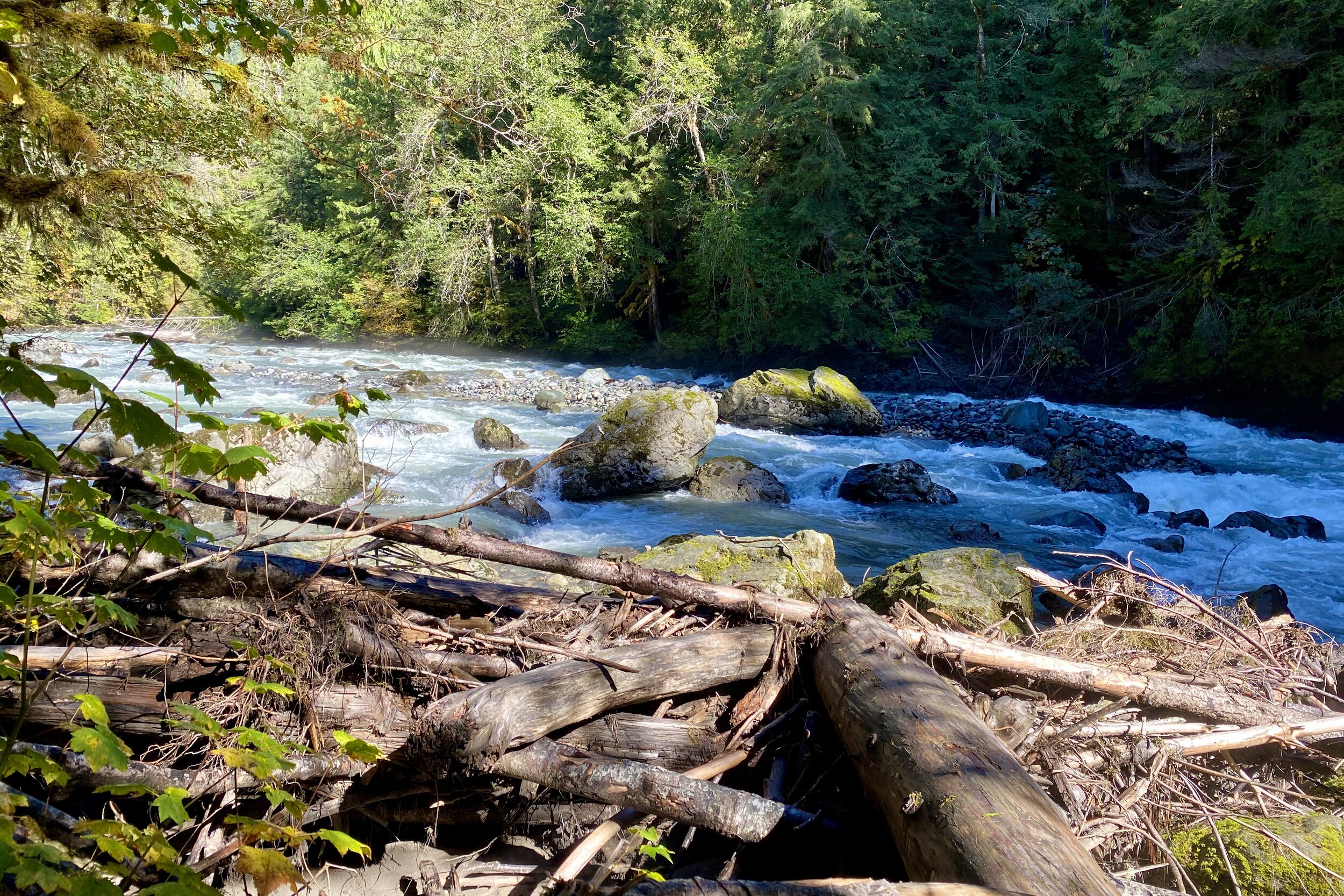
Much of the hike (as well as the road) followed Mountaineer Creek; we crossed it a couple of times on log bridges. The elevation gain was pretty steady, with a few, shorter steep parts.
We made it to the lake and joined the several people having lunch with a view of the mineral-laden water and the larches which were starting to turn golden. We decided not to continue around the lake (the trail we were on is one way to get to The Enchantments) or go down to the water but started heading back.
We saw a lot of traffic on the way up, and even more on the way down. Several people asked if they were almost there, and for a while, we were able to tell them they were. After a while, though, we had to tell them things like there being about 500 feet of gain remaining, but that it was worth it.
Getting back to the trailhead meant we still had about a mile to go before we got to the car. One advantage of having turned around is that we could just head straight out; it didn't take us long to get back to Leavenworth to clean up and think about dinner.


Wagonroad/Franklin Falls
Wagonroad Trail/Franklin Falls—4-Oct-2020, 2.6 mi, 370 ft gain
On the day we drove home, we looked for something relatively short to do. We chose Franklin Falls near North Bend. Since we had to get from Highway 2 to I-90, we decided to take Blewett Pass, which I hadn't been across before. Just past the Snoqualmie Pass summit, the eastbound and westbound lanes of I-90 divide, and in between sits a whole network of trails.
We had to go past the falls and approach the forest road from the west. Once again there seemed to be a lot of cars, so we parked and got ready to begin. Because of where we were, we decided to start with the Wagonwood Trail, which connects with the Franklin Falls Trail near the falls. We would then return on the Franklin Falls Trail, then loop back on the road to the car.
The Wagonwood Trail was pretty empty. It wasn't steep, and we were on the lookout for wheel ruts that were in the trail description; we never did see any.
When we got to the intersection with Franklin Falls Trail, several people were going in each direction, and even more at the falls. We worked our way down to the base, getting a great view.
On the way back, we expected, and saw, lots of people. Oddly enough, it felt like we lost quite a bit more elevation than we had gained, even taking into consideration we ended up a bit lower than the car. It was probably because the return trail was somewhat straight, compared to the winding trail on the way up.
We grabbed lunch in North Bend on the way home. The next day was back to work for both of us, so we were sure to relax a bit that evening.