Hikes - Nov 2020–Feb 2021
We were able to fit in one more hike in November 2020, then switched to snowshoeing starting in January. In addition to a couple of outings in the Snoqualmie Pass area, we also spent a couple of nights in the Lake Wenatchee area and got in some great snowshoe hikes there.
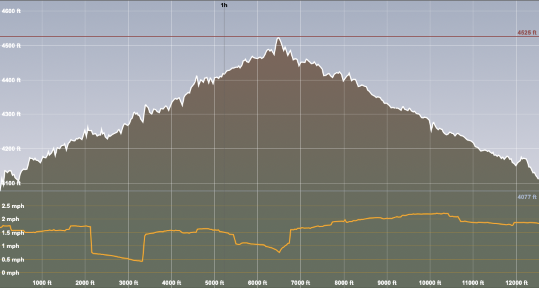
The image of the hiking track shows my heart rate, so the closer to red, the higher my pulse. The graph shows our altitude (the top one) and our pace (the bottom line). It also shows both distance (white numbers at the bottom) and where we were at the various hour markers (black numbers at the top).
Iron Goat Trail
Iron Goat Trail - 1-Nov-2020, 7.8 mi, 850 ft gain
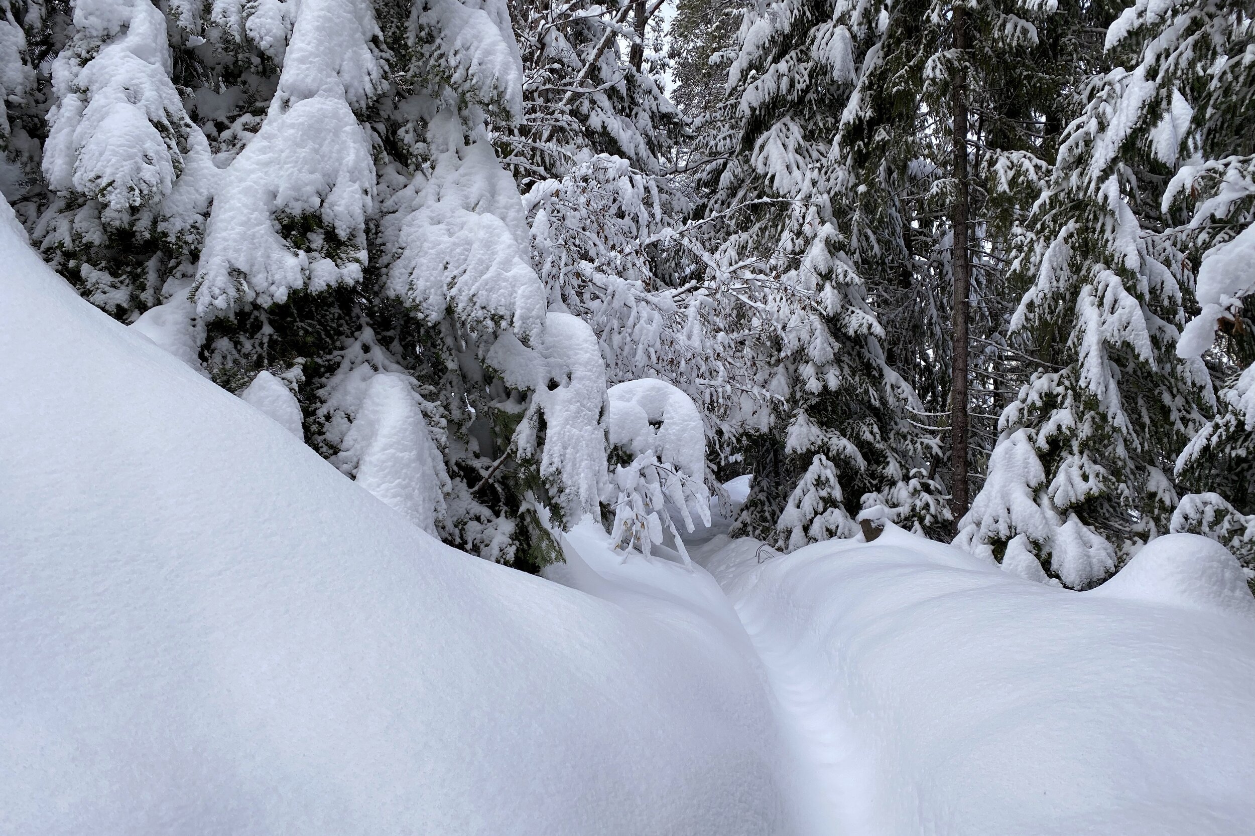
Our last hike of the season was just this side of Stevens Pass. This trail used to be part of the Great Northern Railway, which had a mountain goat featured in its logo. It's two segments of a grade that was built in the 1890s. An avalanche swept two trains off the tracks in 1910, so large snow sheds were built to protect the trains. The back walls are still in place, as are several segments of tunnels.
Instead of following the path recommended by AllTrails (which has you start at the red caboose at about the halfway point), we started at the west end. Going counter-clockwise meant we had a gentle downgrade for almost the entire hike, with a very steep (about 700 feet gain in less than half a mile) set of switchbacks going up about halfway, right by the red caboose (it takes you from the bottom of the lower segment to the top of the upper segment). At the top of the switchbacks, we stopped at the Windy Point Overlook and got a good view of the current train tracks.
We saw several tunnels and snow shed remnants on both halves of the hike, but also got a view of the top of the walls on the upper half. We even saw a couple of adits to mines, but of course, they warn people to stay out.
At the end of the hike is a trail to take you back to the lower segment. Originally, there was a big loop track on trestles, but that’s no longer around.


Lake Easton
Lake Easton - 9-Jan-2021, 4.25 mi, 185 ft gain
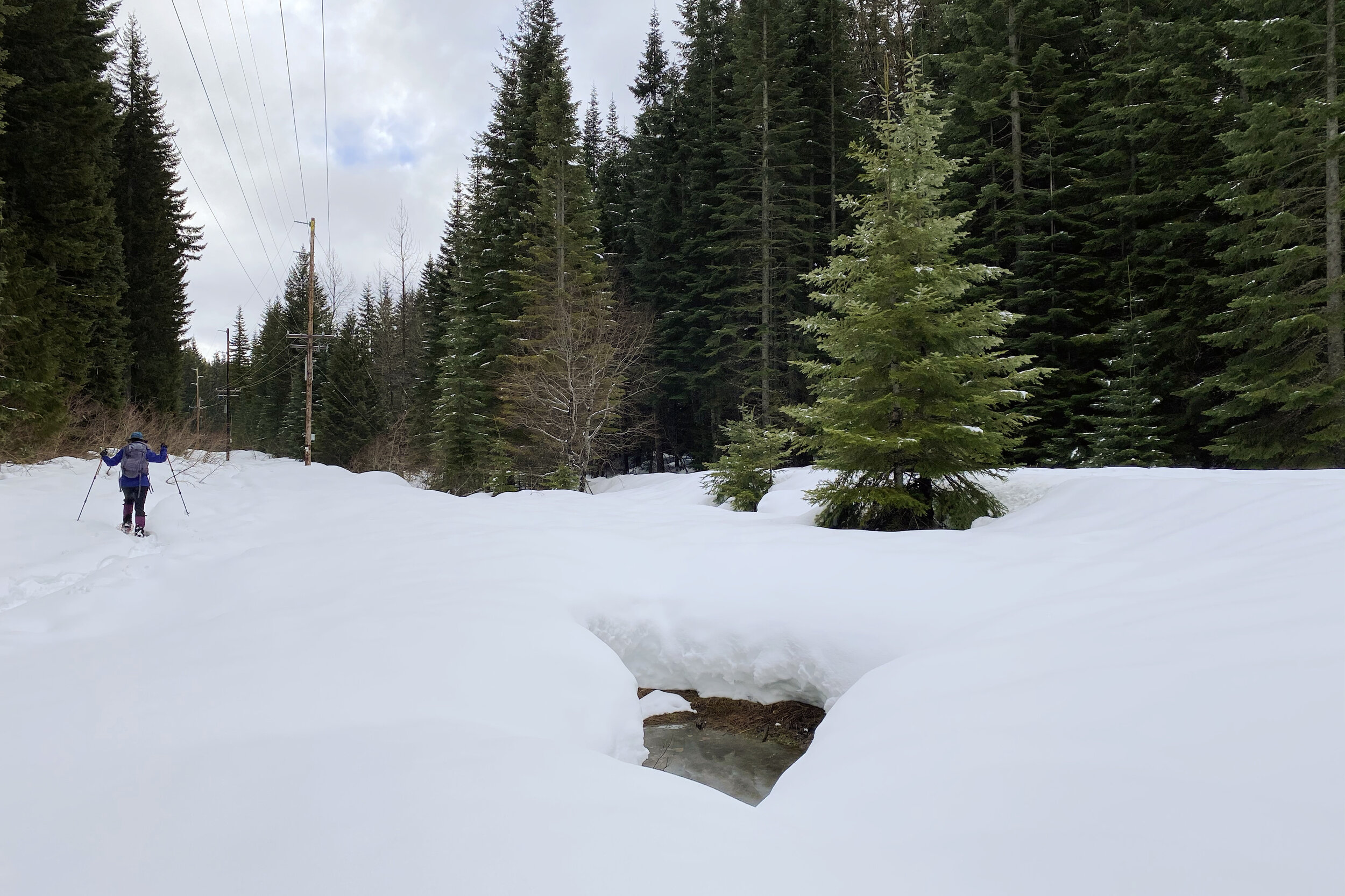
We had been hiking on weekends, and while there were a lot of people, we were always able to find a place to park. We would go on Sundays (since our Farmers Market was open on Saturdays) but ended up heading out on Saturday for snowshoeing. The plan was to go to Crystal Springs, but the lot was so full, a worker was turning people away. By the time we got to the freeway, they had put up a sign saying the lot was full. We went to the next exit to check out Cabin Creek, but that was also full. Next on the list was Lake Easton, which also had a full lot, but the overflow lot was empty. Whew.
Having secured a place to walk around, we got out the snowshoes that we had just gotten. It was a good price, but when they showed up, they were larger than what we had ordered; since there were no snowshoes on the site when I checked at that time, we figured they probably sold out. The plan was to give them a try to see if they did felt too big.
Melody had skied around Lake Easton several times, so she had a general idea of the layout. Fortunately, we had enough cell data to get a map, and we started. Since most of the people were skiing, we didn't run across a lot of traffic, which was nice. The trail was extremely level and the snow pretty packed down, so it was easy for us to go pretty far, making it to Frozen Toe Point along the Yakima River. The gate to the bridge across the river was closed, so we sat down and had lunch. While eating, we did see some people come across the bridge.
On the way out, we had explored several of the loops but chose to do the direct route on the way back. By that time, we had decided that the snowshoes were indeed a bit large, so it would good to get smaller ones.


Crystal Springs
Crystal Springs - 29-Jan-2021, 5 mi, 520 ft gain
Having learned the lesson of snowshoeing on the weekend, I took a Friday off and we targeted Crystal Springs, our original destination when we ended up at Lake Easton. There were very few cars in the parking lot when we arrived, so I guess that was a good strategy.
While we didn't have our normal trail maps, Crystal Springs did have a static map that you feed into an app that will show you where you are (presumably the app is given the coordinates and scale of the image) which worked well enough. Even so, we got turned around once or twice, even making an extra loop we didn't intend to. We got back on track and were able to hit most of the trails.
When we got to the furthest point, we looked around for a place to eat, but it didn't look like there would be enough room to stomp out a place off the trail, so we kept going until we met up with a trail groomed for cross country skiers; the side of that trail made a good place to sit down.
Unlike Lake Easton, there was a bit of up-and-down. We had gotten smaller snowshoes, which made it a bit easier to maneuver. The only downside compared to the previous pair is the lack of a heel lift (you flip it out so your feet are more level as you're going uphill), but there wasn't that much slope, so we were fine. Overall, it was a good move to switch, and as a bonus, the new ones were an even better buy than the first set.


Blewett Pass
Blewett Pass - 17-Feb-2021, 2.5 mi, 465 ft gain
We wanted to try some snowshoeing trails off of the normal Snoqualmie Pass and Stevens Pass corridors, so we planned to spend a couple of nights near Leavenworth. As the trip got closer, the weather started looking less good. We decided to postpone a couple of days and canceled our accommodations in the window where we still got a full refund.
It was a good thing we didn't leave on the original date, since the pass would have been pretty bad (it was closed the day before), and we still had a lot of snow in Seattle. We were able to book a new room, this time near Lake Wenatchee. As that date came, the pass looked like it would be fine, and it was.
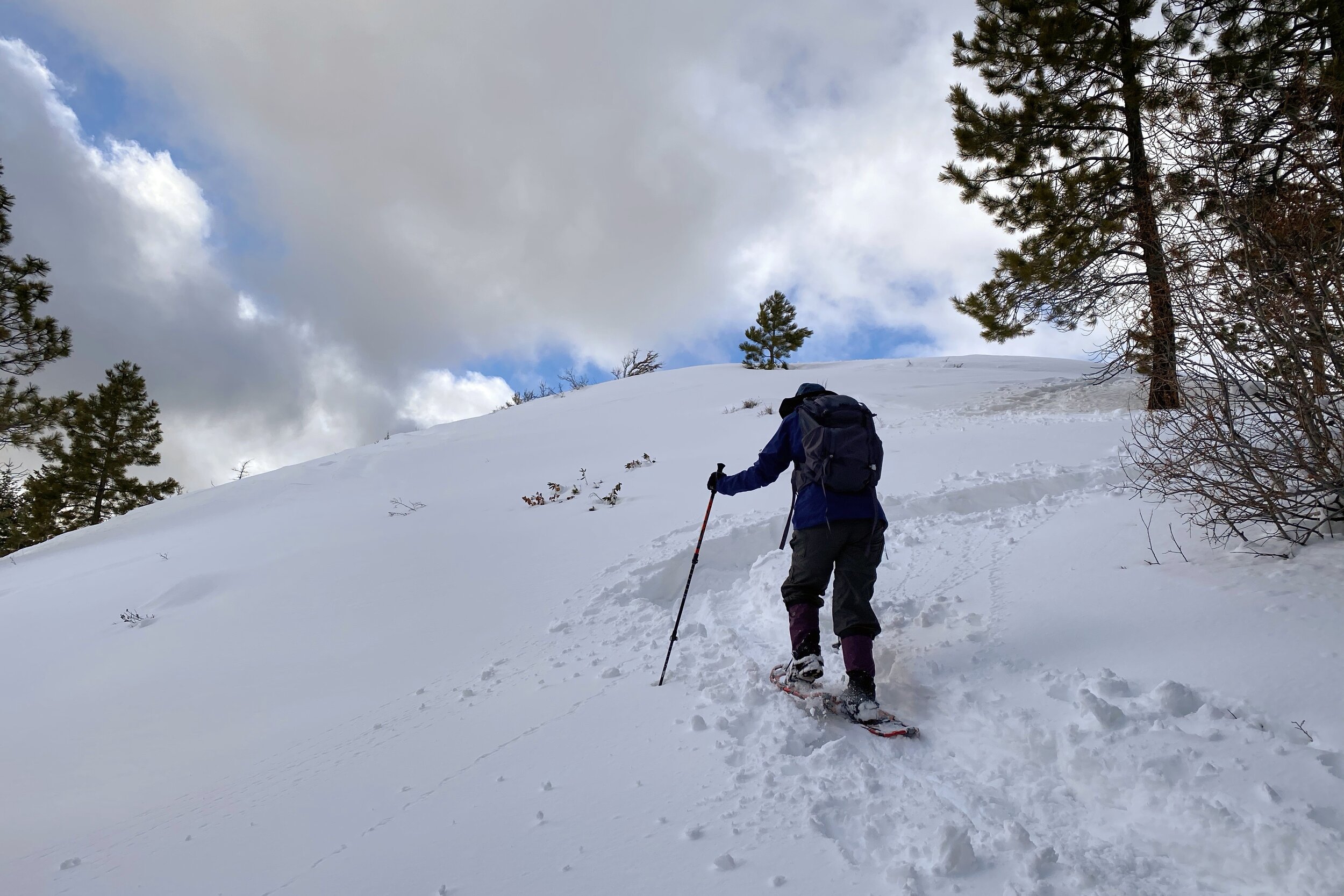
The day ended up being clear and sunny, so we went up to Blewett Pass and checked out one of the trails there. It was one that's also used by snowmobiles, but we didn't see too many as we started, figuring they had gone out earlier in the day, so would be pretty far away.
The trail was a pretty steady uphill trek, but not too steep. We saw a sign for a Discovery Trail, but checking it out, it seemed the trail was through the trees where no trail was stomped out. We followed another trail going away from the sign, and it ended up going a few dozen yards before looping back to where we were. Back to the main road.
After a while, we were able to go on trails dedicated to snowshoe traffic. The snow was nice and soft, and we only saw a couple of skiers on the way up. We found a place to sit and have lunch, then found a trail which started going up pretty steeply; we ended up on with a great view of the valley. On the way down, we started seeing the snowmobiles going back to the parking lot. There ended up being quite a few of them.
Snowshoes off and back in the car, we continued to Leavenworth to stop by the grocery store to get dinner, breakfast items, and some things for lunches. We continued up to Plain (near Lake Wenatchee) where we found our room and checked ourselves in. There was plenty of space for us to spread things out to dry, and we settled in for the night.


South Lake Wenatchee
South Lake Wenatchee - 18-Feb-2021, 2.65 mi, 155 ft gain
Since the trails on the north and south sides of Lake Wenatchee don't have direct links, we opted to split the day in two. We started on the south side of the lake, where we were the second car in the parking lot.
This hike started near Lake Wenatchee, then quickly took us to the Wenatchee River We had seen a couple of people walking down to the lake as we were starting, and as we turned to follow the Wenatchee River, we saw them again at a small dock for rentals during the summer. Since they didn't have snowshoes on, we weren't surprised that they went back towards the parking lot as we continued along the river.
After a quick spur trail to see where the river joined with Nason Creek, we followed the creek down a while, then looped back west, finally meeting back up with the lake. We ran across few people the rest of the way, most on skis. The trail was marked quite well, so was easy to follow.
The weather was overcast, and the snow a bit icy, but not too bad. After putting our things back into the car, we figured we would try to find a spot to eat after going to the north side of the lake.


North Lake Wenatchee
North Lake Wenatchee - 18-Feb-2021, 2.15 mi, 170 ft gain
It had started to snow as we were driving, and didn't seem to be letting up. Since we had the option, we ended up eating lunch in the car. Normally we're somewhere out on the trail when we're ready to eat; we would have been OK in the snow, but it was nice to not have to worry about eating quickly.
Just like on the south side of the lake, our route took us clockwise. We got back to the Wenatchee River, this time on the north side, and followed that along to Lake Wenatchee. Looking across, we picked out some of the places the morning's trail came close to the lake, including the dock we saw the people at.
Even though it was a while before the trail completely left the lake, it started straying away pretty quickly, taking us up a small hill. There were a couple of places where we looked around to make sure we were on the right trail; there were plenty of markers, but some of the social (unofficial) trails were relatively well-used.
Soon after, well in the forest, the trail flattened out and took us through the trees. We were going for a while, taking it on faith that we were going the right way; I eventually checked the map showing the path that we took, and saw we were close to the end of the loop. Sure enough, we shortly got back to the parking lot, thinking with the two hikes, we were good for the day.
Since we were staying in a very small town, we decided to pick up something from the cafe at the other end of town. When I say that, what I mean is we would need to walk past the main part of the inn, the market/gas station, and the hardware store/coffee stand to where we would pick up our food. After placing the order online, we waited a bit, then wandered over.
The cafe was much busier than they expected. The woman behind the counter apologized, but we told her we could just wander around for a bit. There were several people at the tables, but no one on the other side of the building which was for rentals (skis, etc.)
The hardware store was just next door, so we started wandering through it. At the front, it was more of a general store (souvenirs, mostly). In the back, it seemed like you wouldn't know what kinds of things you would find in each aisle. Could be skis/boots, could be shovels, could be bird feed.
After going back to the cafe to pick up our food, we walked back “across town” to eat and settle in for the night.


Nason Ridge
Nason Ridge - 19-Feb-2021, 3.25 mi, 665 ft gain
Our last hike of the mini-vacation was once again on the south side of Lake Wenatchee. This time we parked near the golf course and put on the snowshoes. Being the first people of the day on the trail, we ended up having to break trail through the new snow, Our snowshoes sank about 8–10”, so it was a bit of work since we had to lift our feet higher than our normal gait.
Once we rounded the driving range and some rental units, we got to the other side of the golf course and saw another set of fresh snowshoe tracks which came from another direction but went the same way we were going. Relieved that the going would be easier, we started up.
We were prepared for the hike to be almost all uphill, and that started as soon as we started following the people ahead of us. There was a lot of snow still on the trees, and several small creeks to cross.
After having gone a while, we ran across a couple who were looking out over the lake. We chatted for a bit (a good excuse to take a quick break) and they said they had been going up too, but were turning around to meet up with their kids. Looking past them, we saw fresh snow again, so it was back to breaking the trail as we continued.
We went quite a ways before we decided we must be nearing the turnaround point, but we hadn't seen the pine tree that was supposed to be the designation. Having broken the trail on a steady incline, we decided it was time to have some lunch and think about just turning around. As we were finishing up, a couple of guys were going up, and we mentioned to them they would have to break the trail from that point on; after a few feet, the lead person asked his friend if they could switch for a while.
The way down was, of course, much easier. We saw a surprising number of people going up, so while it was more work, it was fun to know that we were the first people of the day on a large part of the trail.
When we got to the parking lot, the people in the car next to us were also just getting back. They had left at the same time as we did, but were skiing.
Since both Stevens and Snoqualmie passes were open and relatively clear, we took the faster route of Stevens. There was a bit of slush past the pass, but it cleared up pretty quickly, and it wasn't long before we were at home.