Columbia River Gorge, 18–22 May 2021
Spring is a good time to go looking for wildflowers, so we did that in the Columbia River Gorge. We did a bunch of hiking and a little bit of playing tourist. The weather was mixed, but the worst we had was a little rain, a little hail, and big winds. Yes, we did see lots of wildflowers, as well as a lot of views of the Columbia River.
Since I normally describe hikes themselves in a dedicated post, I’ll just give general outlines of them here, as well as some photos.
Tuesday, 18-May
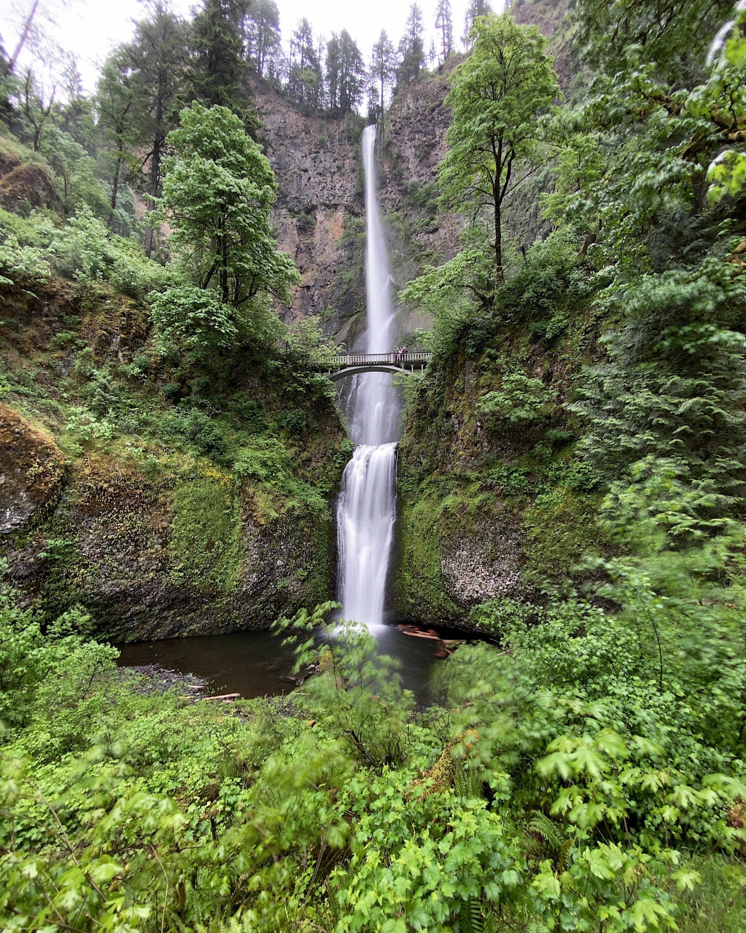
When we were planning the trip, we knew we wanted to do most of it during the week to try to minimize crowds on trails. Since Melody’s monthly book group is on the third Monday, we decided to leave on Tuesday. Having decided to go to the south side of the Columbia River to Multnomah Falls on the way to our AirBnb (our first trip out of Washington since 2019), we left early (for us) for the 3+ hour drive. Since we were going east of Portland, we avoided crossing in Vancouver, which can get busy. The exit was on the left, and the parking lot was in between the east- and westbound lanes of US30/I84.
After parking (there was a good view of the falls from the lot), we went through the pedestrian underpass and we were right there at the base.
Since we started relatively late, we ate lunch not long into our hike higher up but still close to the falls. Quite a few people were coming and going, so we didn’t linger in case someone else wanted to use our bench.
After looking at the top of the falls, we followed the Multnomah Creek, went across a ridge then met up with the Wahkeenah Creek to the falls of the same name. Between the two main waterfalls were several others, each different. We then hopped onto the connector trail which took us back to the base of Multnomah Falls, and we headed back to the car.
The next stop was our AirBnb room. The route options were 40 minutes with a $2 toll or twice as long without. We figured that the toll was a good value, so we crossed the Columbia at the Hood River Bridge, which dropped us right into White Salmon, where we were staying. We found the place with little problem, but the parking spot was tight, with a turn that needed to be navigated between a couple of trees. We got parked with no damage and started unloading the car.
The room was a studio above what looked like a workshop. Quite big, with a pool table in the middle. Since we didn’t plan on using the table, we didn’t need to put down the $300 deposit the owners were asking. They had boards and a cover over it so people could put luggage, etc. on top, which was nice.
After unpacking, we walked over to the grocery store to get dinner and breakfast items. We were more than ready to eat when we got back to the room and didn’t last all that long before going to sleep.
Wednesday, 19-May
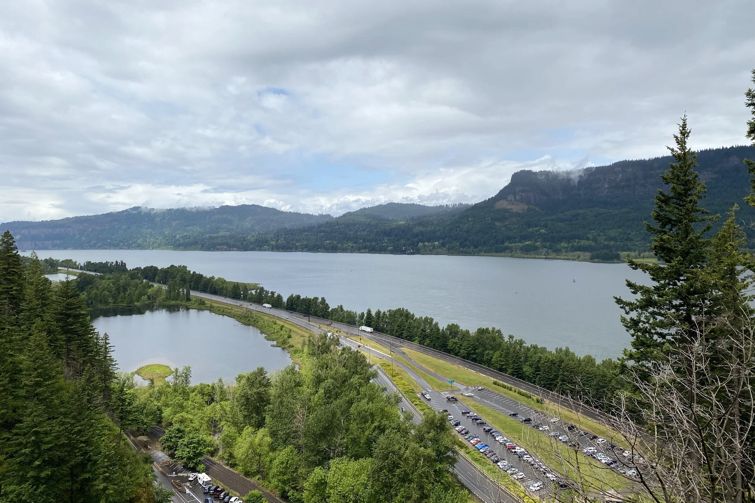
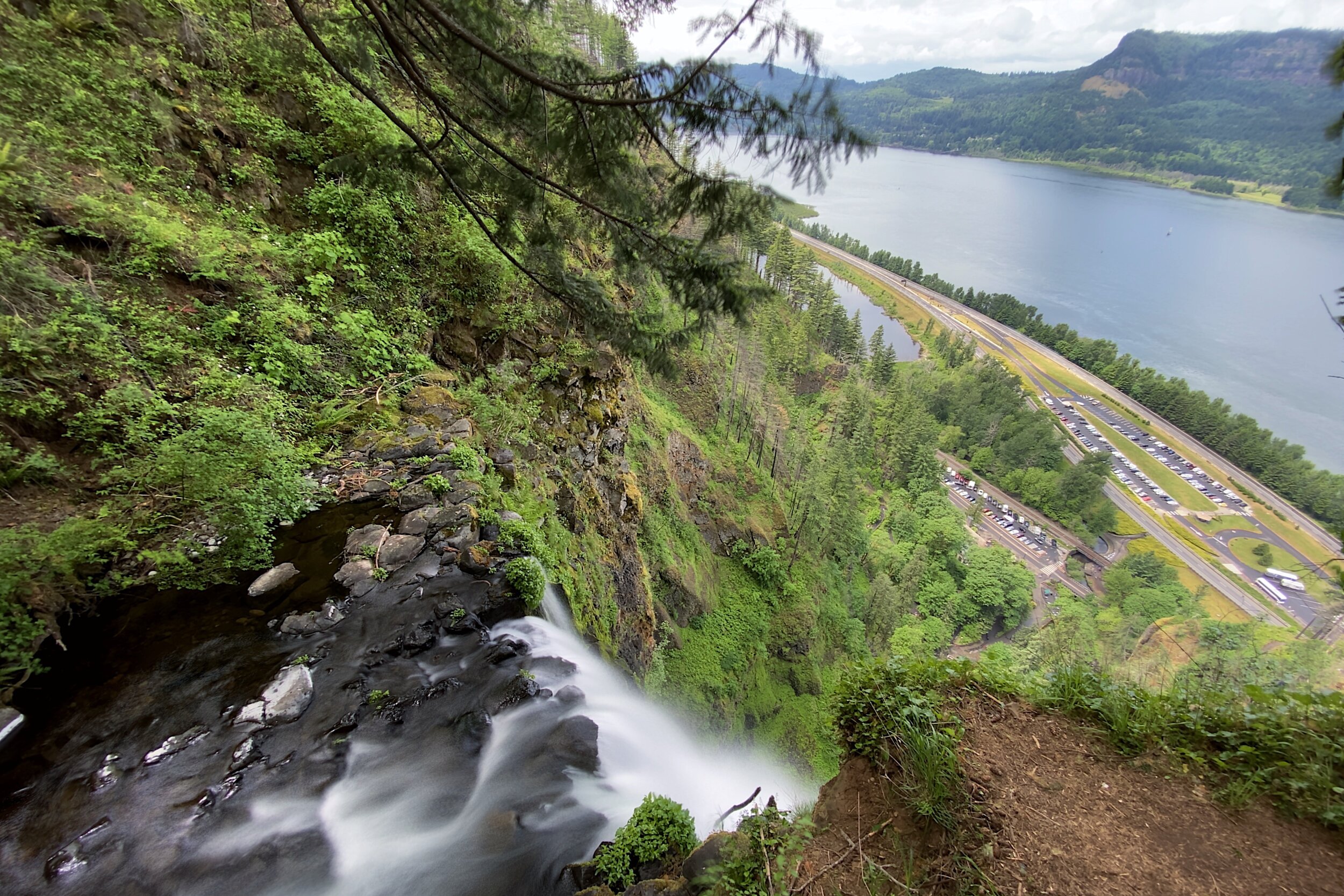
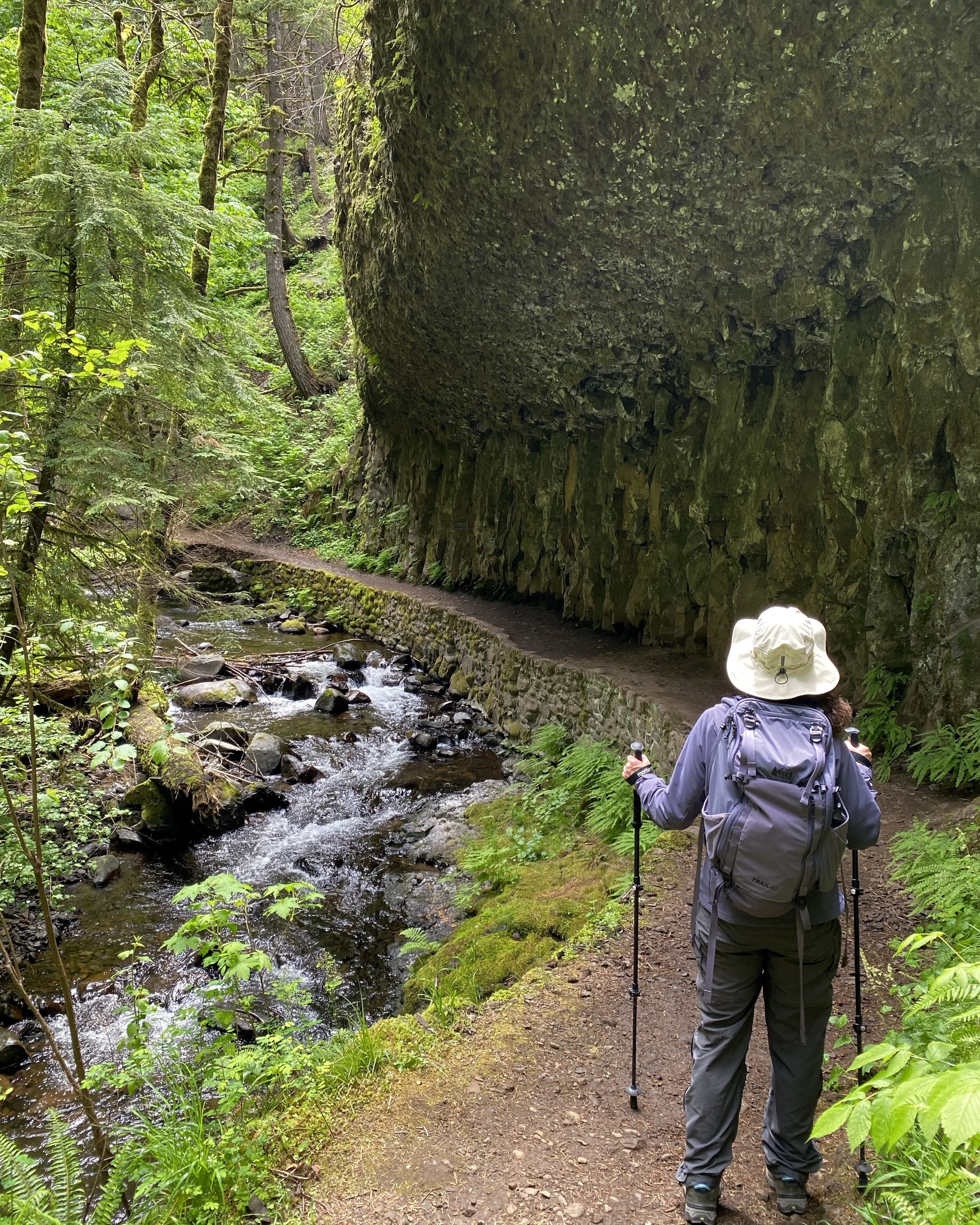
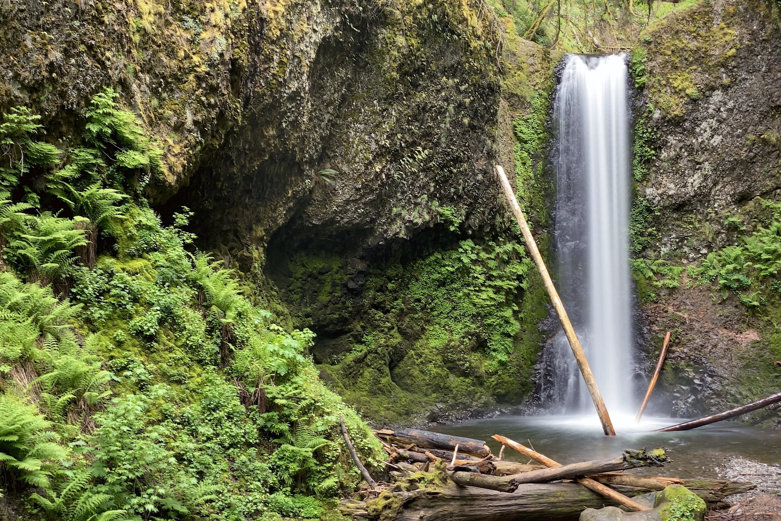
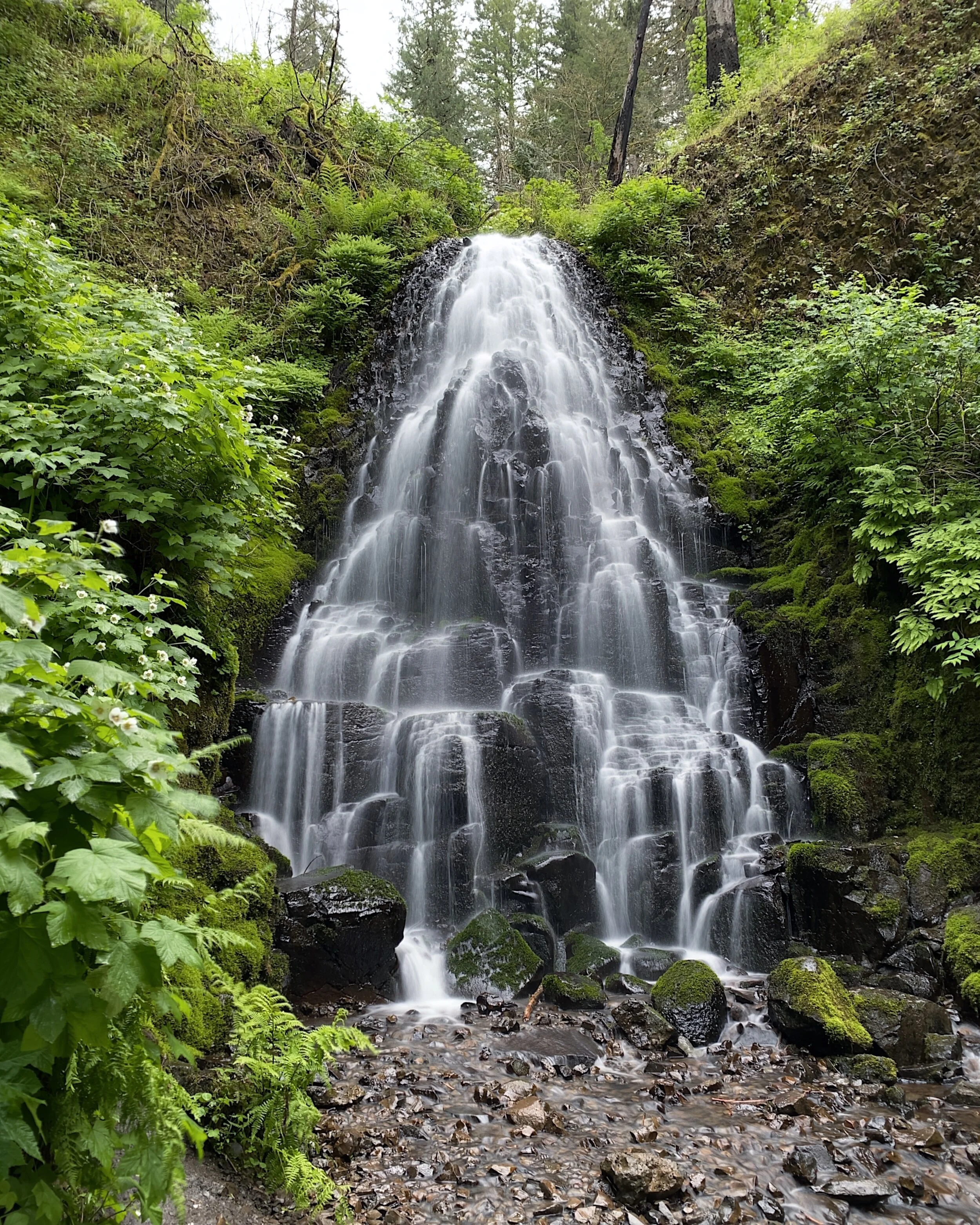
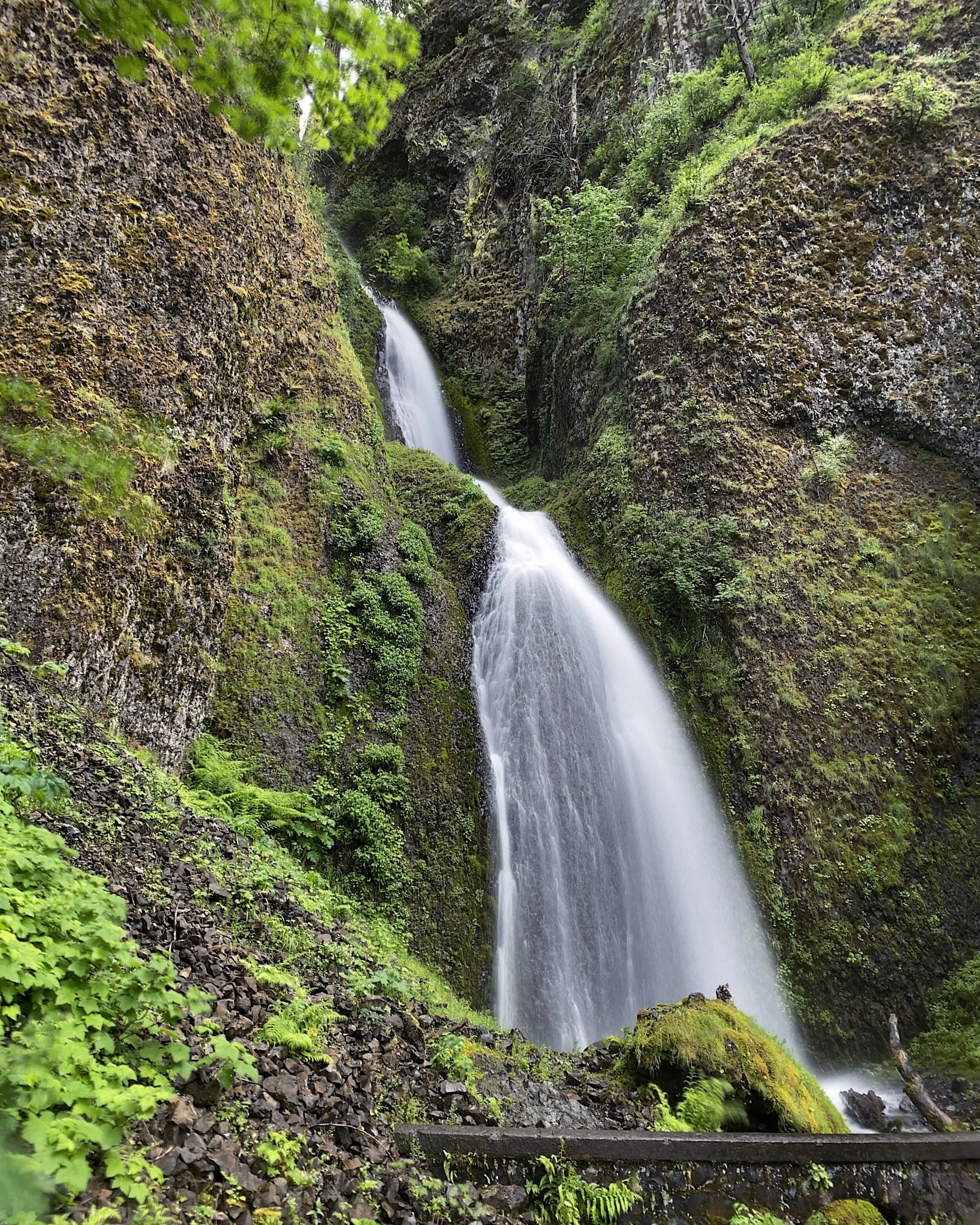
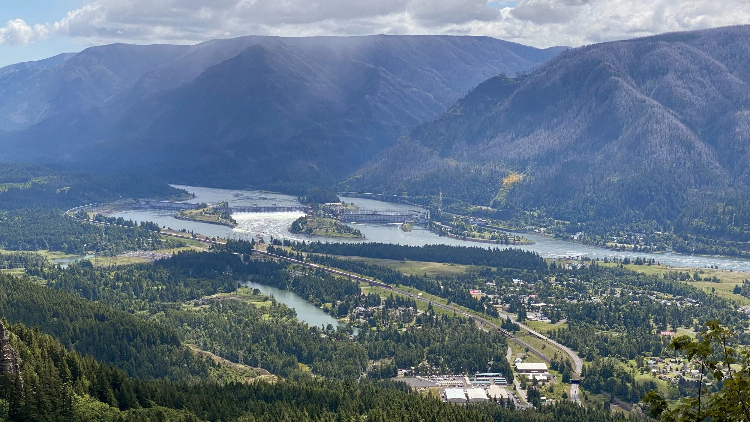
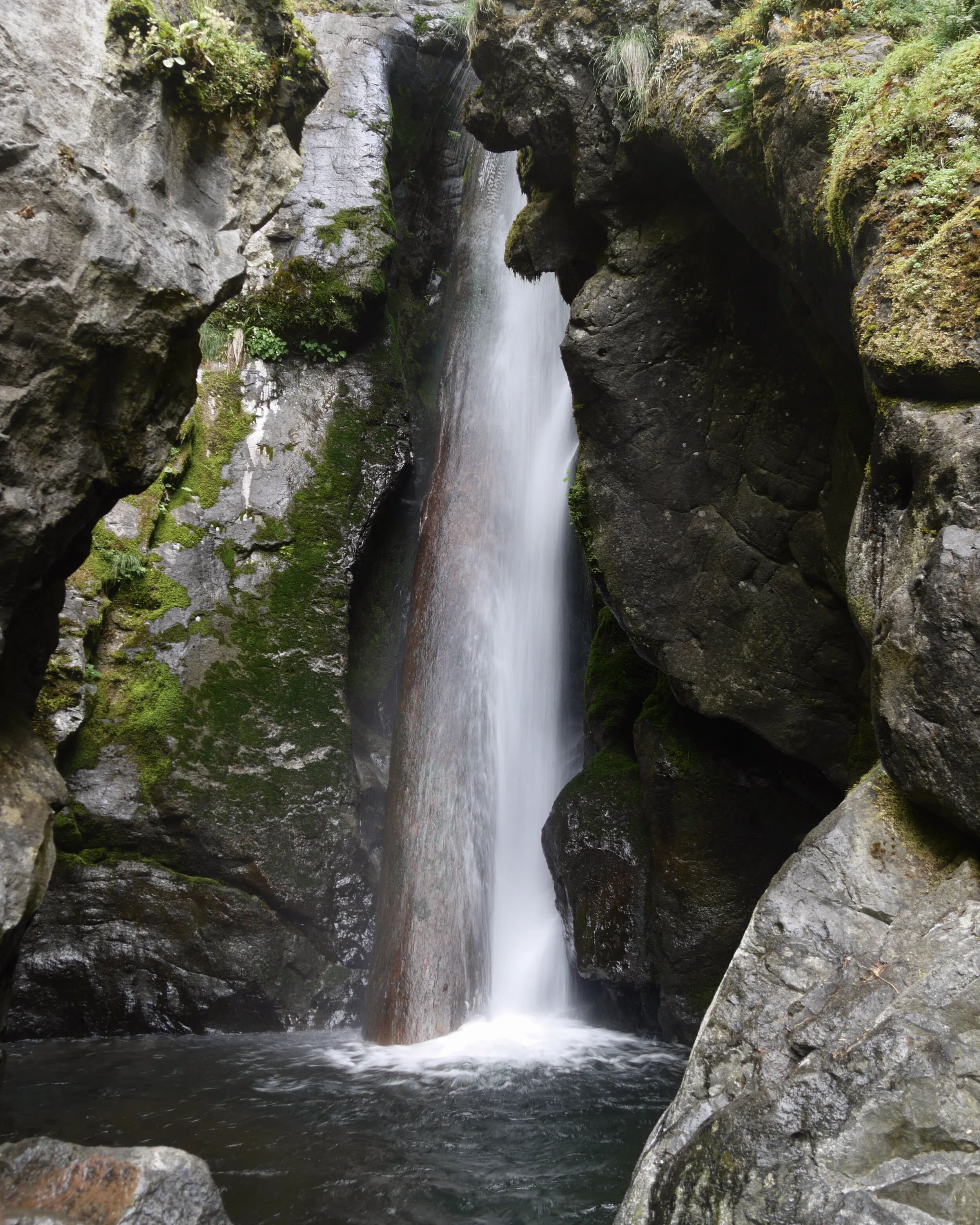
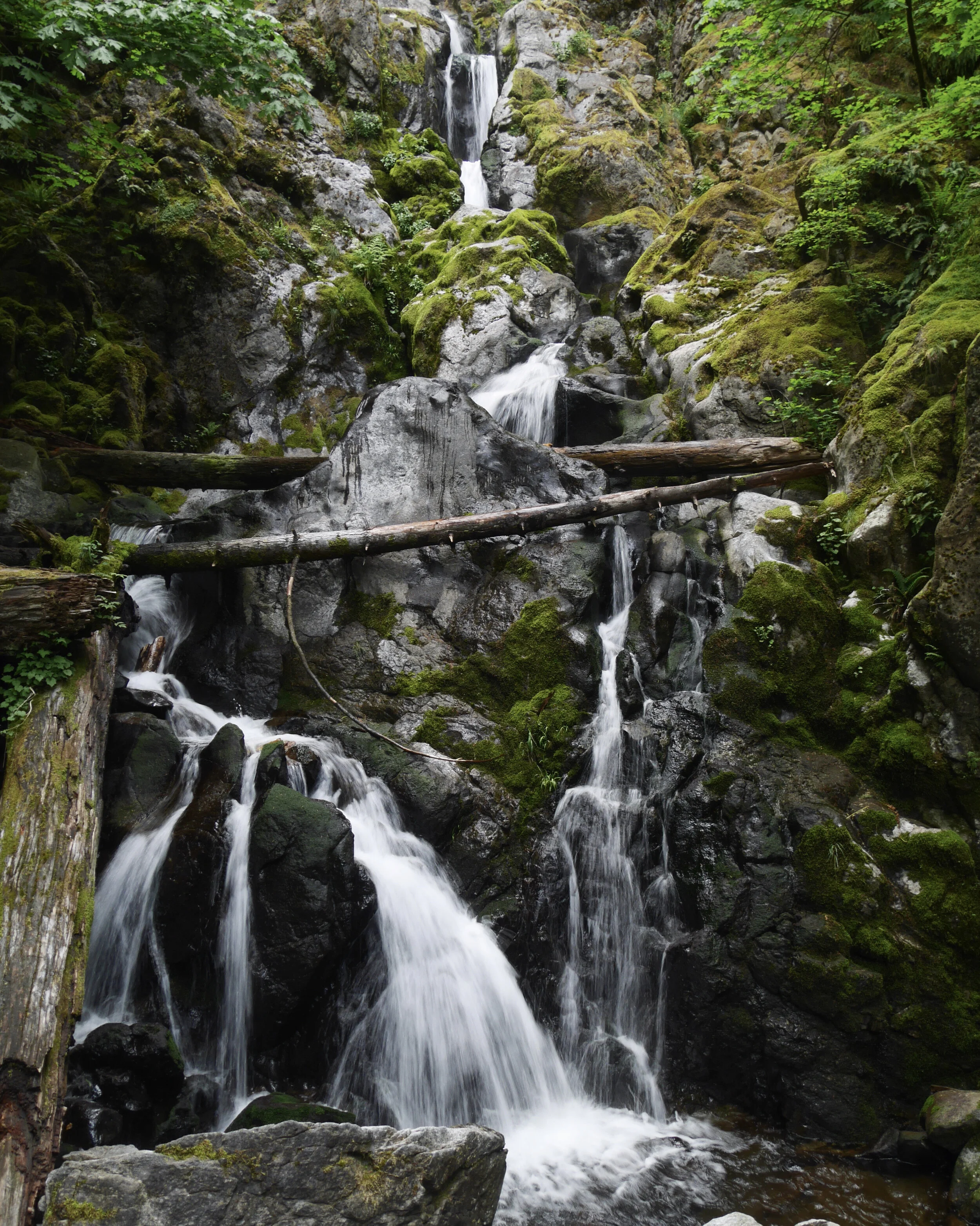
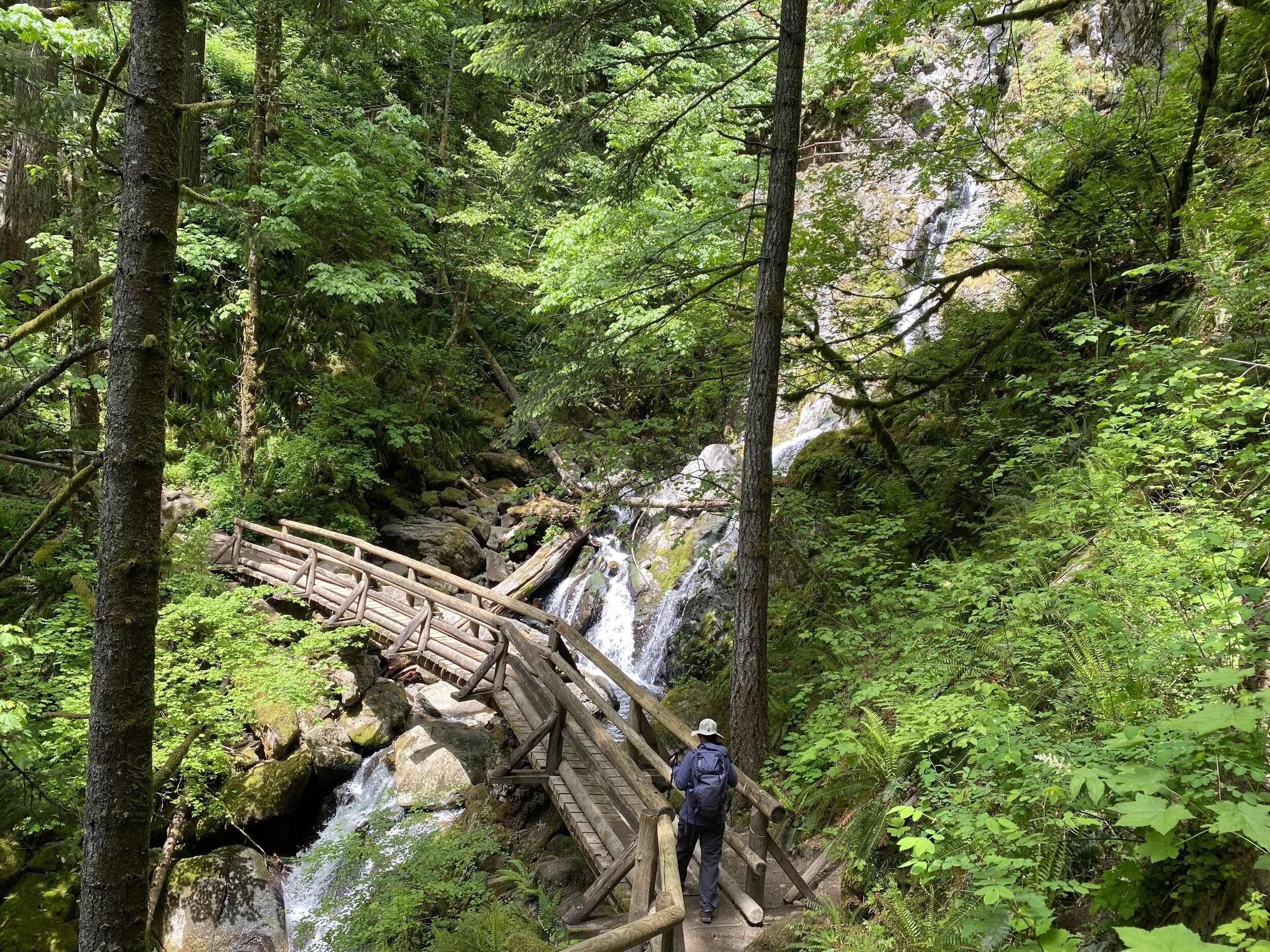
Since we knew we didn’t have far to drive to the Hamilton Mountain trailhead, we didn’t rush in the morning. We passed the Dog Mountain Trail parking lot, which had a few open spots, so we kept that in mind for later in the week. By the time we got to the parking lot, there were only a few other cars. Since there’s poison oak on many of the trails, we added pre-contact gel to our sunscreen routine, then started. The trail started pretty steeply, but after about a mile we got to a couple of waterfalls. The first, Hardy Falls, is somewhat hidden away, but the next, Rodney Falls was in plain view. At its top was Pool of the Winds, a spectacular waterfall in a water-carved grotto. We spent quite a bit of time there before continuing up to Little Hamilton Mountain, from which there were great views of the Columbia.
Having another 700 feet to gain, we continued up, passing a couple of other viewpoints, until we reached the top. No view from there, since it was blocked by vegetation. It was also extremely windy, so we kept moving. We did find a protected viewpoint for lunch, then went to the back of the mountain through Hamilton Saddle. We finally wound our way back down to the parking lot, passing the waterfalls we saw earlier when we closed the lollipop and returned on the stick. There were quite a few more cars in the lot by that time, so our timing was good.
Since we are always on the lookout for ice cream, Melody had spotted a frozen custard place on the way over. We looked it up before heading out, but it had already closed. We did find another ice cream store, but when we pulled up to it, the signage was missing and the place was closed. Looks like they closed for good not too long ago, since most of the appliances were still there.
On the way back to White Salmon, we checked out the Dog Mountain parking lot again, which this time was full.
We needed to get more groceries, so we went back to the store when we reached White Salmon and got snacks, too. After putting things away and cleaning up, we were ready to hunker down for dinner and the evening.
Thursday, 20-May
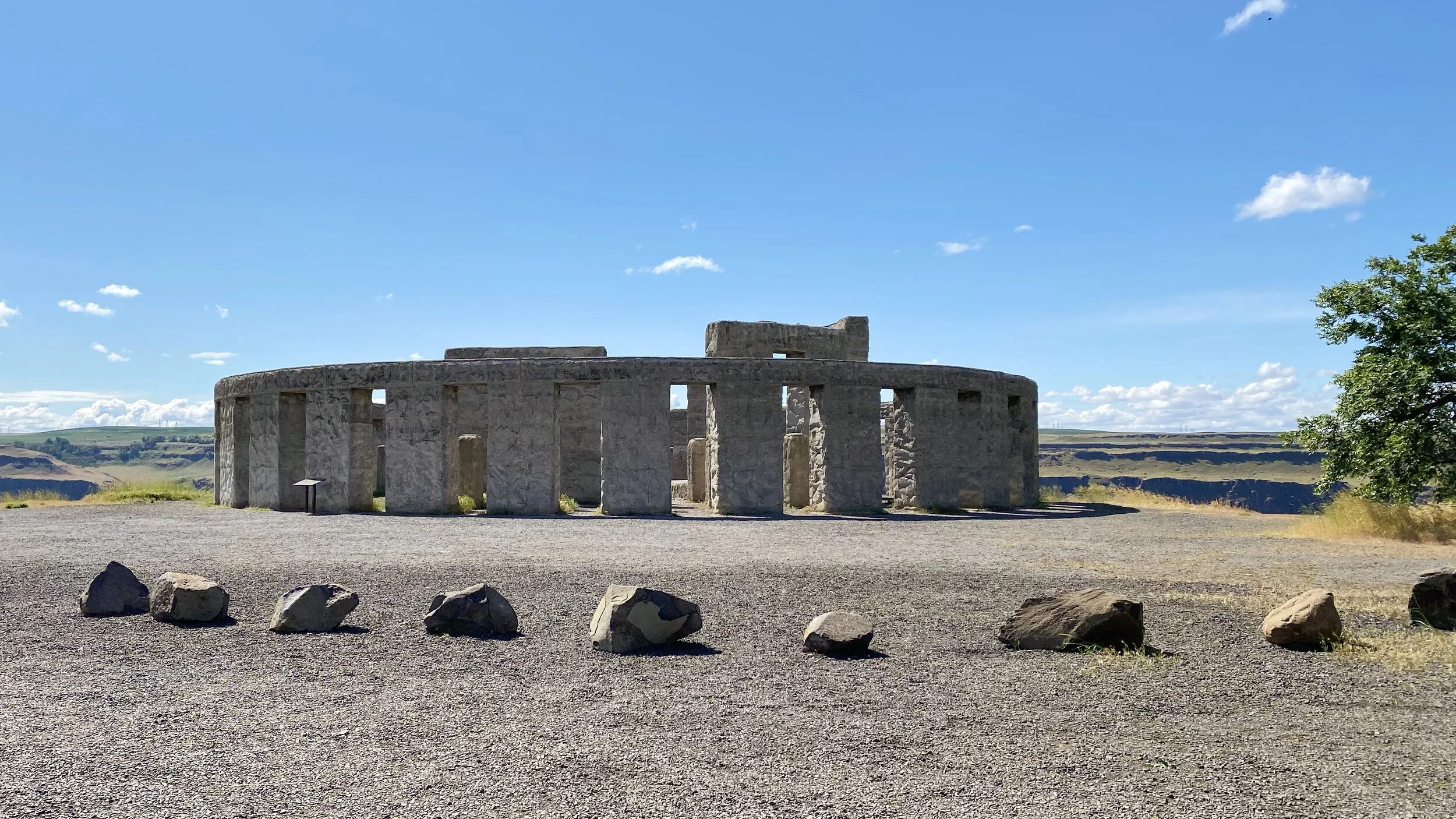
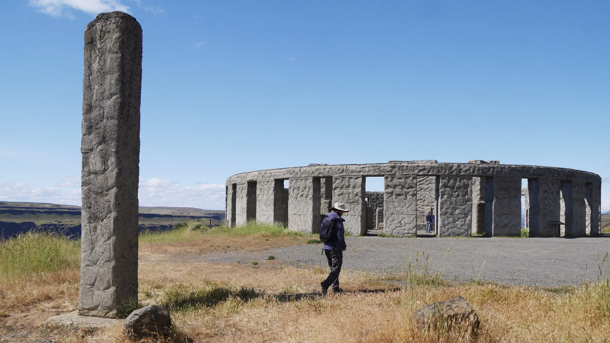
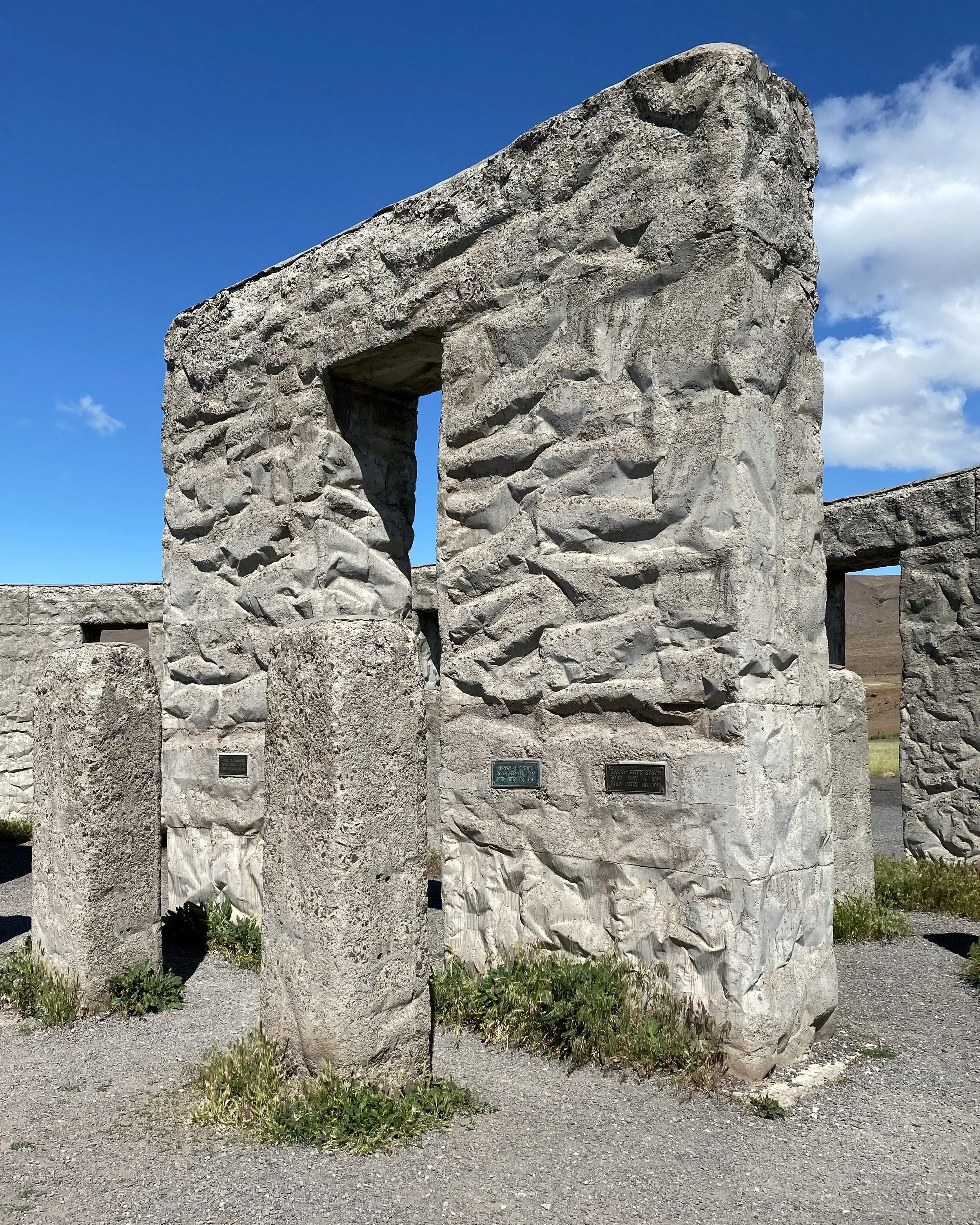
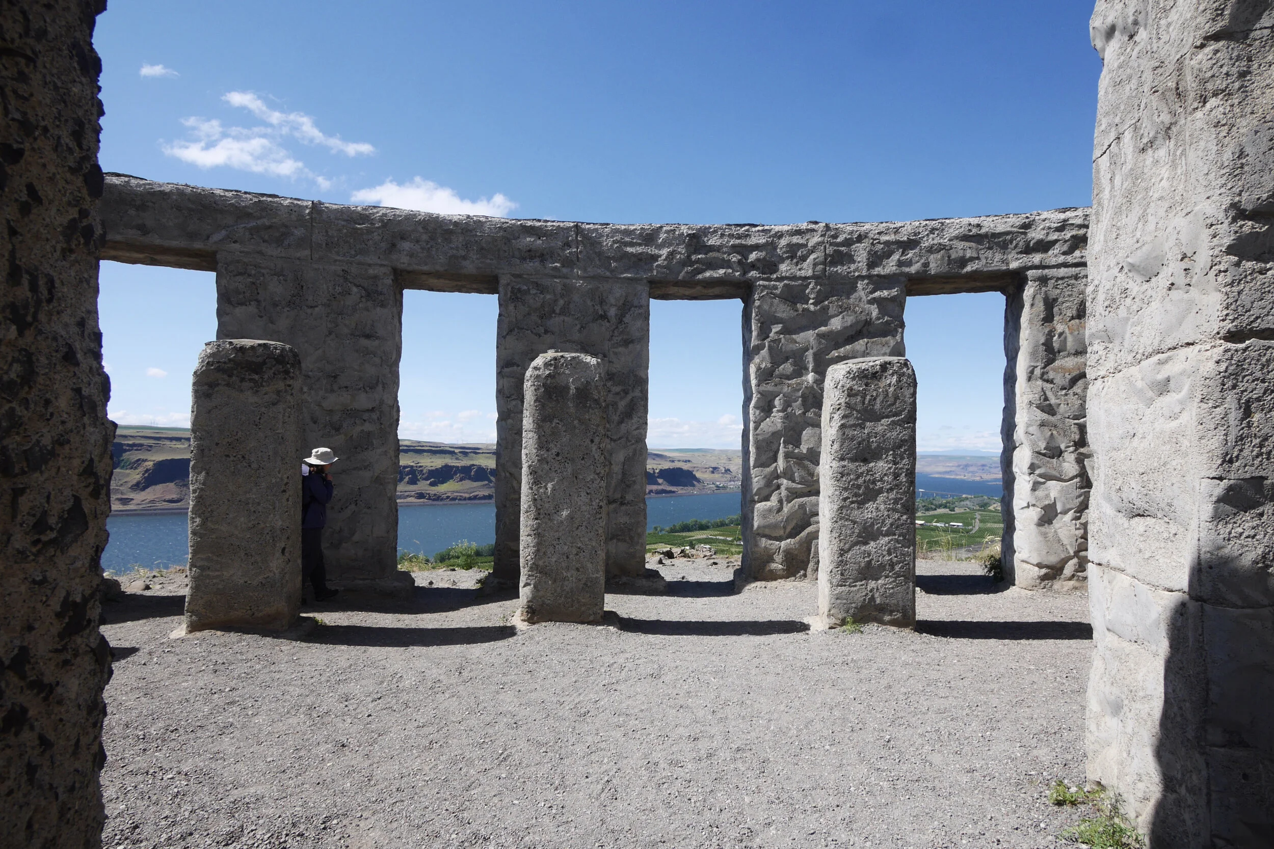
Having done quite a bit of distance and elevation gain the previous two days, we decided to take it easy this day. Even though we were going to Maryhill Museum on Saturday, to make that day less crowded, we drove out to the Maryhill Stonehenge Memorial in the morning. It’s a full-sized replica of what Stonehenge would look like if it were complete. It was built as a memorial to those from Klickitat County who died in WWI.
We wandered around and through the stones, and it’s a different feeling than the original, with dirt and the Columbia River and Gorge rather than the grassy Salisbury plains. Nearby was a memorial for Klickitat County service members who died in wars after WWI.
We knew lunch options would be sparse, so we started heading back, crossing to Oregon to get lunch in The Dalles. We found a BBQ food truck and shared a pulled pork sandwich, then walked a few blocks to a bakery to get dessert.
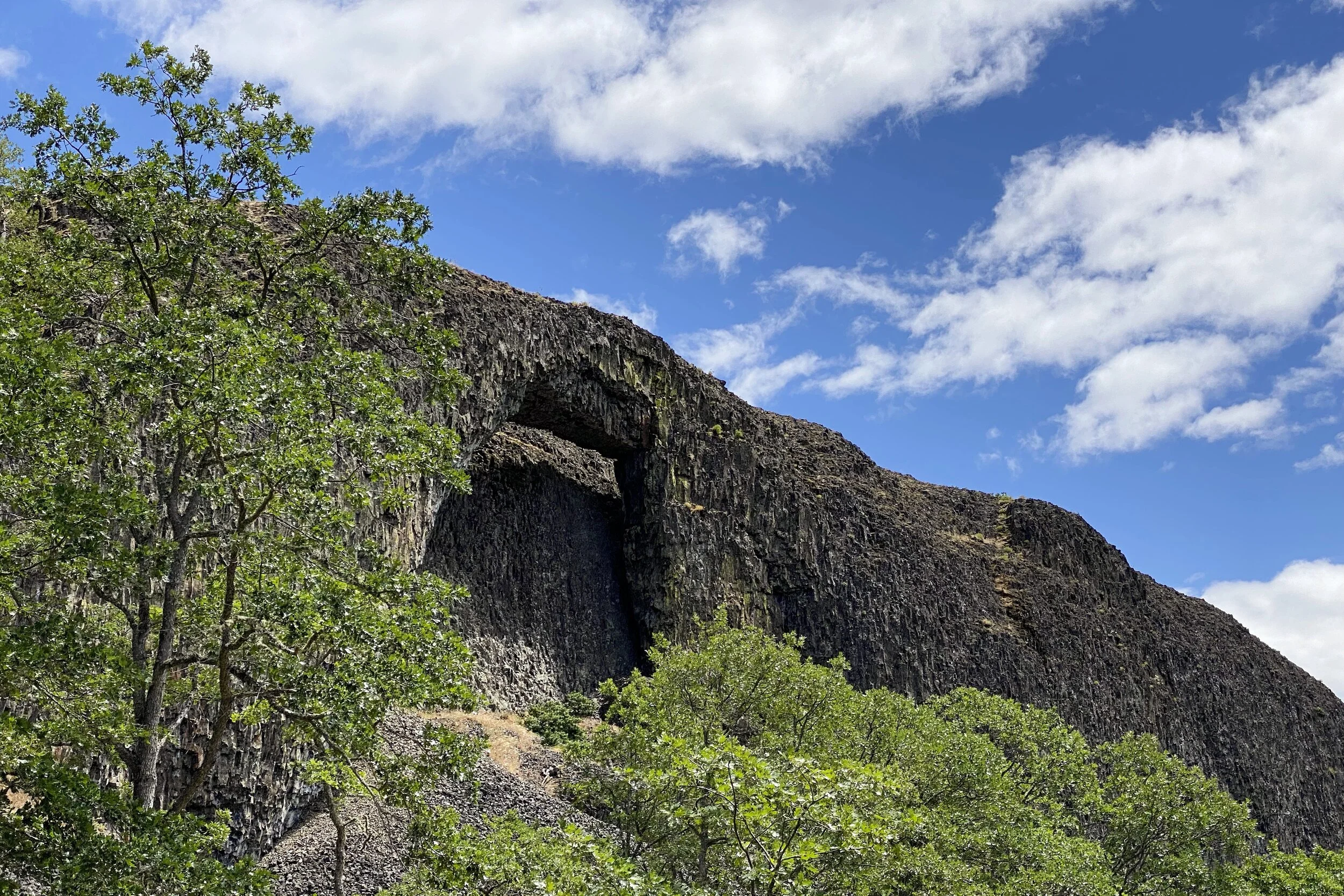
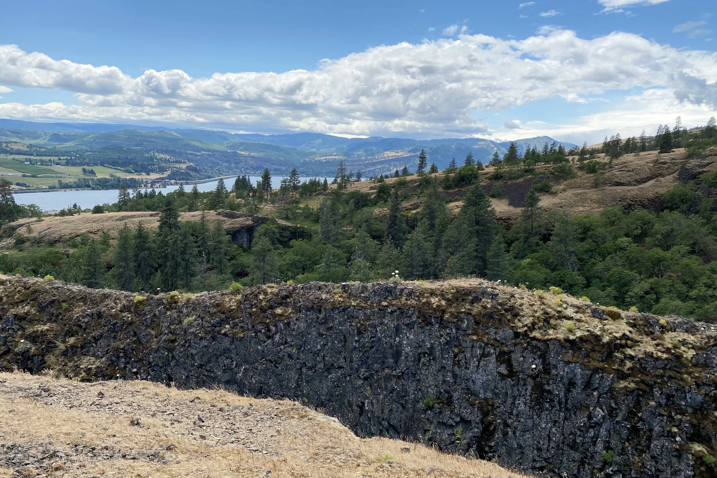
Back to Washington to find Catherine Creek, where we got out of the car to extreme wind. Fortunately, it mostly died down when we started on the trail. Not fat from the trailhead is a natural arch which we got good views of. There’s more rock behind it, so we were lucky that the sun shone between the two so the arch was more evident with the back rock partially lit from above. After that, we followed the trail which eventually led to the top of the rock behind the arch. You can’t see through the hole from above but can see the top of the arch.
Since the hike was short, we had a leisurely rest of the afternoon, including walking to a deli to pick up dinner. We didn’t stay up too late so we could get an early start the next day.
Friday, 21-May
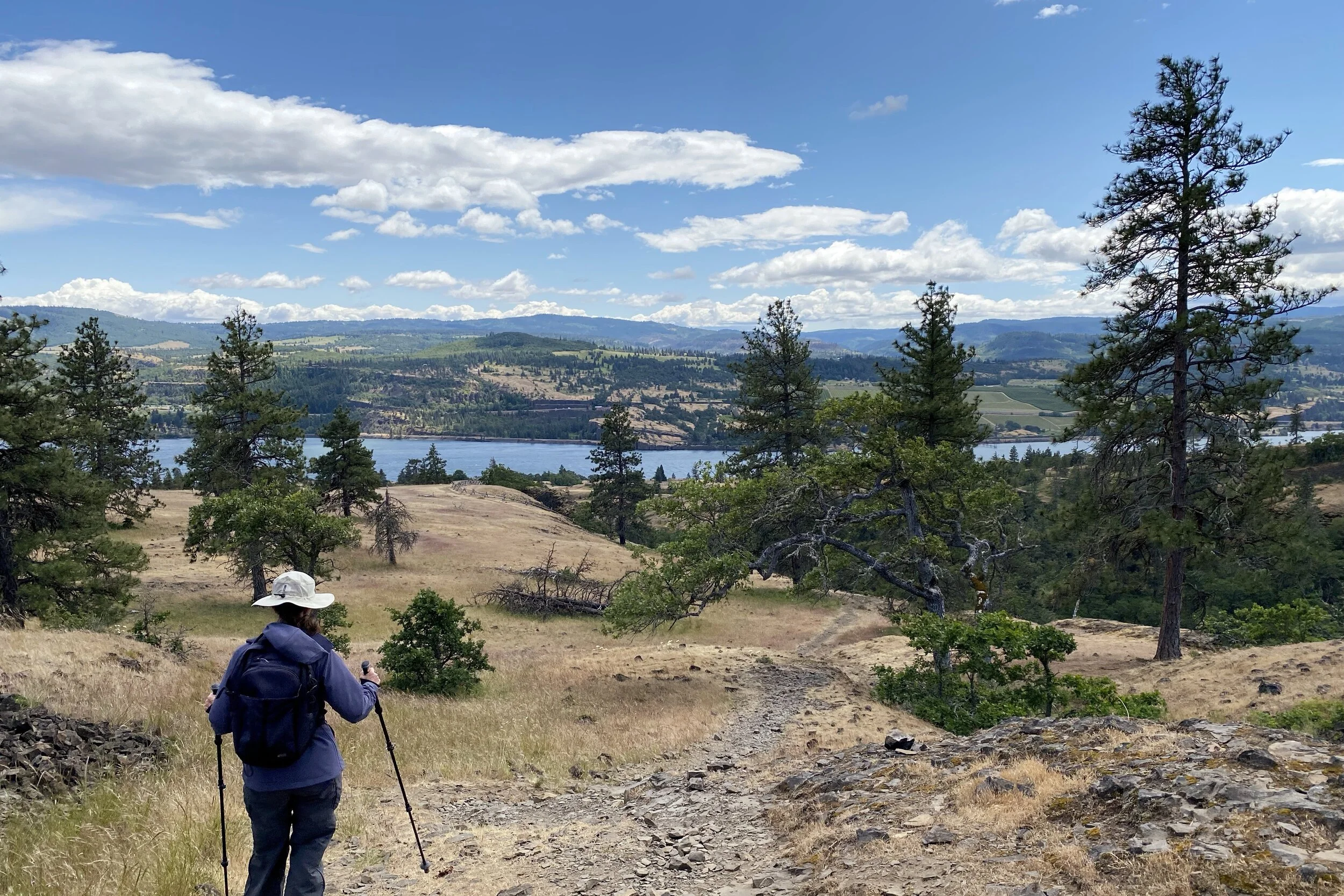
Knowing we would want a good chance at getting a parking spot, we headed out earlier than usual for Dog Mountain. The lot was probably about three-quarters full, so it was good we got there when we did. Many of the spots filled up as we were getting ready, too.
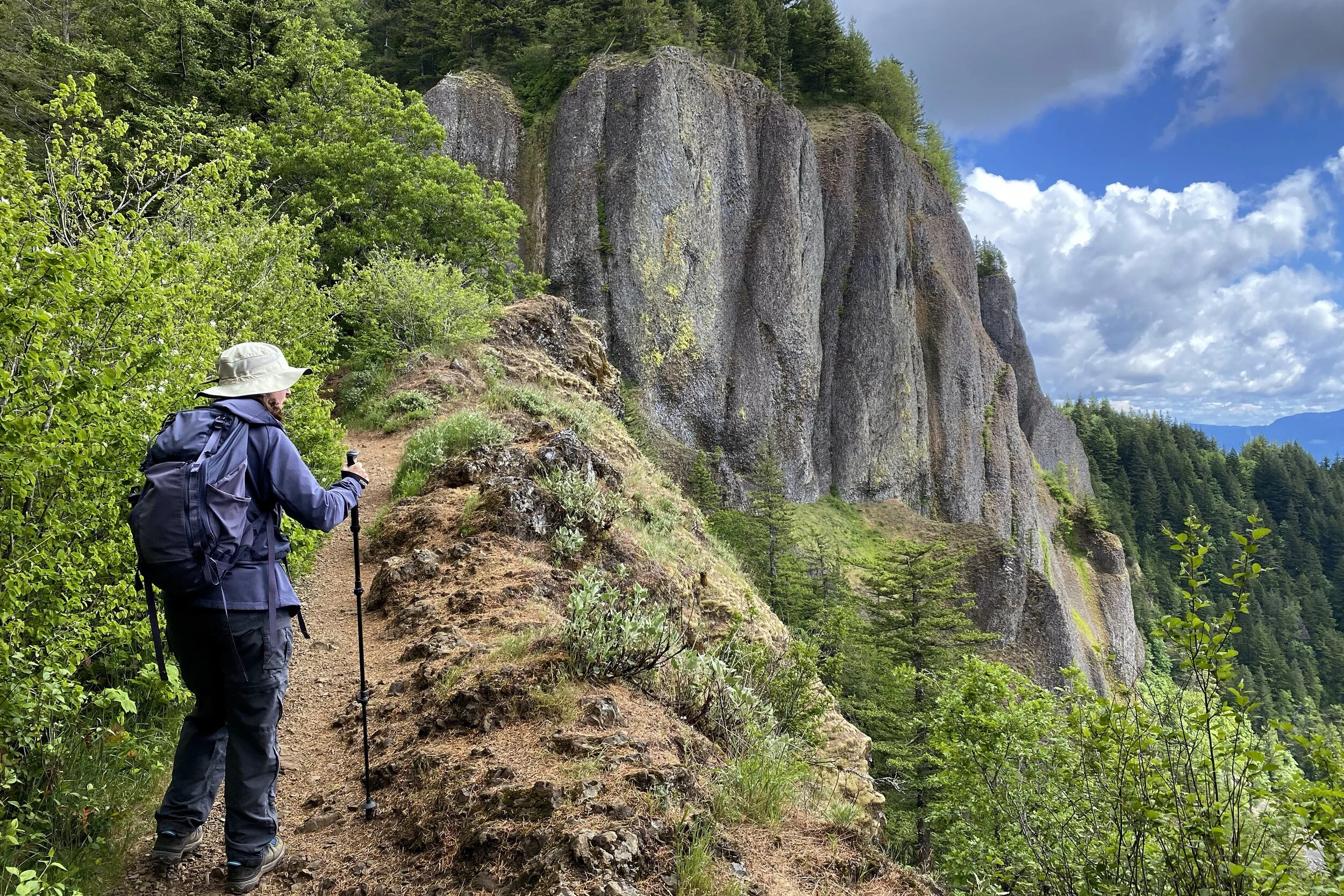
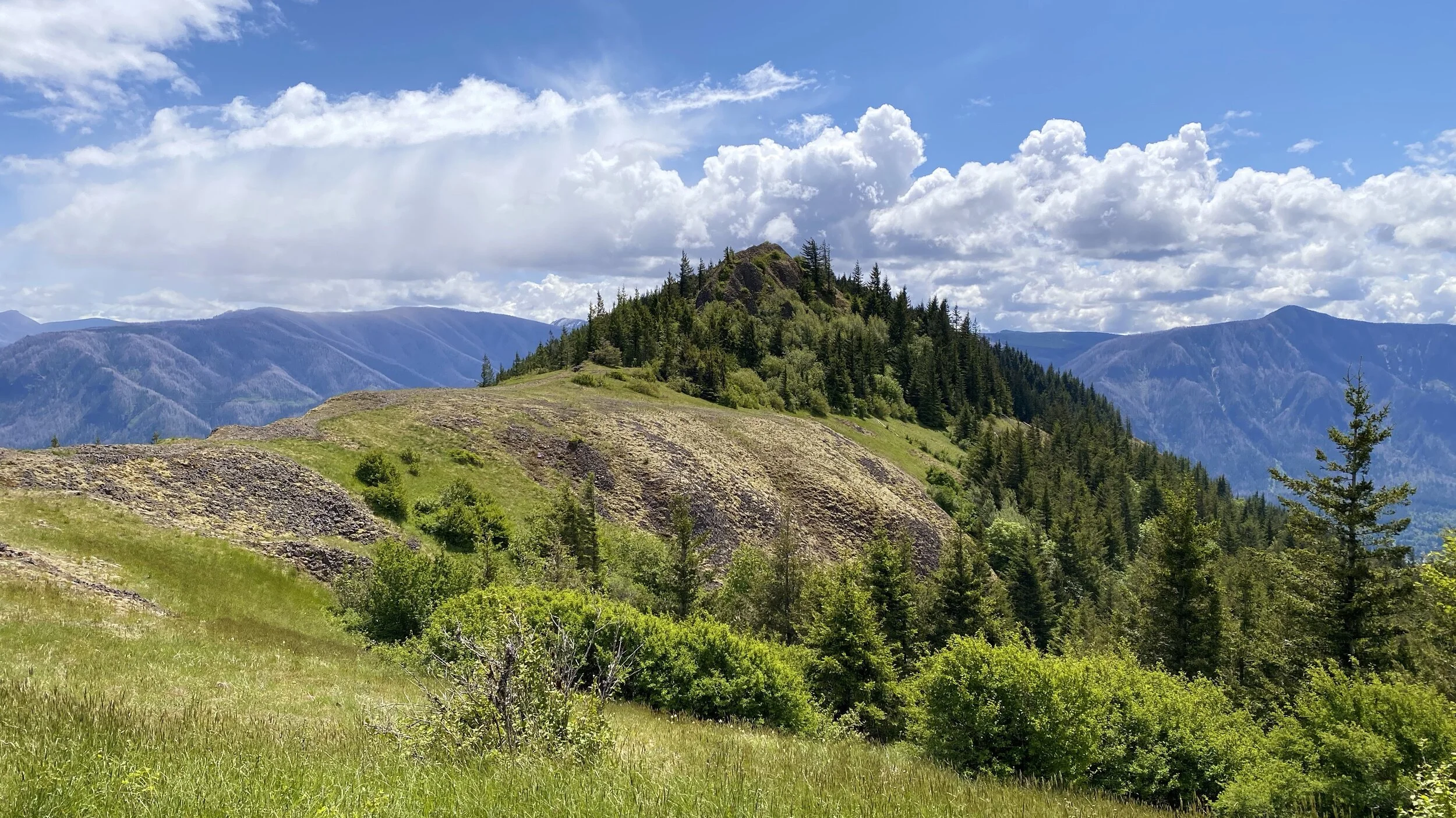
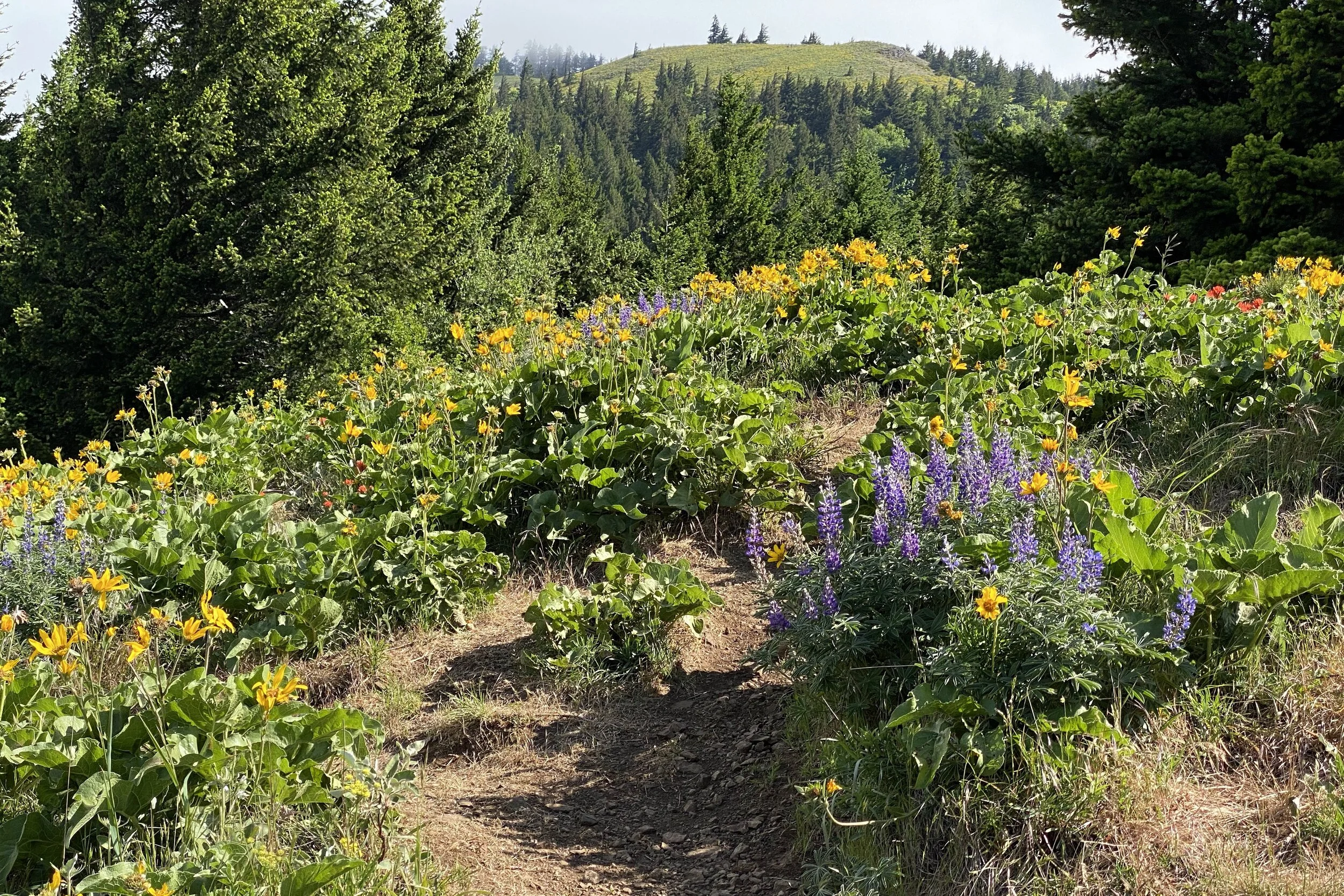
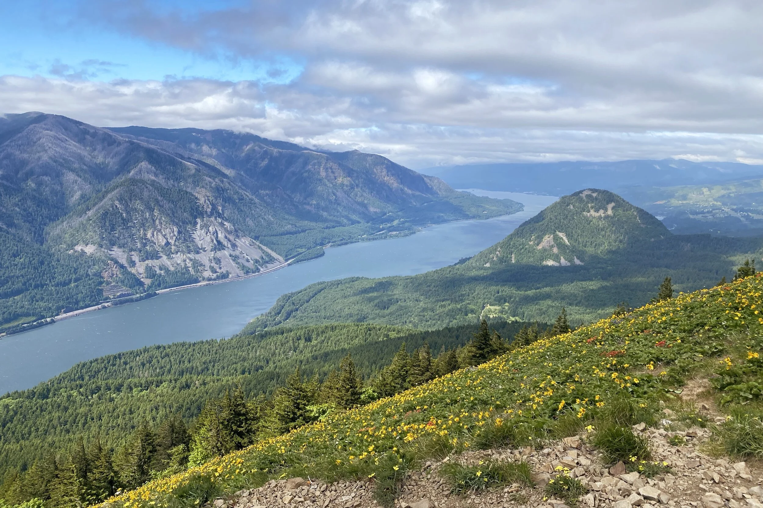
There were many reports of poison oak along the trail, so once again we got out the pre-treatment gel along with the sunscreen and started. The start of the trail was pretty steep, about 750 feet of gain in a bit over a half-mile. At that point is a sign that points between the new (marked Difficult) and old (More Difficult) trails up the hill. The new trail offers some great vistas of the river, so we went that way.
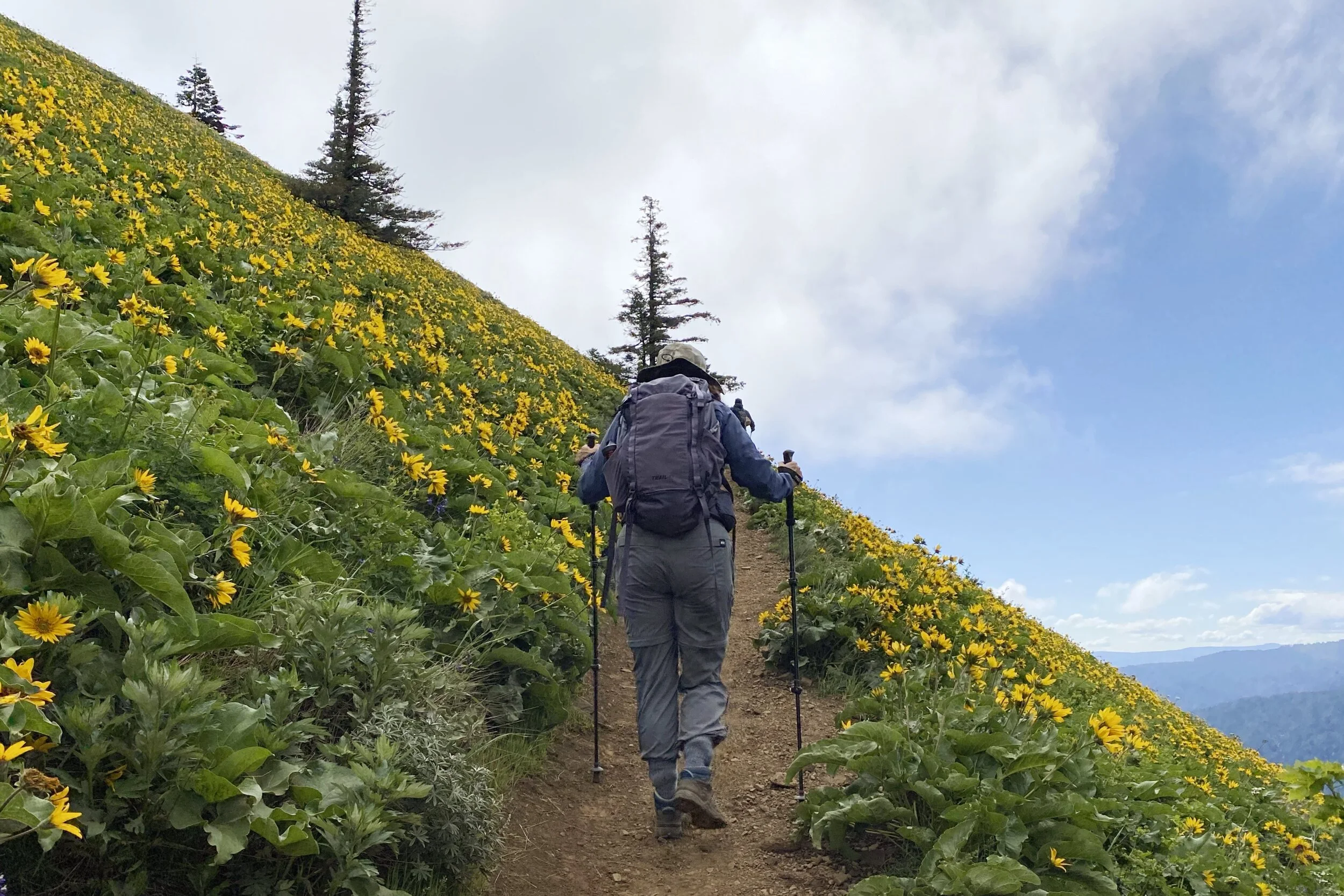
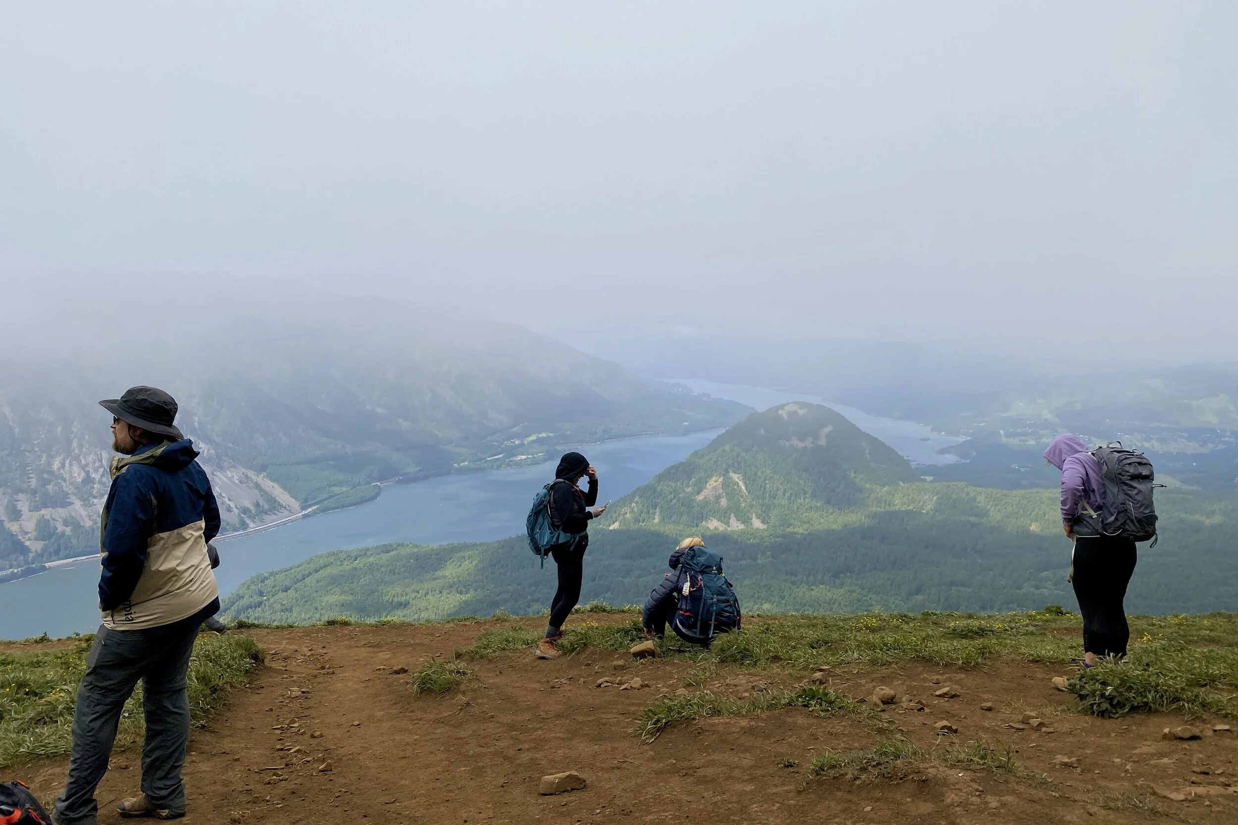
There were lots of wildflowers, and part of the way up was a sea of balsamroot. Also on the way up we had strong gusts, wind, and hail. Once we reached the top, there was still a lot of wind, but we couldn’t see as far because the skies were no longer clear.
We took another route on the way down which was a little longer but less steep. When we got to the car, not only was the lot full but cars were parked along the highway.
Another night of relaxing and grabbing takeout for dinner, which was just what we needed.
Saturday, 22-May
Unlike the other days, we had a schedule to keep with timed tickets for the Maryhill Museum of Art and the Goldendale Observatory. Fortunately, the museum didn’t open until 10 am, so we didn’t need to rush. We packed the car, carefully pulled out of the tight parking spot for the last time, and headed east for the last time.
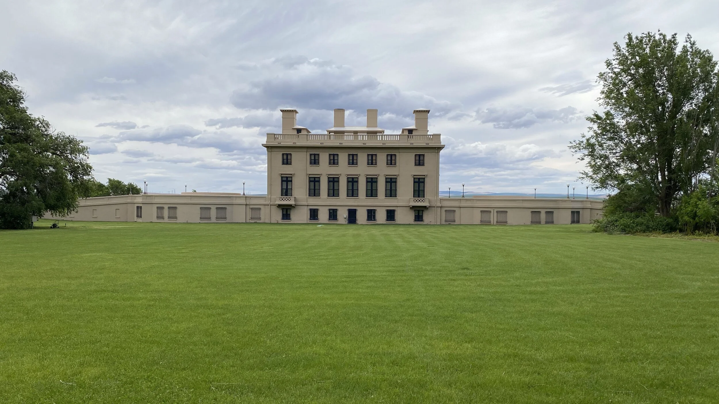
Maryhill Museum of Art
We were able to time our arrival at Maryhill just right, and we went in as they were opening.
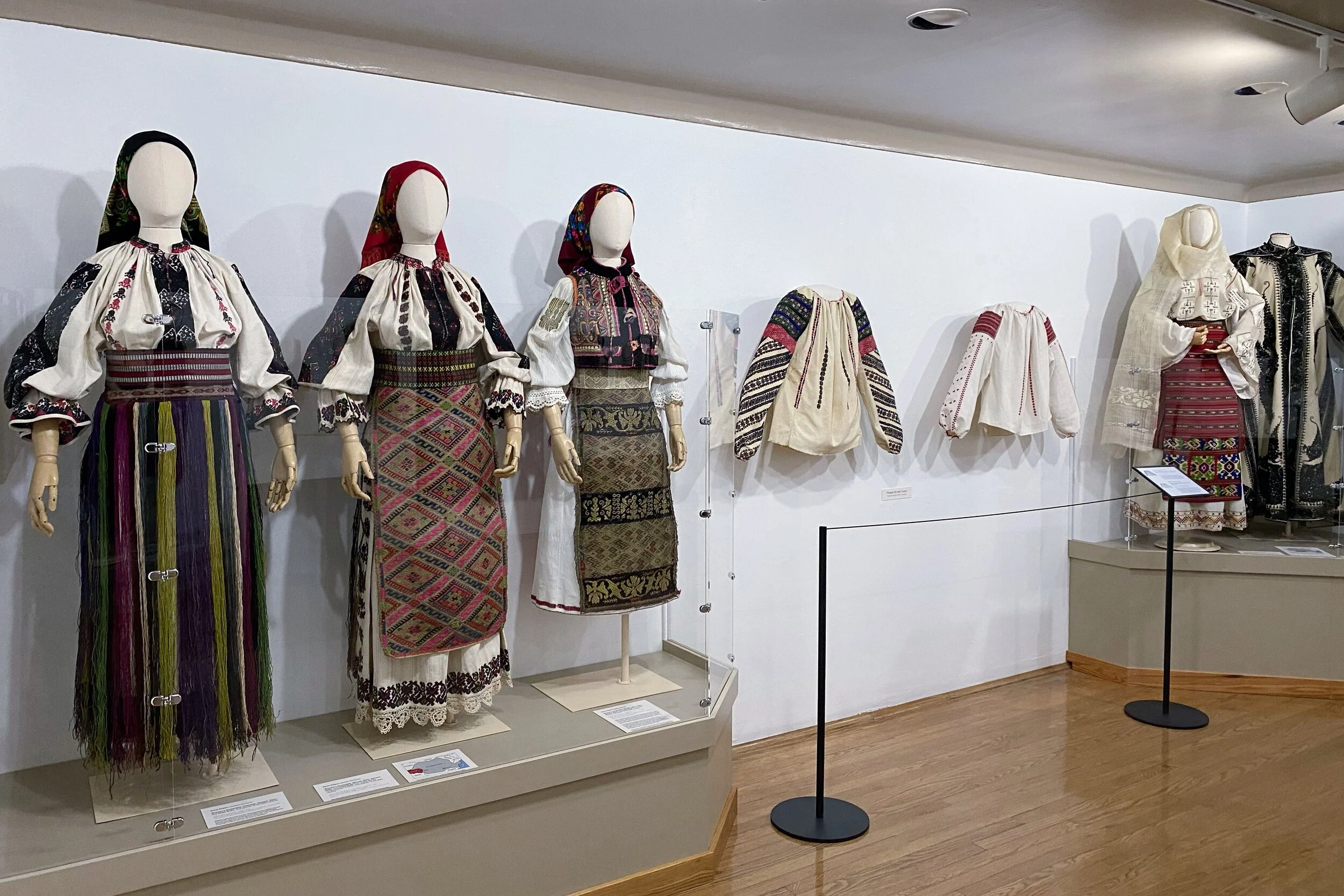
The collections seem pretty eclectic on the main floor, but seem more cohesive on the upper and lower floors. At the top, Romanian Folk clothing is on display, zeroing in on various regions of the country.
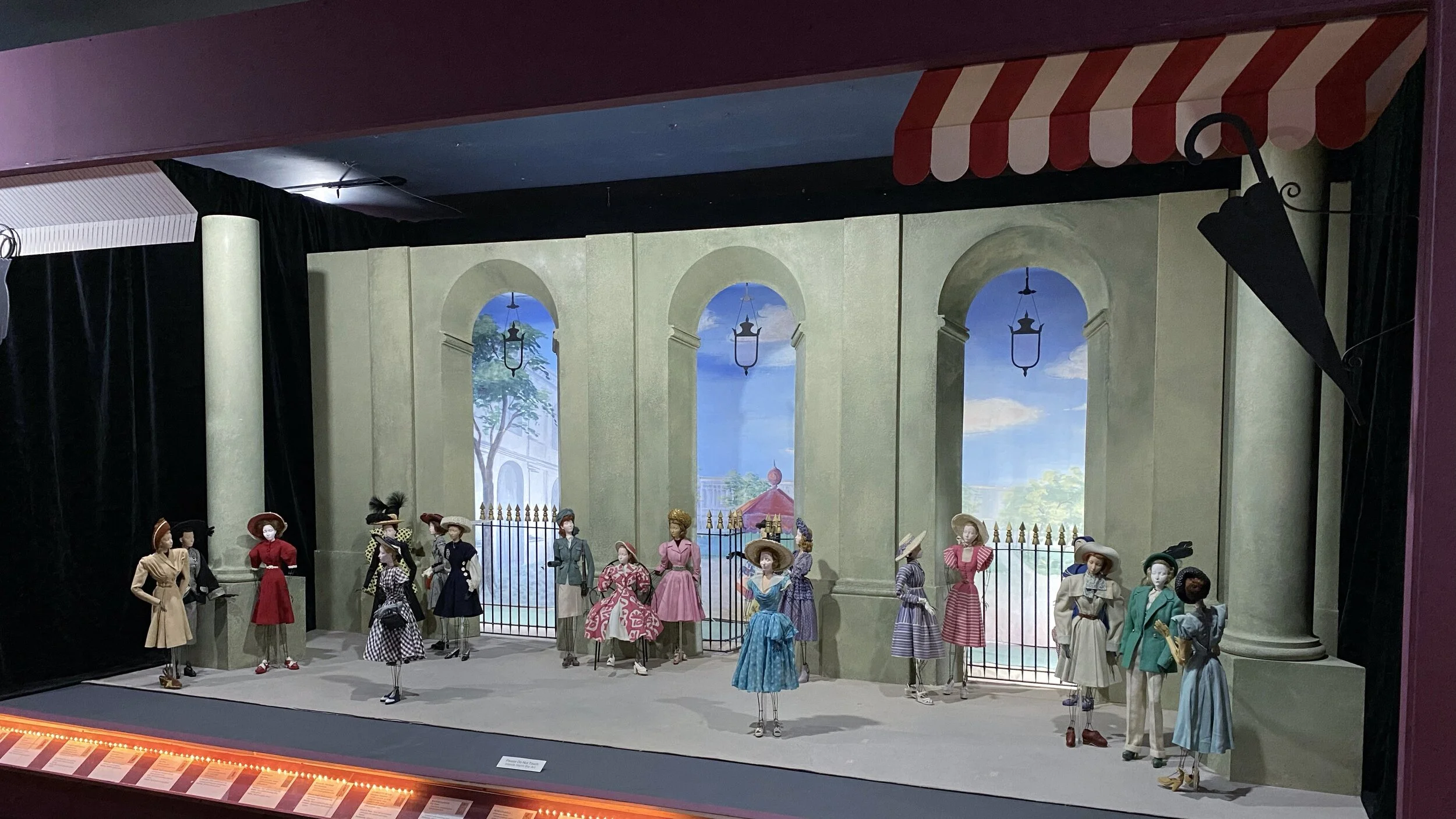
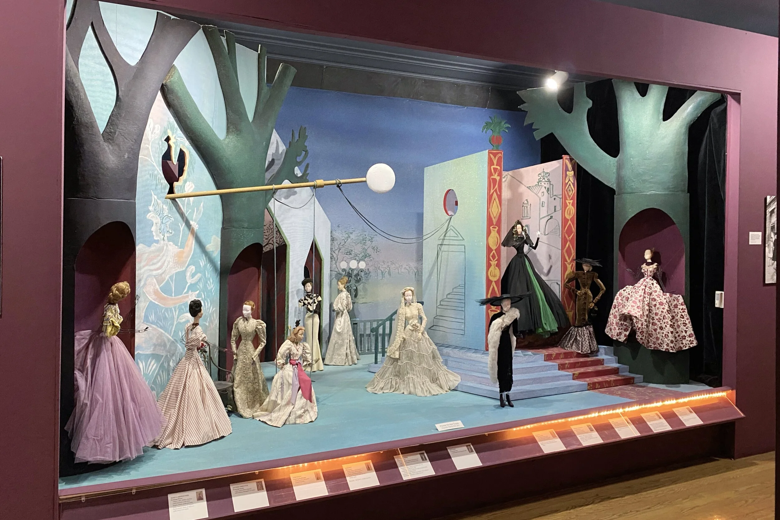
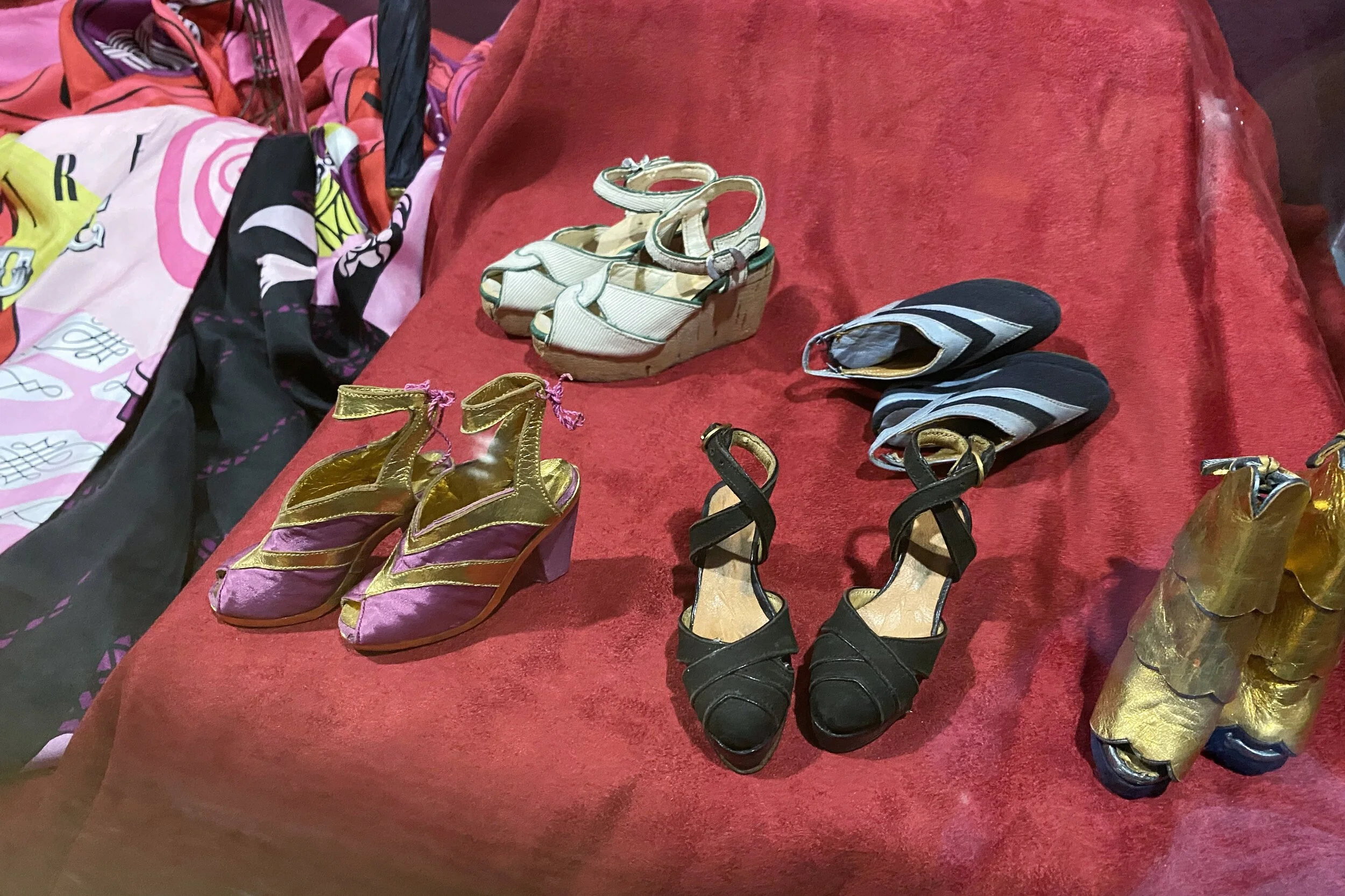
The other half of the top floor has pieces from Théâetre de la Mode or Theater of Fashion. Fabric was in short supply following WWII, so the French fashion houses wanted to help the economic revitalization by creating miniature versions of their collections which were displayed on mannequins that were 27" tall. They collaborated with theater set designers, coiffeurs, jewelers, fashion accessory artisans, and others to create the displays.
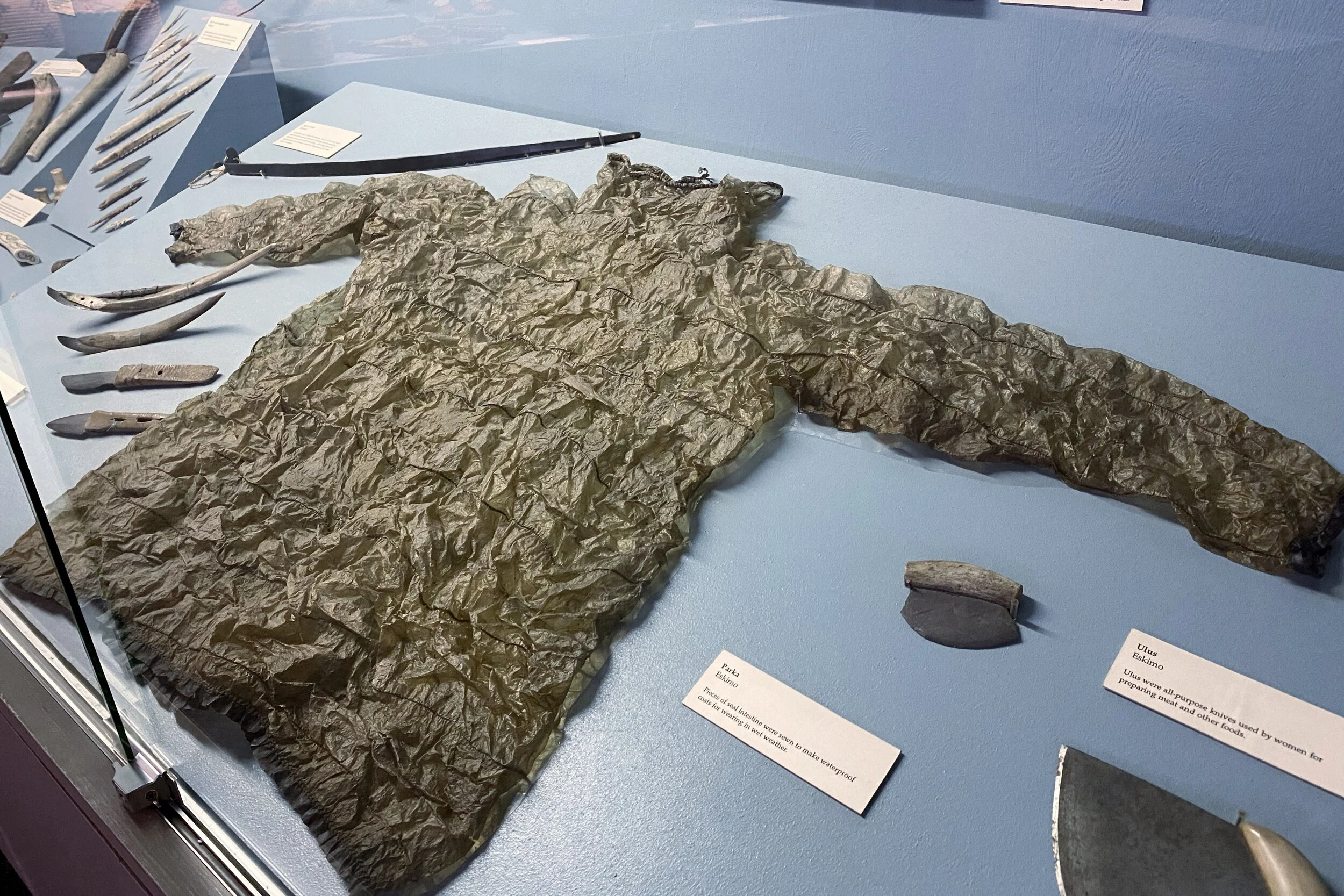
The lower floor has a generous collection of artifacts of Indigenous people of The Dalles region, and on the other end is a good selection of Rodin sculptures, castings, and sketches. Most of them aren't well-known pieces, which makes the display more interesting.
Right outside the Rodin room was a photo of Rodin and Loïe Fuller, which led into a hallway with lots of photos of the modern dance pioneer who was known for her long, flowing costumes. It was she who convinced Sam Hill to convert his mansion into an art museum.
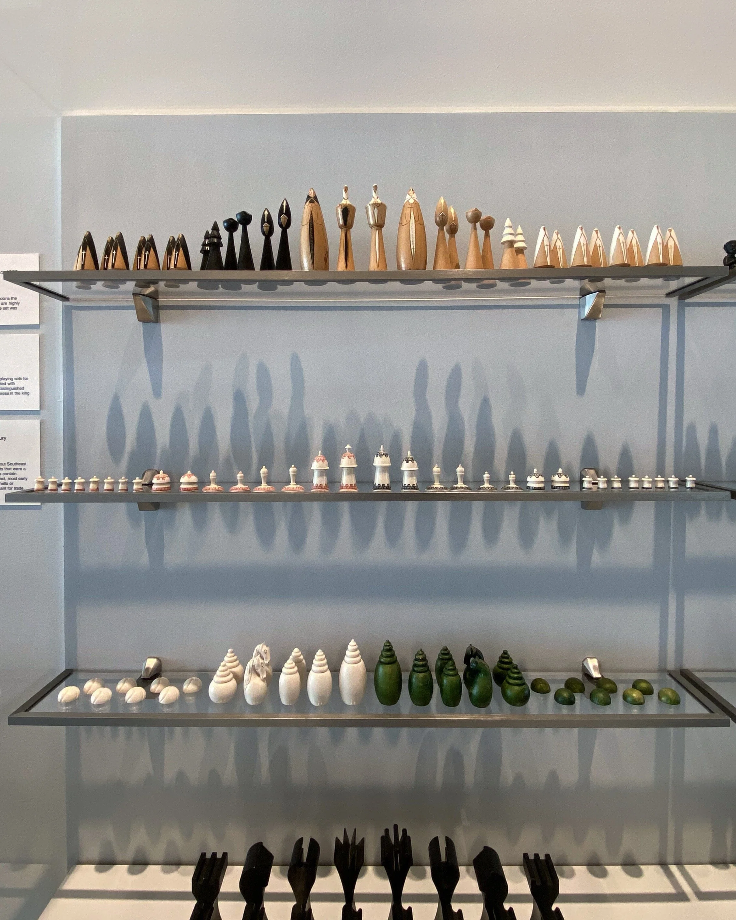
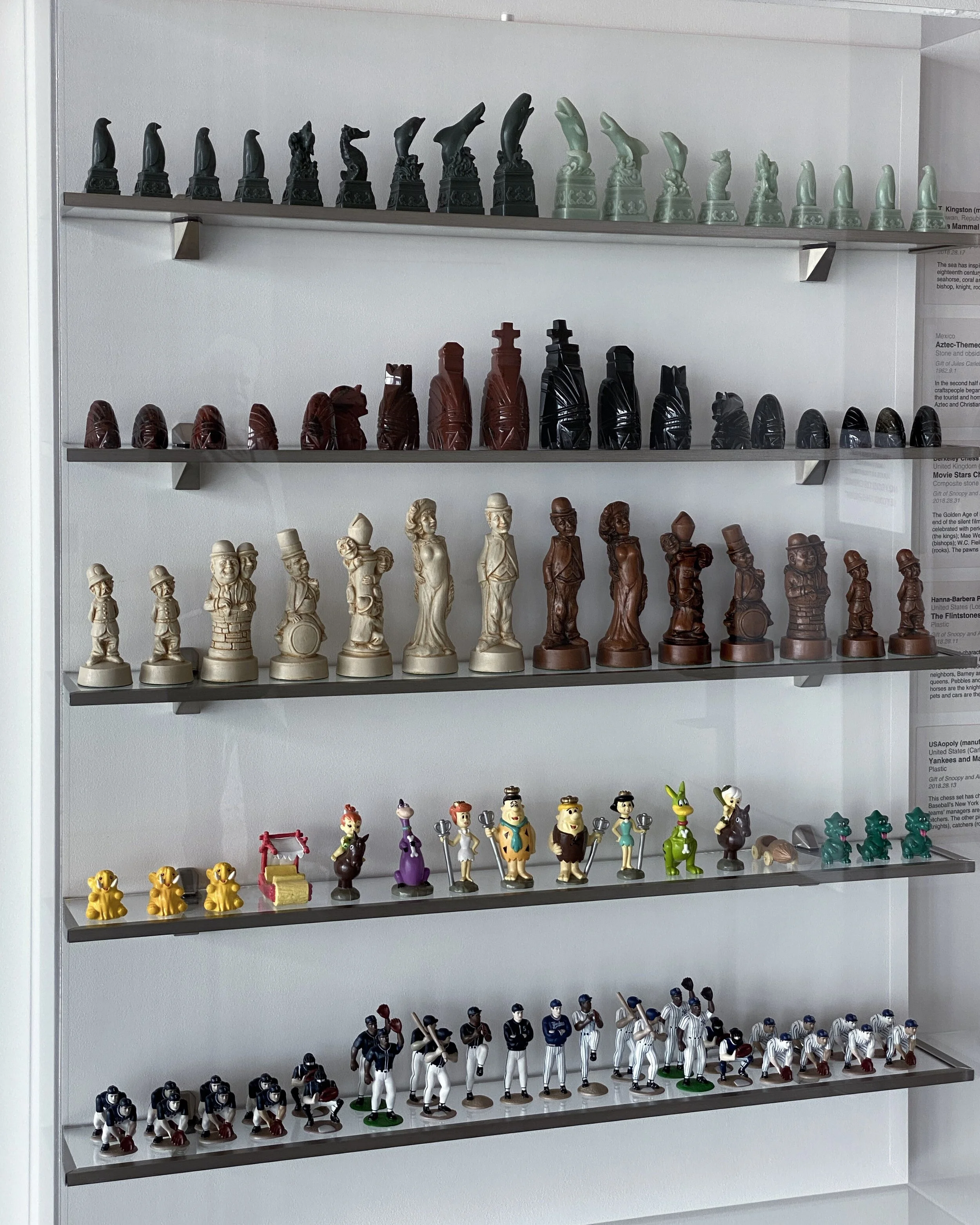
The museum's café on the lowest level is named Loïe after the dancer, and on the way, the hallway's walls are packed with dozens of chess sets from all over the world. Some of the sets were of a specific period, others were modern sets inspired by historic events, periods, or even more modern influences (including a set representing silent film stars and another of the Flintstones).
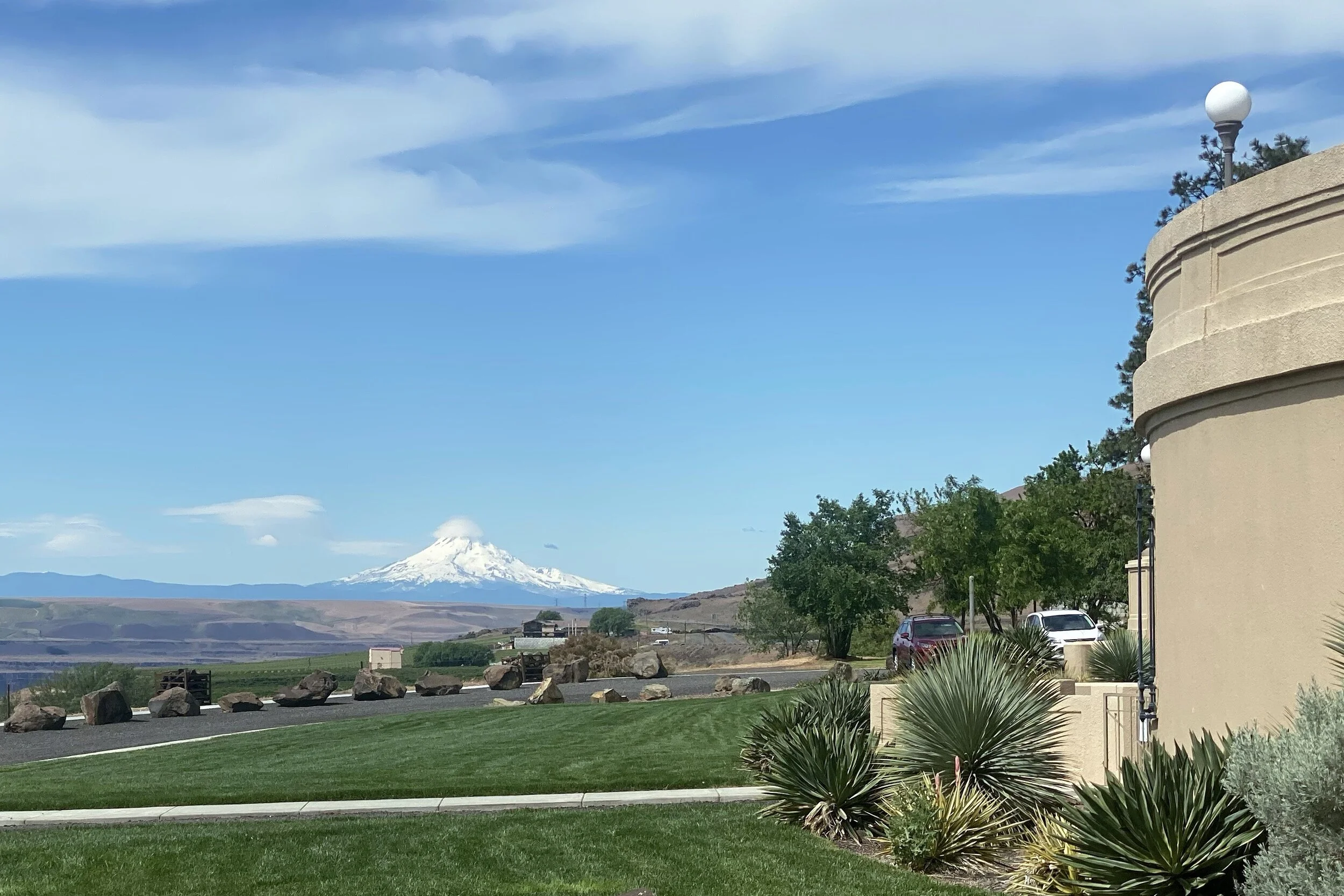
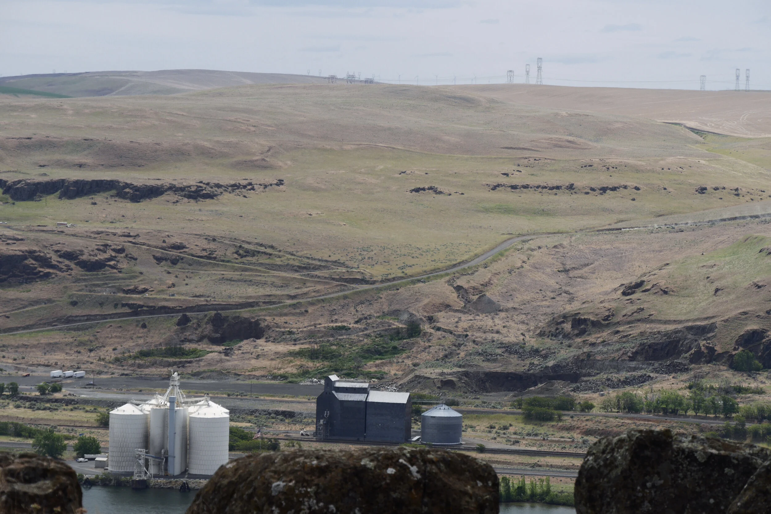
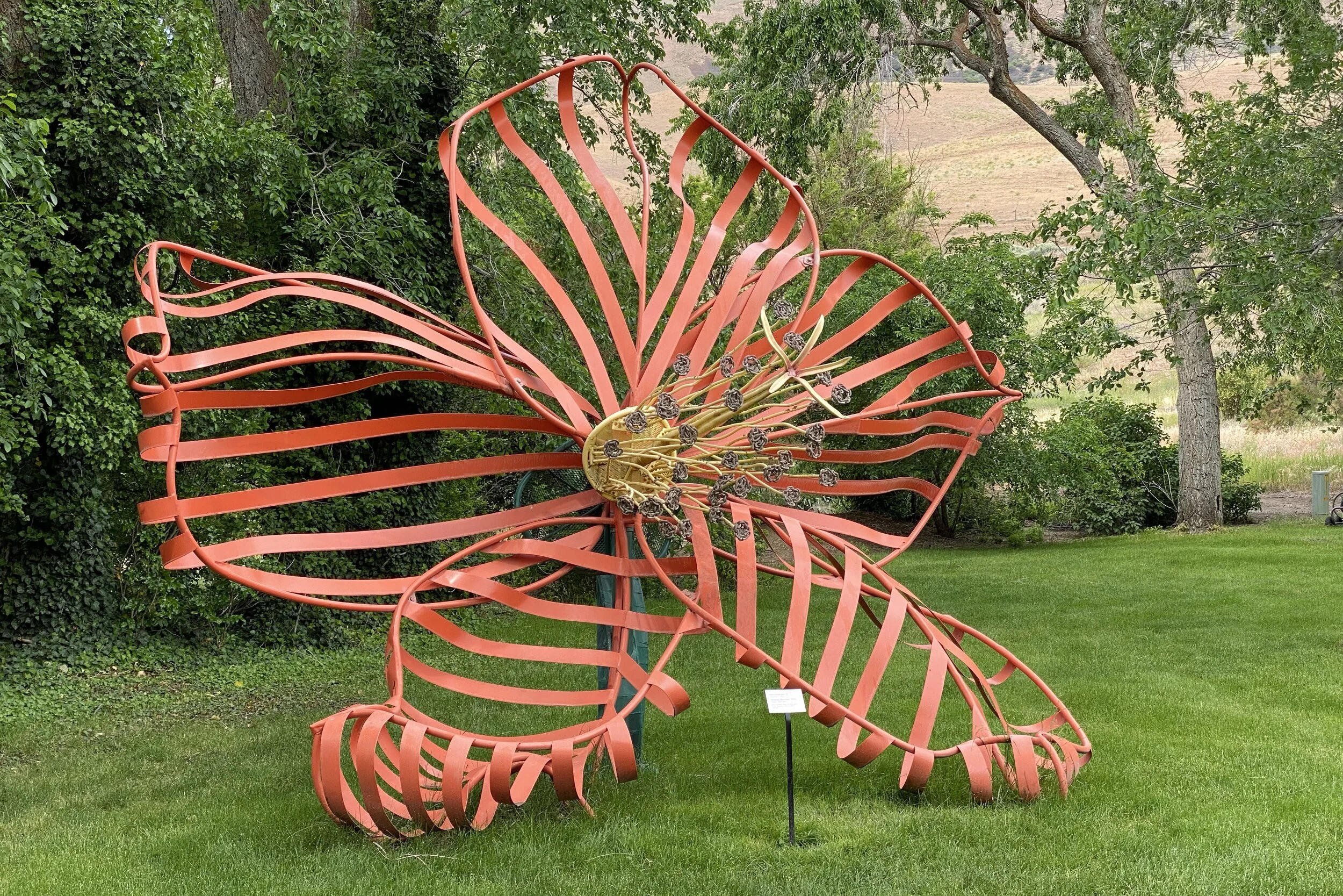
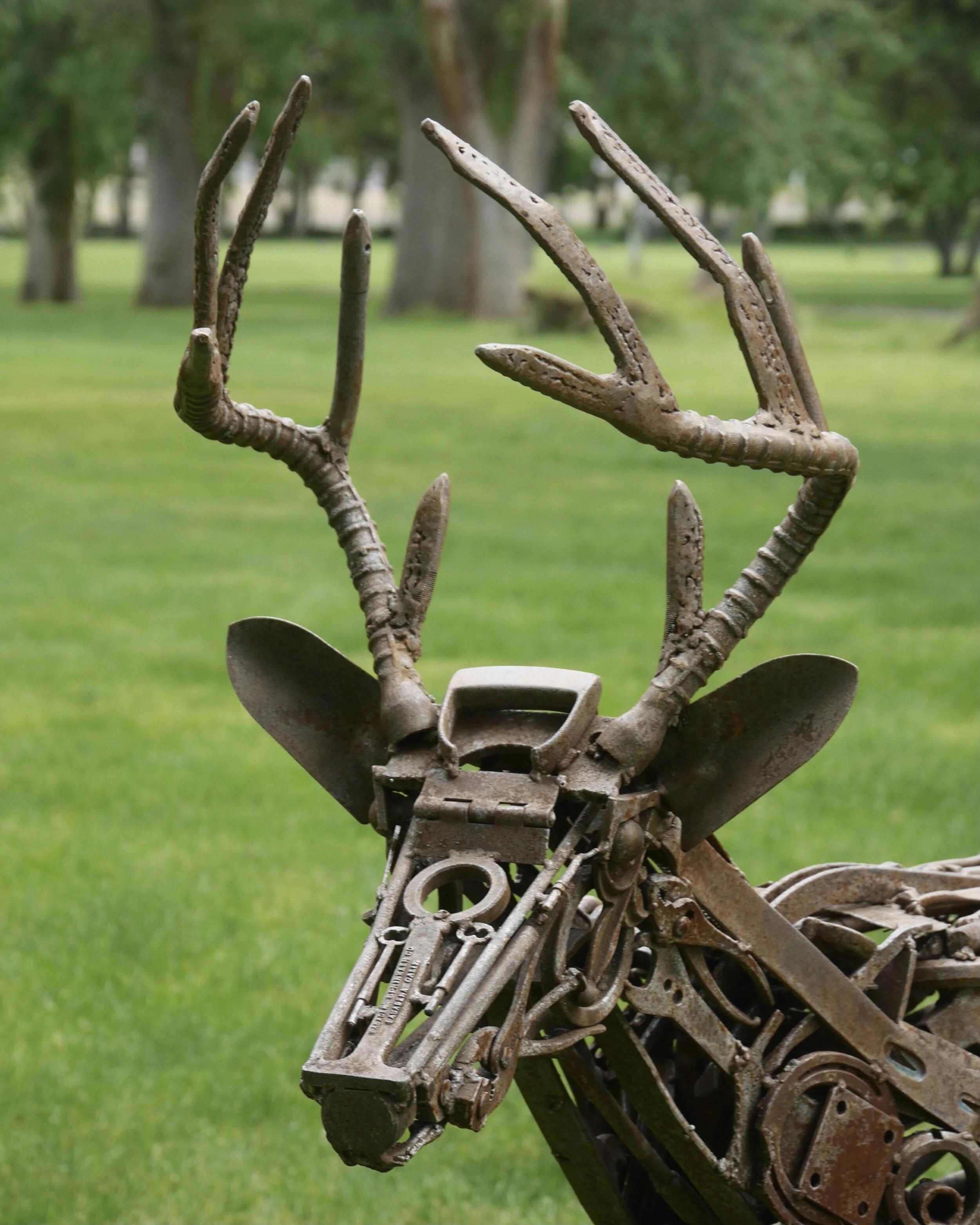
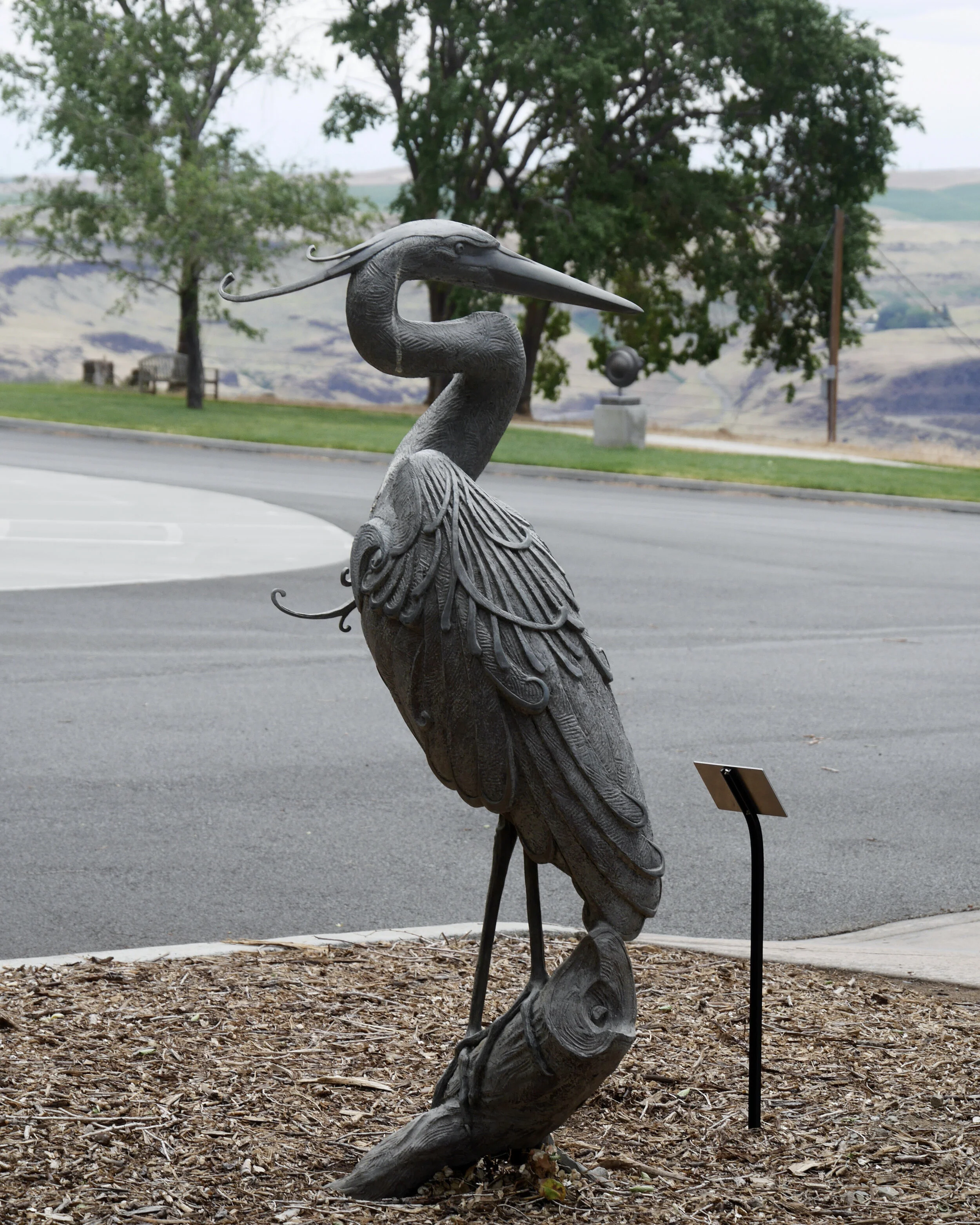
Having finished with the exhibits in the building, we went outside to walk the grounds. Across the Columbia River you could make out some tracks of the Oregon Trail, and Mount Hood looms large. Scattered around the building are several sculptures, so we got to take in views of the surrounding area and the mansion while going between pieces.
Back in the car, we looked for a place to eat and settled on getting takeout from a diner in Goldendale, so we started north.
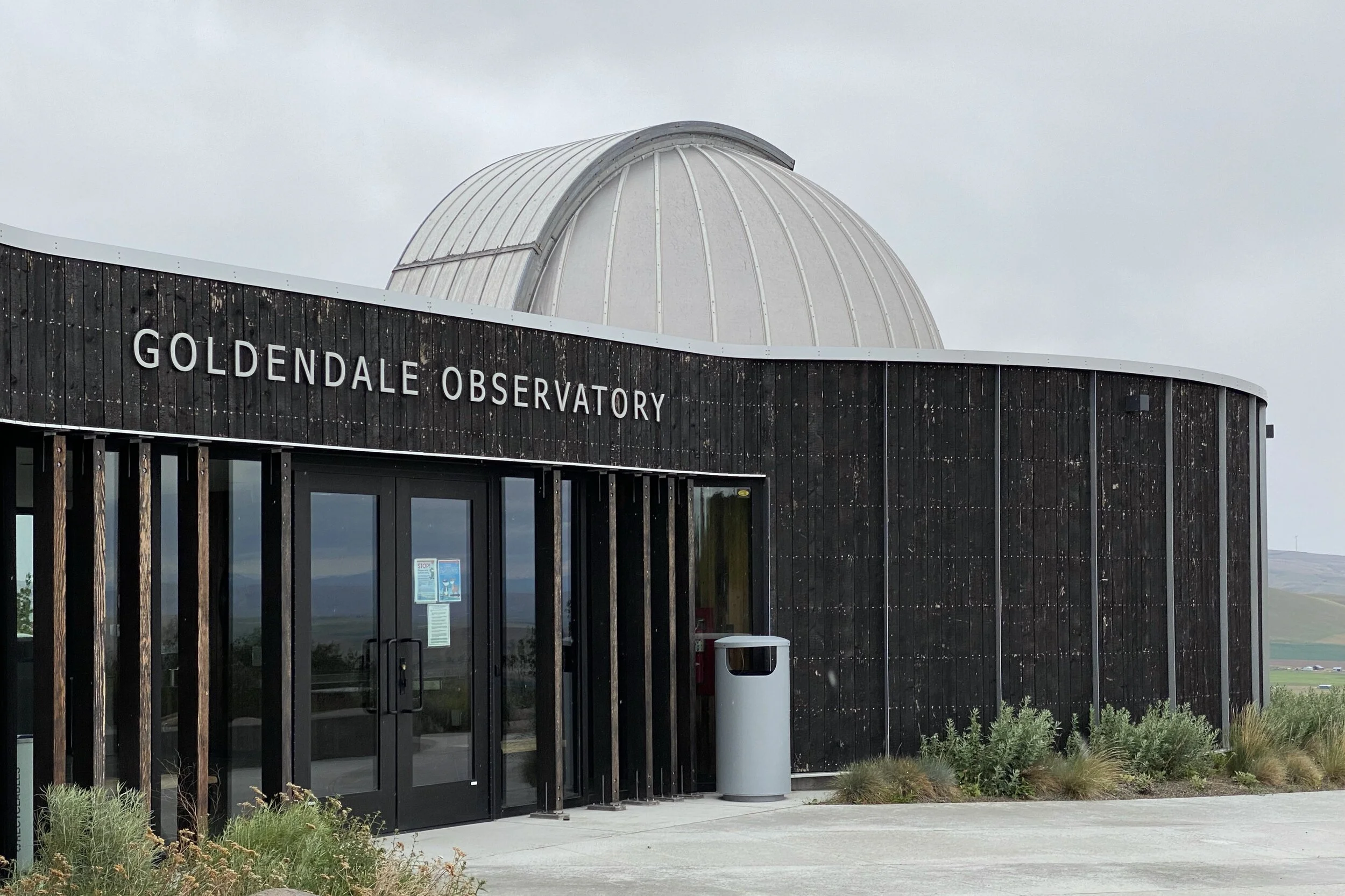
Goldendale Observatory
Our tickets for the Goldendale Observatory were for 2 pm (they only have one show on the weekend days and are closed during the week) but we had plenty of time, so we planned on parking near the observatory and eating our lunch in the park. The gate was closed, but we found a small parking lot and sat on the railroad ties.
A series of trails weave around from where we had parked, so we picked a route and headed out. There was a viewpoint for Mt. Hood and Mt. Adam’s, but the weather prevented us from seeing them. On the way back to the car, we saw a vehicle drive by towards the observatory, and a while later, we saw it going the other way. By the time we got back to the car, it had returned and pulled in, saying that the gate was still closed. The driver tried calling to see what was up but had to leave a message. She decided to wait in front of the gate, and we followed.
It was a bit before 2 pm when a ranger came by and opened the gate. After we all parked, he unlocked the restrooms and then went inside to set things up while we walked around the building. It started to rain, so we were all glad when he opened the doors. He explained that there was supposed to have been another person who opened the gate earlier, so that mystery was explained.
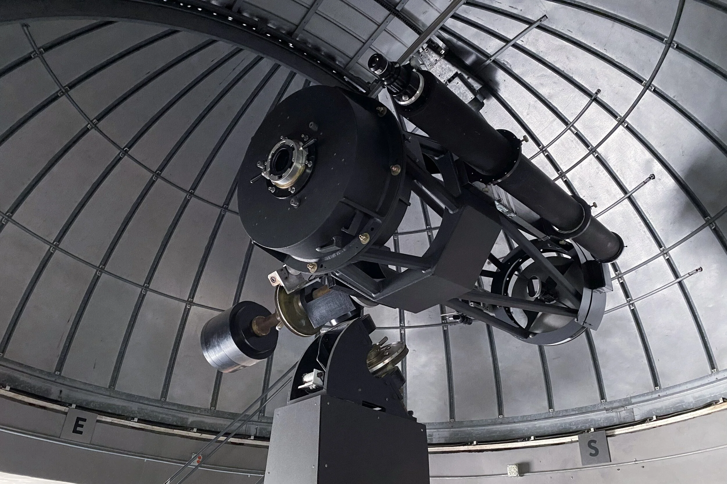
As it ends up, the ranger not only was the director of the Goldendale Observatory, but he was also a big astronomy nerd. He wasn't afraid to dip into the weeds when talking about technical aspects of the telescope or cosmology in general.
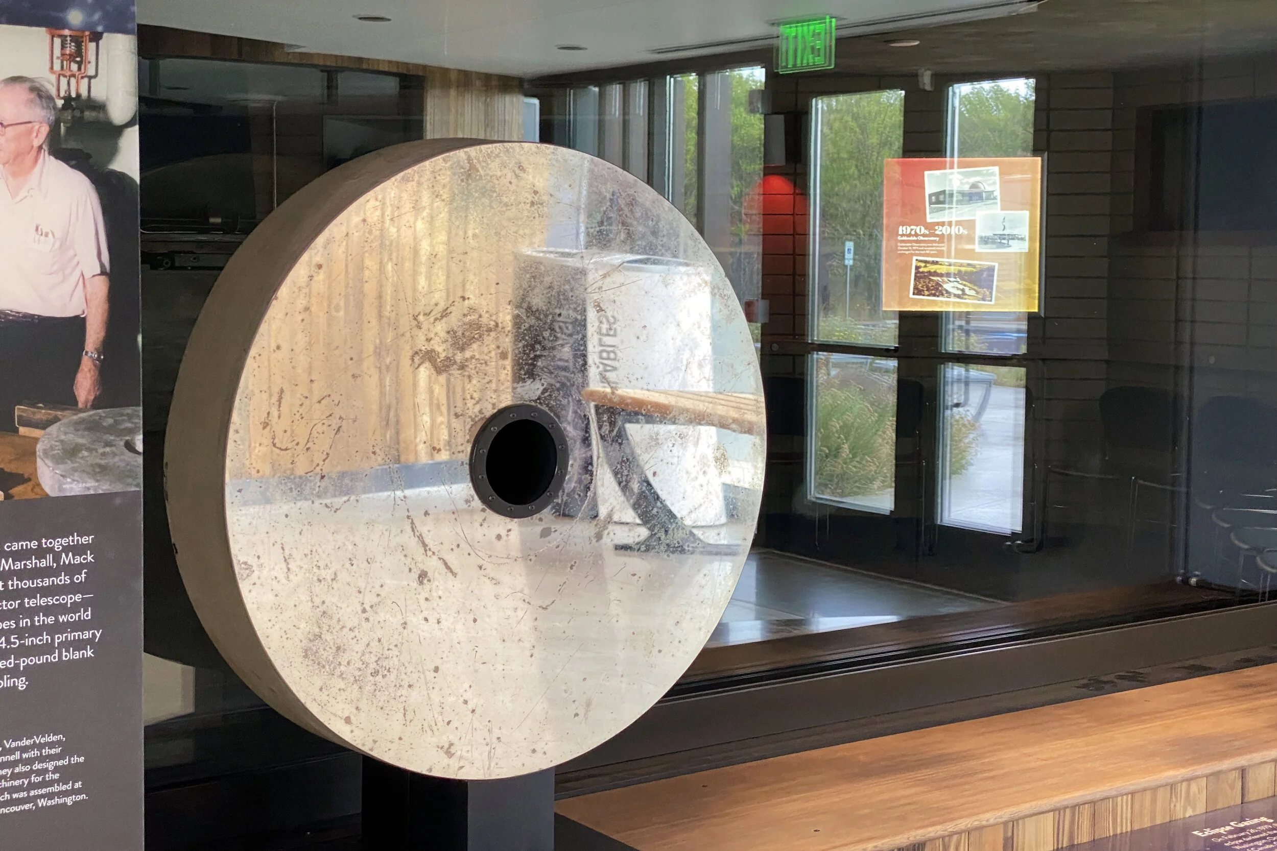
The program started with the telescope where visitors can look at the sun. Since it was raining, however, the dome needed to stay closed. The ranger did describe how the telescope was originally built in Vancouver, WA by amateur astronomers, but the combination of Goldendale being in the path of the total solar eclipse in 1979, being close to the same latitude, and far less light pollution were reasons enough to move the telescope to the current location.
The observatory just went through a lot of construction, expanding the classroom and shoring up the telescope.
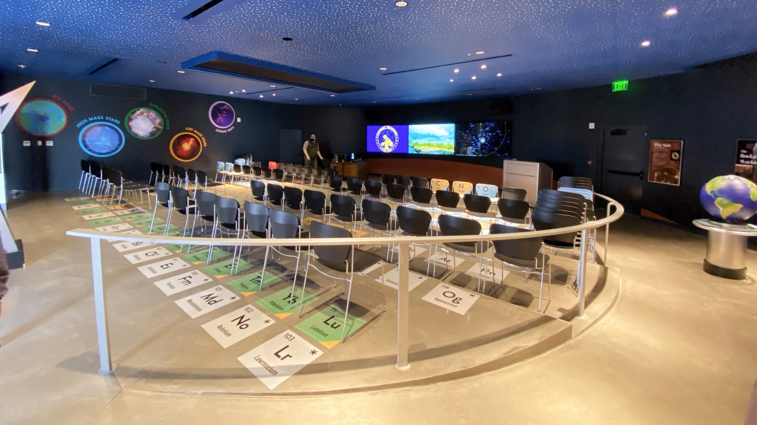
We then moved over to the classroom where the ranger gave a lot of information about stars and the science behind solar observations. He was good at answering questions, especially from a young girl; the ranger's replies addressed her questions and statements and used them as jumping-off points to continue the discussion.
We saw several photos and videos he had taken, both through the telescope and of the skies around the observatory. He caught some of a Starlink satellite deployment, which looks like a streak going across the sky. He said that once they get into their final orbit, they're not easy to find; they can show up, but for the most part only when they're reflecting sunlight.
After the program, we hit the road, knowing we would want to grab dinner on the way home. We picked up a bento box in Ellensburg, but it was large enough that we only shared half of it. We put the rest into the cooler and did the familiar route from Ellensburg to home.