Hikes July–October 2021
Autumn marks the end of the hiking season in the Pacific Northwest. We ended getting only a handful of hikes over the past several months, but Melody did hike several times with a weekly group.
The image of the hiking track shows is a 3D rendering, with our route in orange (the grey/white circle with the blue arrow is our starting point). The graph shows our altitude (the top one) and our pace (the bottom line). It also shows both distance (white numbers at the bottom) and where we were at the various hour markers (black numbers at the top).
Oalallie Lake
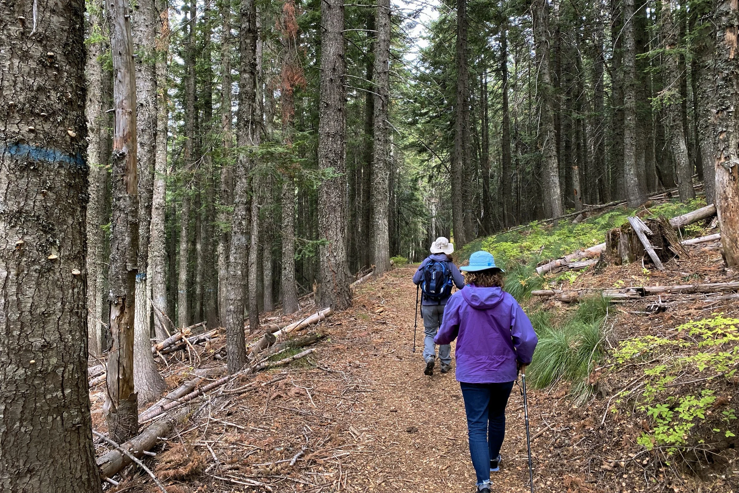
Olallie Lake via Pratt Lake Trail—5-Jul-2021, 8.25 mi, 2,200 ft gain
Since it was the height of hiking season, we looked for a place that both wasn't too far away and had several parking spots so we would be pretty sure to find a place to park. When we did arrive, there several spots in the lot, and we were able to grab a place not far from the trailhead.
The same lot and trailhead are used for the Granite Mountain Trail, which is quite popular, so we figured we would see more people until the Granite Mountain cutoff, and that was indeed the case.
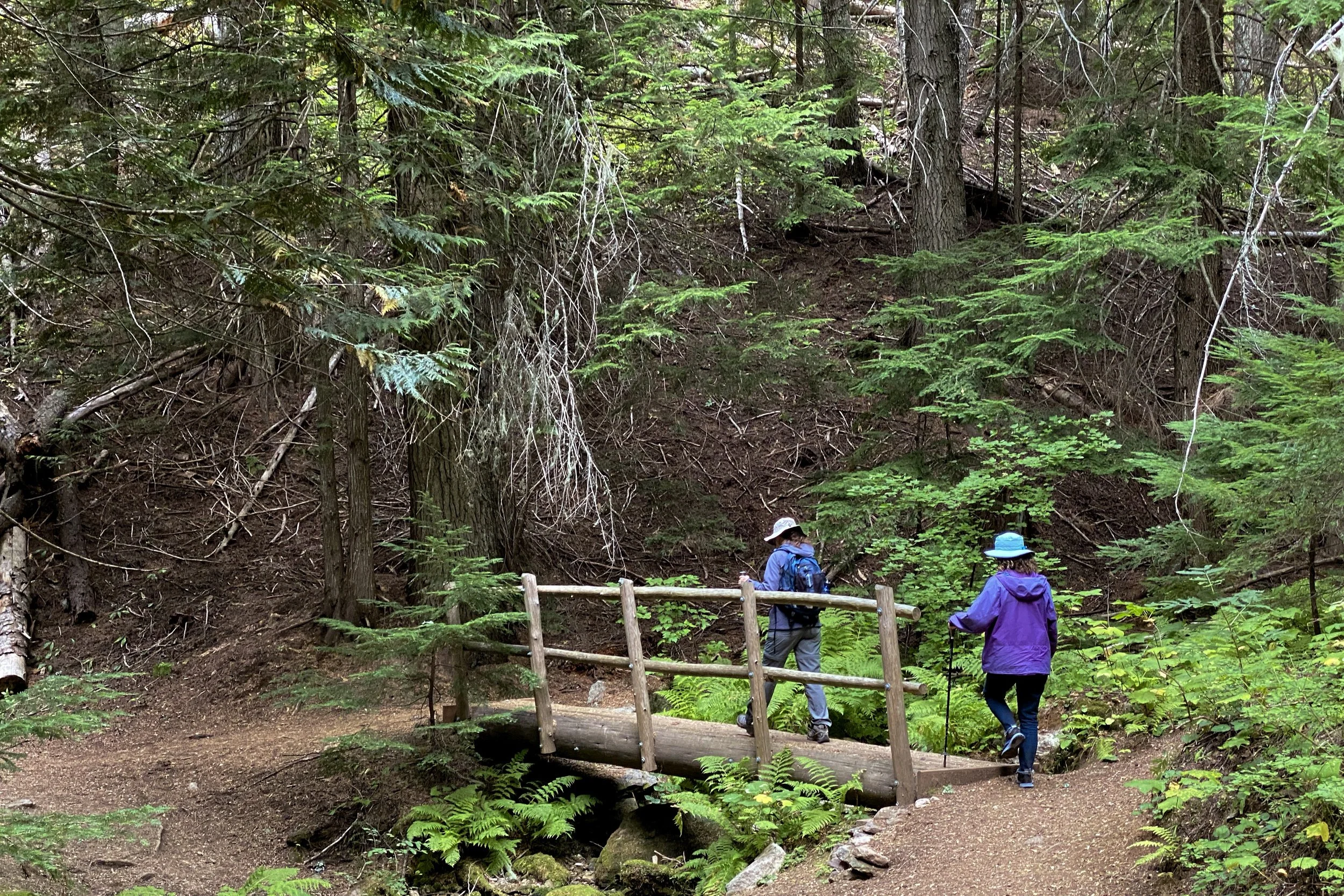
There were a few stream crossings along the way, but they were shallow and had plenty of rocks to step on. We also saw quite a few waterfalls of different sizes. The stream crossings started getting large enough that we were going across on boardwalks and simple log bridges.
Before too long, we reached the lake, and it was time to find a spot to eat. There were several other people there also enjoying the view.
After eating, instead of going back, we started looking for the boot trail that would take us to the Pratt Lake Trail and around Oalallie Lake. Before getting there, though, there was a huge tree across the trail. Another couple was taking a detour coming back towards us, which helped show us the way. We got to where the map showed the boot trail, and after a little bit of looking around, we found it. Following it up a pretty steep hill, we made it to the Pratt Lake Trail and began heading back. After completing the loop around the lake we went back the way we came, enjoying the waterfalls from the other direction.


Lime Klin Trail
Lime Kiln Trail—1-Aug-2021, 7.1 mi, 735 ft gain
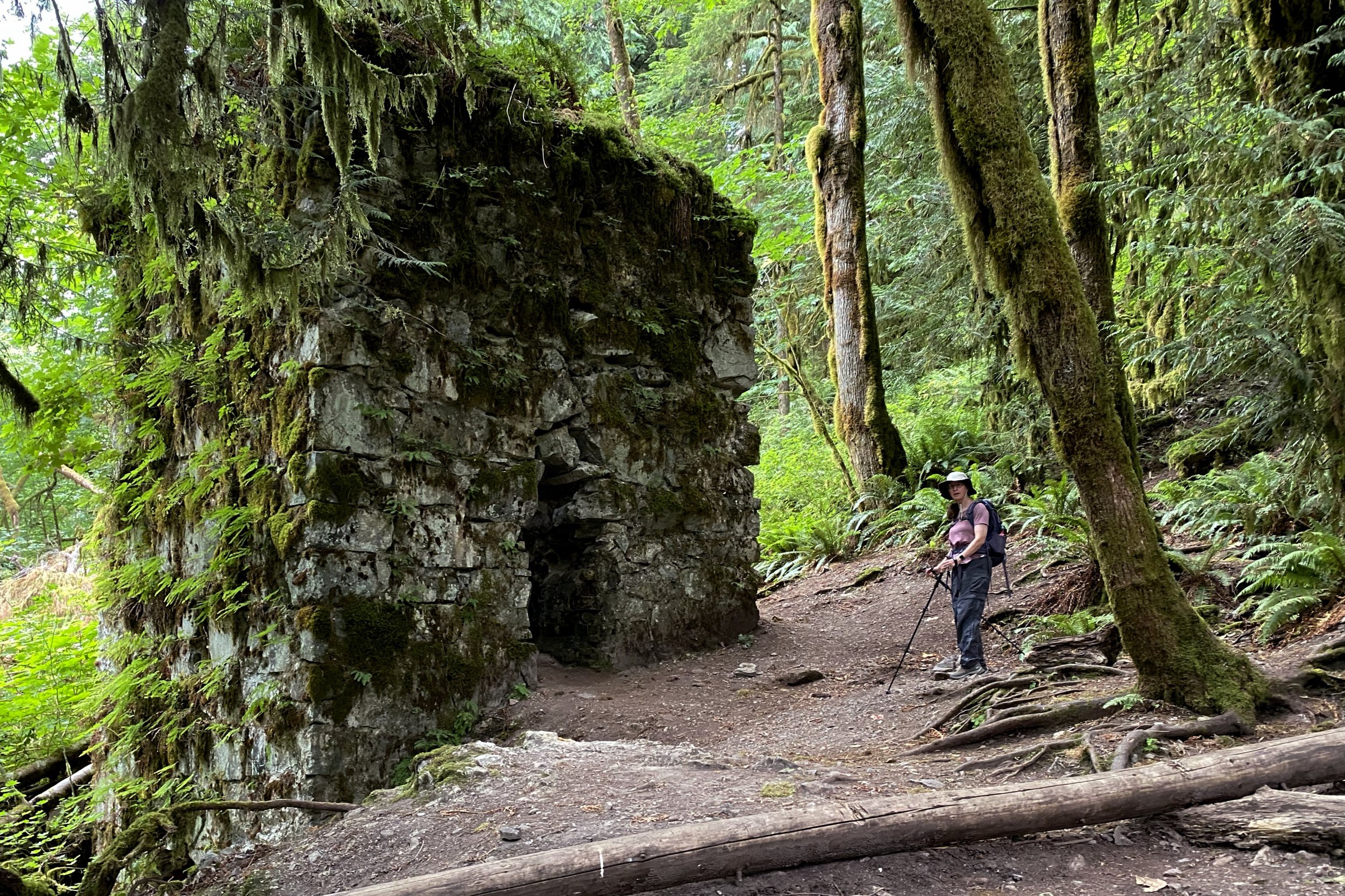
We had seen this trail pop up a while ago but never made it out there. We were up for a hike that was a little less strenuous, and this one fit the bill. We didn't do a bunch of research about what we would find, other than a lime kiln.
When we got to the trailhead, we saw that there were new signs put up just the month before as an Eagle Scout project, which seemed like a good one to do. The trails around the Goldendale Observatory were mapped out as another Eagle Scout project, so it wasn't the first one we had seen this year.
Early on, we saw there were a lot of thimbleberries along the trail, which were a treat since ours had already finished for the year. The trail eventually started wandering near the South Fork Stillaguamish River, with great views of the water below us.
It wasn't too long before we reached the lime kiln, which was hard to miss. It's a huge stone cube-shaped structure with fire pits on three sides. Lying nearby were several old and rusted saw blades. Our map showed were other relic locations, but we didn't see anything there.
Being a bit early for lunch, we proceeded along the trail to the end where we saw the site of a rail bridge which is long gone, but concrete pads showed where the bridge crossed the river. We then worked our way back a bit to a spot by the river which was a great lunch location. There were a few other people there, but lots of space was available.
After eating, we retraced our path, going around some muddy sections, around big tree stumps, and under trees that went across the trail.


Granite Mountain
Granite Mountain Trail—6-Sep-2021, 8.3 mi, 3,700 ft gain
Note that these numbers are what two of my devices recorded, but Melody’s was closer to what trail descriptions say, 9.5 miles and 3,800 ft gain.
We felt up for a challenge, and with the weather forecast looking good, we decided to go up to the fire watchtower at the top of Granite Mountain. It uses the same trailhead as Oalallie Lake, but with the promise of clear skies, there were more people parked there. We found a spot a little way down the road, got our stuff, and started.
The first mile or so was familiar ground, but this time we took the cutoff to head up The Granite Mountain Trail. The whole way was a pretty steady uphill climb, with short spots which were mostly level.
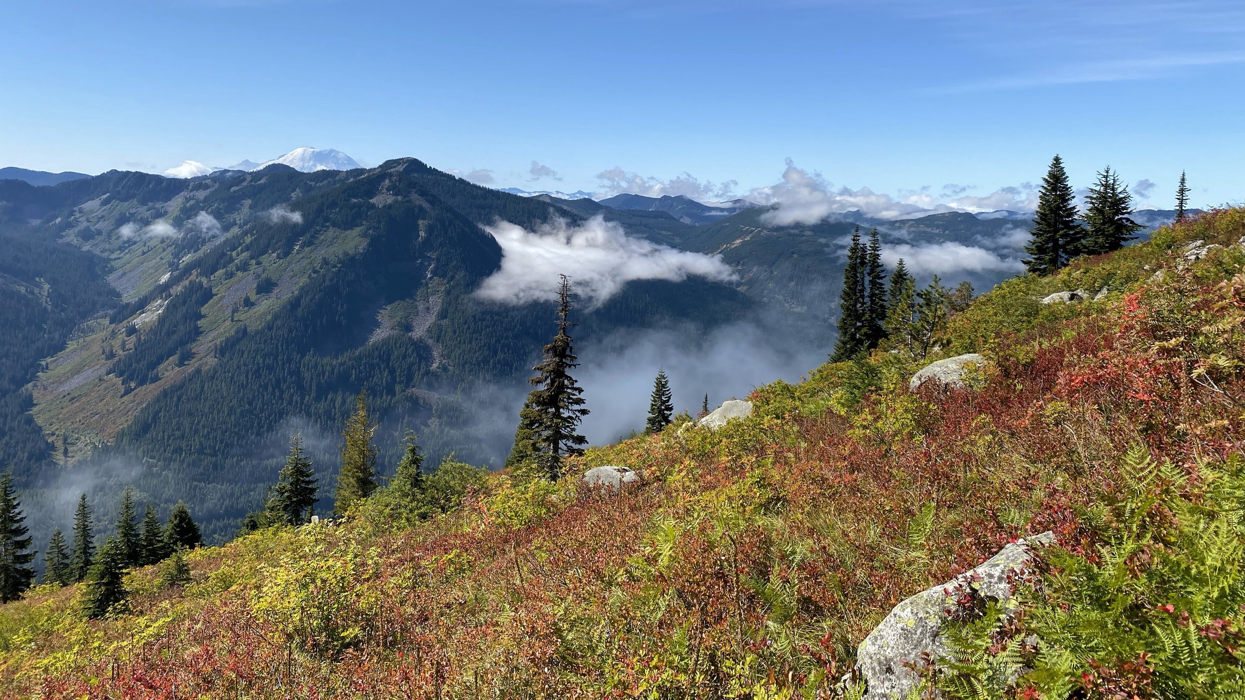
The beginning of the hike had us in the fog, but it thinned out as we gained elevation. Once we got above the fog, it was clear blue skies the rest of the way.
About halfway up, we got to a meadow where we started seeing lots of berries. We even saw someone harvesting into several containers. Of course, we snacked on berries, not only because they were tasty, but they gave us quick breaks.
It was at this point of the hike that we got our first glimpses of the watchtower, which looked very small and very high up. As we got closer, it became evident how Granite Mountain got its name, with all lots of huge granite boulders all around.
As the watchtower got bigger, we took the main trail went around the back, but there was another path where you scramble up a ridge. We saw some people going that way, probably because the default route on AllTrails went that way (it has since been changed to the main trail). Because of the angle, we couldn't see the peak for quite a while, but after taking the turn on the last switchback, it was right in front of us.
Granite Mountain is a very popular hike, and there were a lot of people hanging out around and under the watchtower. We found a spot underneath and sat down to have lunch, with a great view of Mt. Rainier in front of us.
The hike back down was mostly uneventful, other than seeing even more people picking berries into containers. Since it was pretty steep going up, we took our time going down.


Mt. Spokane Trail 100
Mount Spokane Trail 100 to Smith Gap—17-Sep-2021, 7 mi, 1,700 ft gain
We try to do some sort of outdoor activity when we're in Spokane, and this trip was no exception. Celeste was with us, and since we hadn't hiked in the Mt. Spokane area, we decided to give that a try. It was pretty tricky to find the trailhead, but we did. Oddly, we were the only car there, which made us wonder if we were in the right place, but we did see where the trail began, so we went on ahead.
Trail 100 works its way down along the side of Mt. Spokane towards the Smith Gap, so we knew we would be going up on the return trip. Fortunately, it wasn't very steep, so we were able to go at a pretty good clip. There were several intersections with other trails, so it was nice that the signs were pretty good.
The end of the trail is where it intersects with Trail 140 right at a small picnic area with a restroom, which made for a nice place to have lunch.
When we were done, we got ready for the hike back uphill. The relatively gentle slope and overcast weather made it a pleasant climb. At one point Melody and Celeste saw some wild turkeys running along the trail, but we never figured out where they went.
Getting back to the parking lot, we were still the only car there. We weren't surprised, since we didn't see anyone else on the trail.


Maple Pass Loop
Maple Pass Trail—3-Oct-2021, 8.5, 2,300 ft gain
Fall is the season for the larch trees to change color in the North Cascades, and every year we try to find a hike that lets us see them. This one was a bit further north than we've gone before, being on the Cascade Loop. It was also pretty far (the drive was about 2½ or 3 hours), but very popular, so we left pretty early to hopefully not have to park too far away.
As we got close, we started to see cars parked along the side of the road, so we found an open spot and pulled over. We ended up being within a ½ mile of the turnoff, and the trailhead was pretty close to the road, so we didn't add too much distance to the hike. We considered ourselves fortunate.
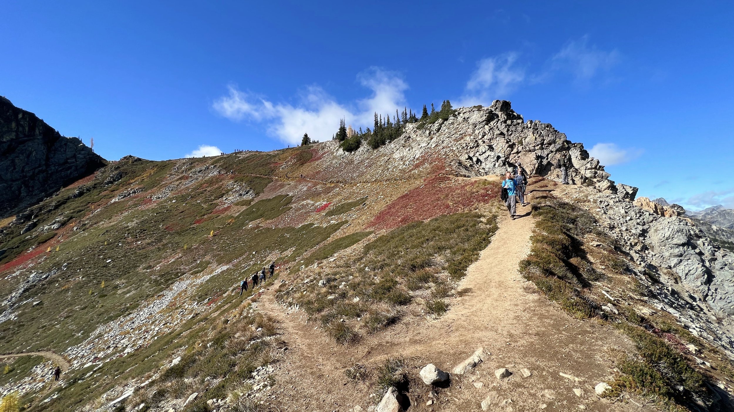
Most people hike the Maple Pass Loop counterclockwise, taking the steeper part down. Since we find it easier on our knees to do the steeper part while climbing, we went clockwise.
The beginning was an interpretive trail, but before too long it turned and started climbing. We got some hints of fall color in the bushes, but no larches were to be seen on the early part of the hike.
At the end of one of the switchbacks, we got our first look at Rainy Lake, not realizing that a couple of switchbacks later, we would get a stunning view. It was so spectacular that some hikers coming down the other way audibly gasped.
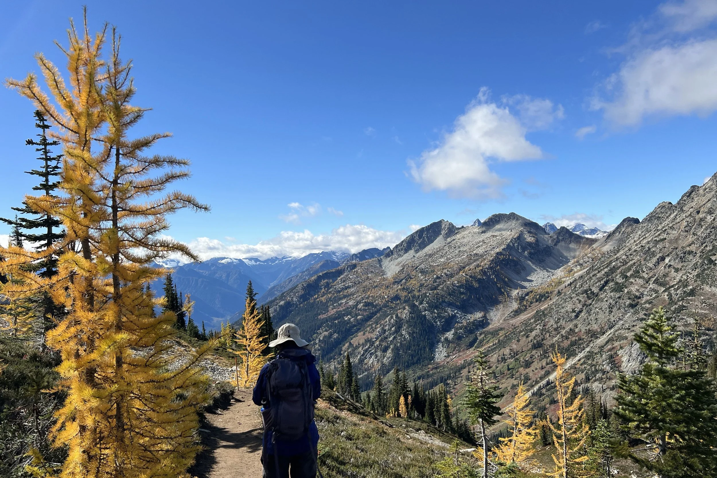
It was time to start going up to Maple Pass, and we started to see some larches. My glasses have a slight bronze tint when they’re dark, so the colors looked even more golden than when I took them off to see the true color. It was a good way to view them, though.
Going up the side of the mountain was quite a bit of work, and we could see people at the ridge, but they looked quite small. When we were almost at the top, we started getting glimpses of Lake Ann, which we would be circling for the rest of the hike. Shortly after that, we were on the ridge and found a place to have lunch.
Having reached the top of the trail, we started working our way down to finish the loop. It got very windy for the first part but calmed down pretty quickly. We saw a lot of people working their way up, and as we turned to look at how far down we had gone, the people at the ridge once again looked very high up and very small.
This is where we started seeing a lot of larches, not only on the hillside but all around us as the trail wound amount them. We got to see them from all angles, including backlit by the sun which made the larches glow. It’s easy to see why we look for them every fall.
Being enchanted by the larches doesn’t mean we lost sight of Lake Ann. We got different looks at it as we worked our way around, and it slowly got larger as we dropped in altitude. There were even more hikers going the other way than we saw higher up.
Eventually, we got low enough that we lost view of Lake Ann, but we took the spur trail that led to its shore. We didn’t take the time to find one of the beaches, but we did get a good look at the water.
Once we met back up with the main trail, we didn’t have too much further to go to reach the parking lot. Because of the long drive and lengthy hike, we ended up grabbing dinner on the way home, rather than getting home in the middle or late afternoon.