Hikes - May/June 2021
Most of our hikes in May were during our trip through the Columbia River Gorge, but we did sneak a hike early in the month to Wallace Falls. We intended for that early hike to get us used to elevation gain (knowing we would have 2,500+ ft gain hikes), but it also ended up being very long. And the last hike was snuck in before several busy upcoming weeks.
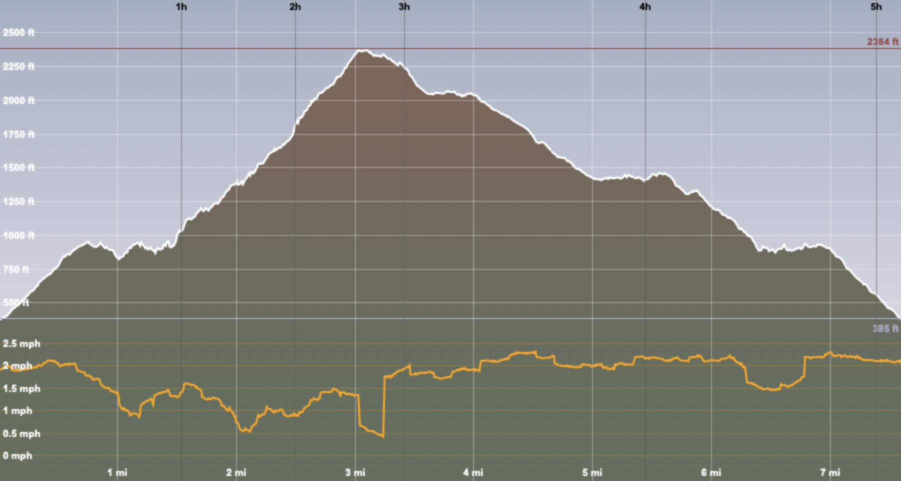
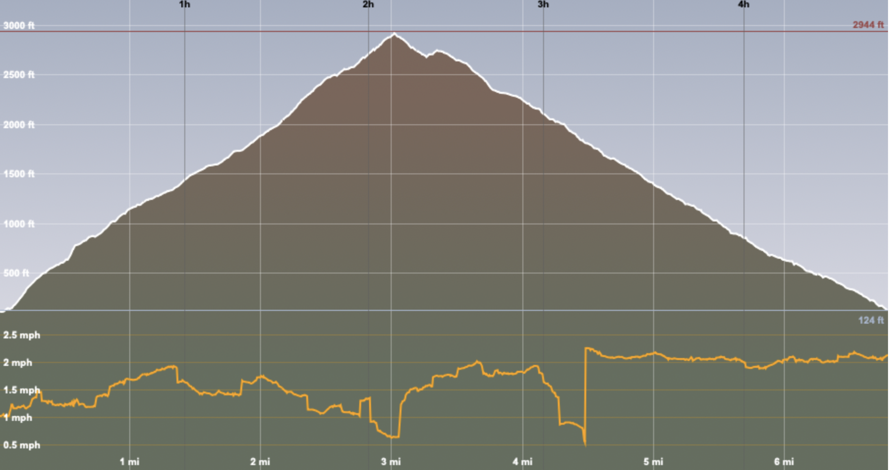
The image of the hiking track shows is a 3D rendering, with our route in orange (the grey/white circle with the blue arrow is our starting point). The graph shows our altitude (the top one) and our pace (the bottom line). It also shows both distance (white numbers at the bottom) and where we were at the various hour markers (black numbers at the top).
Wallace Falls and Wallace Lake
Wallace Falls and Wallace Lake Loop—2-May-2021, 13.25 mi, 2,150 ft gain
When we started planning on doing this hike, we thought that we would be happy with going to the Lower, Middle, and Upper Wallace Falls, which is about 5 miles and gains 1,500 feet. If we felt good after that, then we would go on to Wallace Lake and then loop back, which adds another 5½ miles but only 500 feet. If you look at how far we went, we did more than just the loop.
Since this trail isn’t very far away, it’s very popular; we didn’t go extremely early but did try to make sure to not take too long to get onto the road. The parking lot was extremely full, but we were able to slip into one of the last designated spots. After grabbing our bags and poles, we were off.
There are several waterfalls along the first part of the trail, and it wasn't long before we came upon a short spur that took us to Small Falls. The name is appropriate.
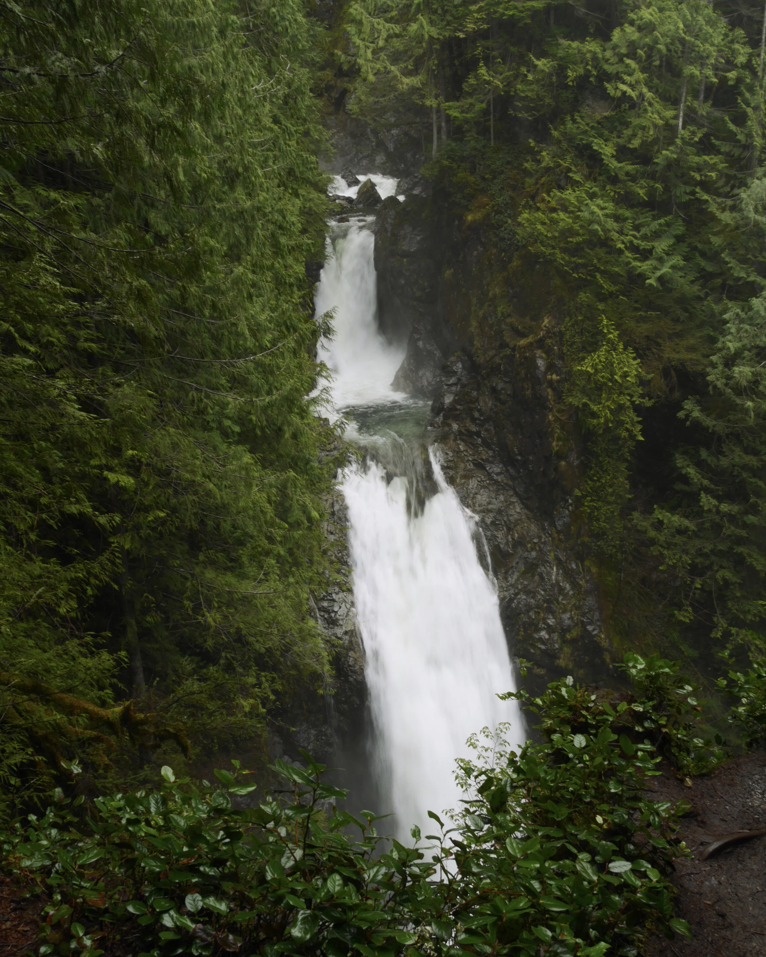
It was time to start climbing alongside the Wallace River. There were quite a few people on the trail; we weren't surprised, since it's a popular trail. We quickly gained altitude, 400 feet between the Lower and Middle Falls, and another 300 to the Upper Falls, over one mile. All three falls had great views, and we took advantage of the first Middle Falls lookout to have a quick snack and take in the view of the Skykomish River Valley.
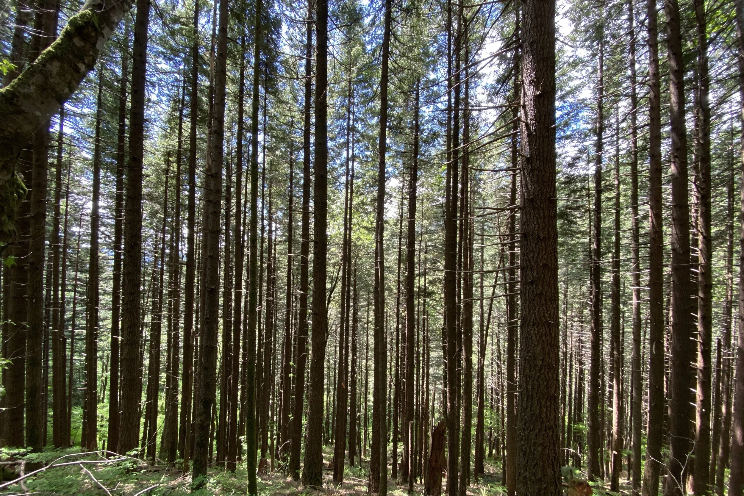
Having taken in the waterfalls, we felt that we would be able to add the extra amount to go to Wallace Lake. There's a pretty steep less-maintained trail that heads from the Upper Falls to a logging road, which you follow for quite a while. Several clear-cut sections were giving us a view of the valley, but uphill from the road was a dense forest.
After following the logging roads for a bit longer, we came to Wallace Lake. There's a picnic table at the south end, but we continued along the west side until we found a spot that had a great view, sat down, and ate lunch.
We started thinking about whether we also wanted to go to Jay Lake, which would add three miles from the picnic table. We figured we were already more than halfway along Wallace Lake, so we decided to go to the north end, hoping for more views. The lake was obscured at that point, but we saw a sign for Jay Lake that said it was less than a mile, so we decided to go for it.
The trail between the lakes was level for the most part and an easy walk. We got to the lake, but most of the views were pretty obscured. After walking around a bit, I found a spot where I could hold my camera up to get a view. Since there was a composting toilet there, we took advantage of the opportunity before starting to head back. We saw another person who was also disappointed by the view.
Rather than going back to Wallace Falls, we followed the North Fork Snoqualmie River, which was a more direct route back. There weren't nearly as many people along this trail. One couple had been smoking a joint, and were very happy; a while after passing them, we could tell where they had stopped to smoke.
Towards the end, we met back up with our original trail and tried to be encouraging to the people who were asking how much further the falls were. The grandmother of one family wasn't optimistic that she would make it; they were about halfway, and there was still a bit of climbing to do.
As we were almost at the car, we were feeling the 13-mile hike, which is more than we normally go. We did take it easy for the next day or two, so it was good to know that it doesn't take us long to recover.


Multnomah and Wahkeenah Falls
Multnomah and Wakeenah Falls Loop–18-May-2021, 5.8 mi, 1,625 ft gain
Note that I didn't start recording our track until after we left Benson Bridge, so there's a gap in the loop that we walked.
We did a quick trip to the Columbia River Gorge, and on the way we went to Multnomah Falls, doing a loop that took us over to Wakeenah Falls. This was the first time we had been out of Washington since things got locked down, even though it was just across the Columbia River.
The eastbound and westbound lanes of US 84 split right around the falls, opening up a big parking lot. We got a place to park very close to the pedestrian underpass which took us to the Multnomah Lodge. We were able to see Multnomah Falls from the parking lot but got a better view from the lodge. We then started along the path which took us to the Benson Bridge at the base of the main falls.
Leaving the bridge, we started on a series of numbered switchbacks. Since we got a relatively late start having driven from Seattle, we ended up having lunch on a bench at one of the switchbacks which a great view of the falls.
Having eaten, it was back to the switchbacks until we got to a ridge, then we went back towards the falls to view them from the top. The viewpoint is far enough back that you can’t see much other than the water going over a ledge, but it was a nice place to take in a view of the Columbia.
Multnomah Creek flows into the falls, and we started following it upstream. There are several other waterfalls along the way, the Lower, Middle, and Upper Dutchman Falls, Wiesendanger falls (a particularly photogenic one going into a pool), and Ecola Falls. With that, we veered away from Multnomah Creek and started our way further up the hill so we could cut over or Wakeenah Creek and start our way down.
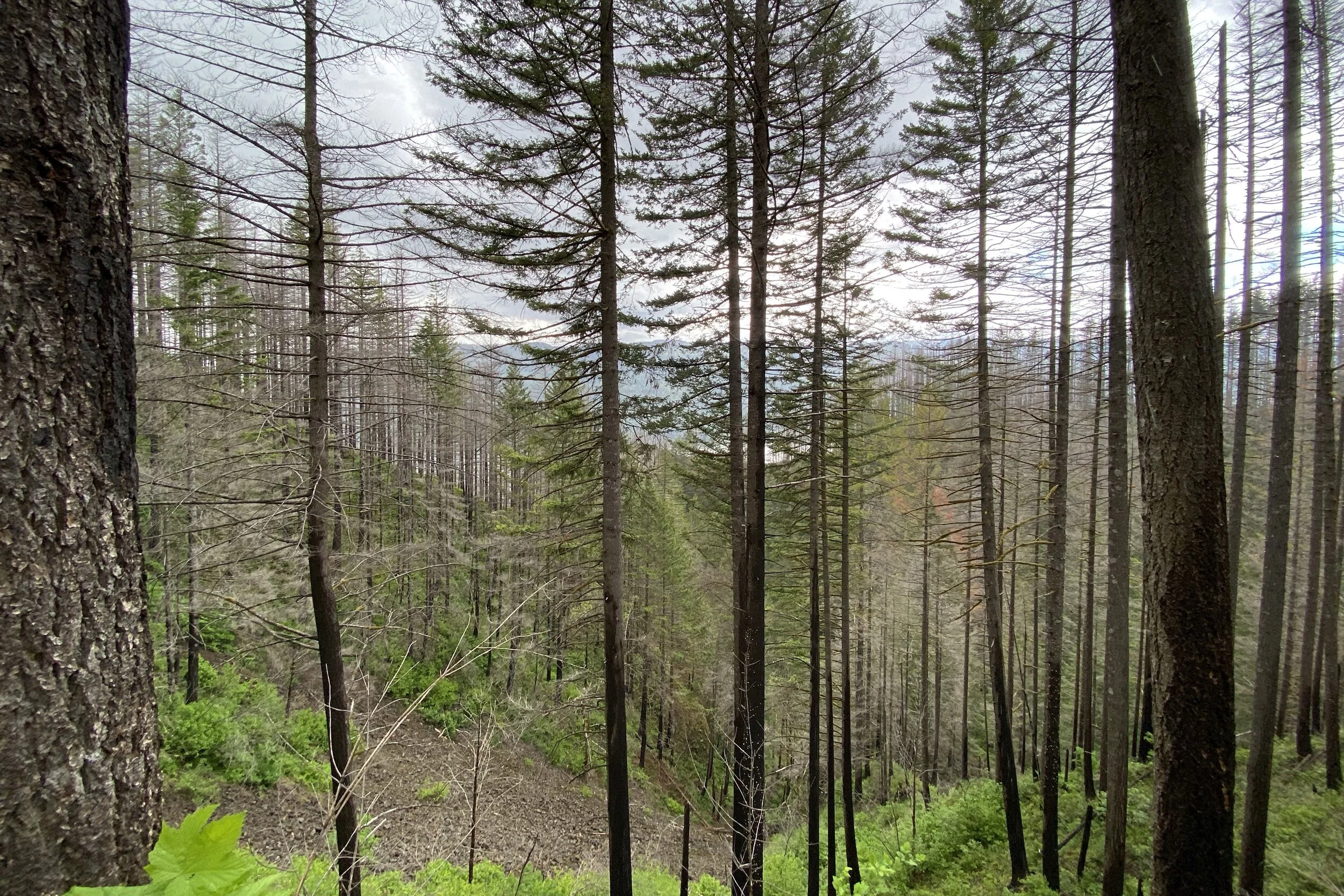
The weather had been overcast when we began but we started to get some sprinkles. Even though we were going through a forest that had burned in the Eagle Creek Fire of 2017, there was enough cover that we didn’t get all that wet. Before too long we were at the junction where we joined the trail following Wahkeenah Creek and started down.
The first waterfall was Fairy Falls which fans down over a sloped cliff. After going through a canyon, we went out to Lemmons Viewpoint for another look at the Columbia. Then it was down more switchbacks until we got to Wahkeenah Falls, which cooled us off with spray.
From there, it was a quick walk back to Multnomah and the car.


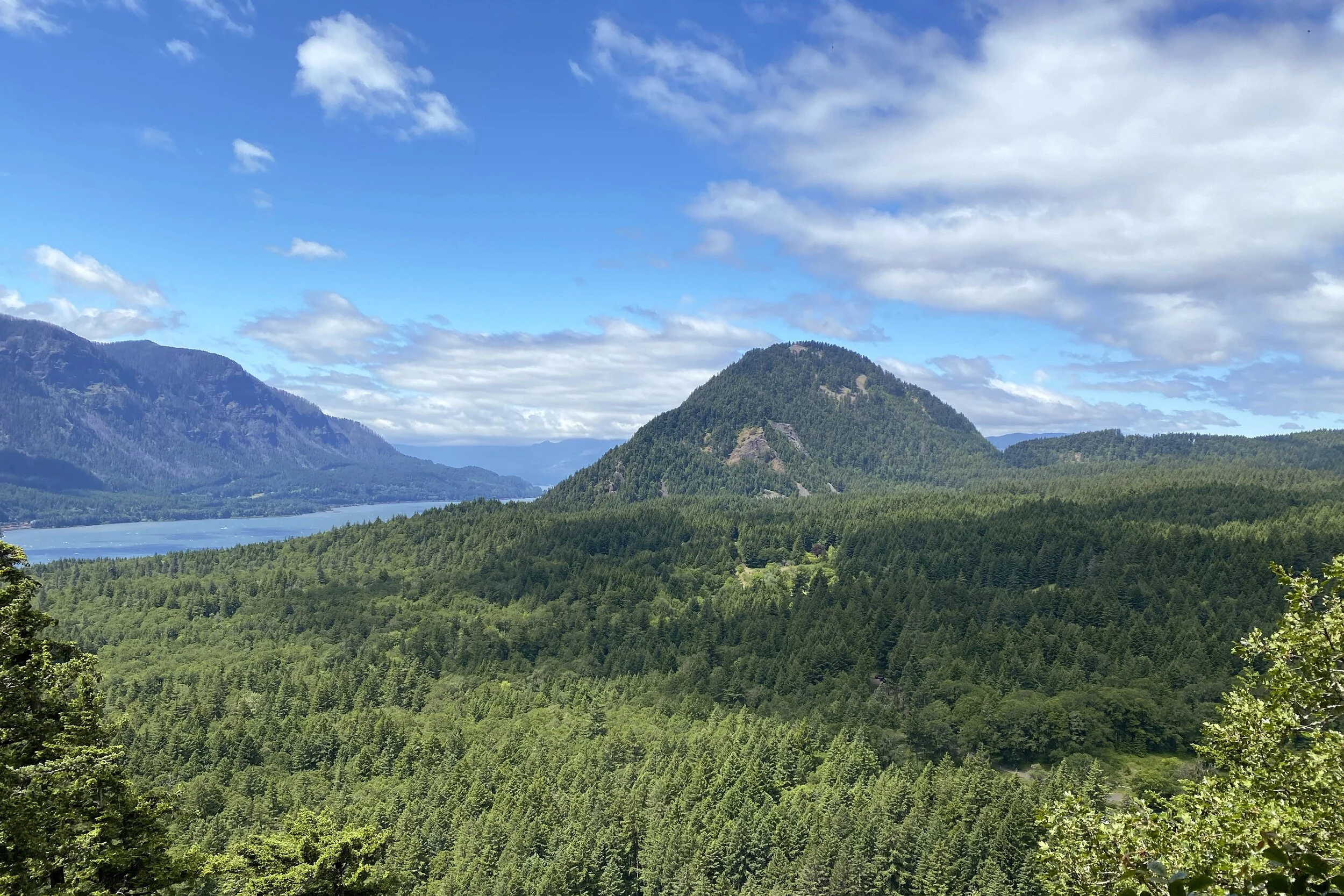
Hamilton Mountain
Hamilton Mountain Loop—19-May-2021, 8 mi, 2,525 ft gain
This was one of the two major hikes we had planned for the Columbia River Gorge area. We were wondering how crowded the parking lot would be, and as it ended up, we were probably the third car there; we tried to find a spot that would stay in the shade during the hike.
Several sources of information about the Columbia River Gorge area mention poison oak, mostly around Dog Mountain, but there were warnings for Hamilton Mountain, too, so we added a layer of preventative gel to the sunscreen. With that, we were on our way.
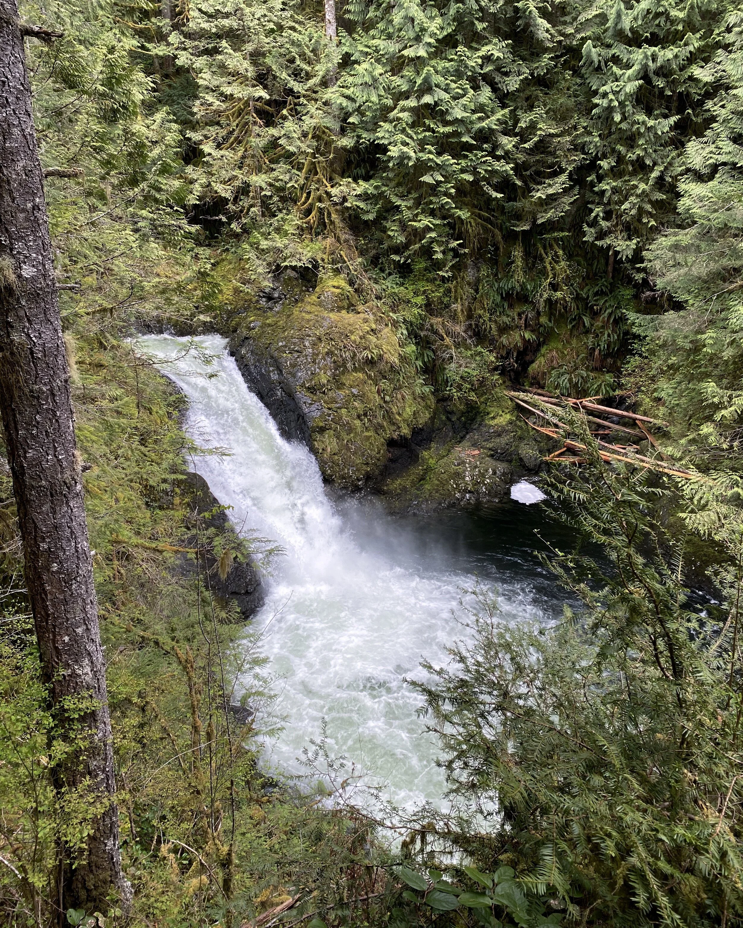
The hike starts with a quick gain of 500 feet in about ¾ of a mile, then levels out a bit. There's a quick spur trail to Hardy Falls, which one of the guides we read said wasn't worth going to. We decided to take a look anyway, and while the falls were pretty far away, they still were nice to look at and listen to. However, the real gem was not much further; just before Hardy Falls, a spur takes you up to the top of the falls, where you look into a grotto and see the Pool of the Winds, with a waterfall going into a pool. It's probably the most exotic scene we saw on the whole trip.
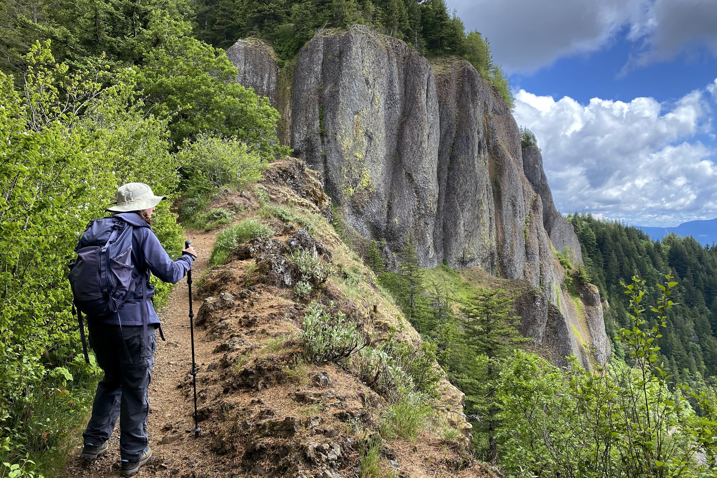
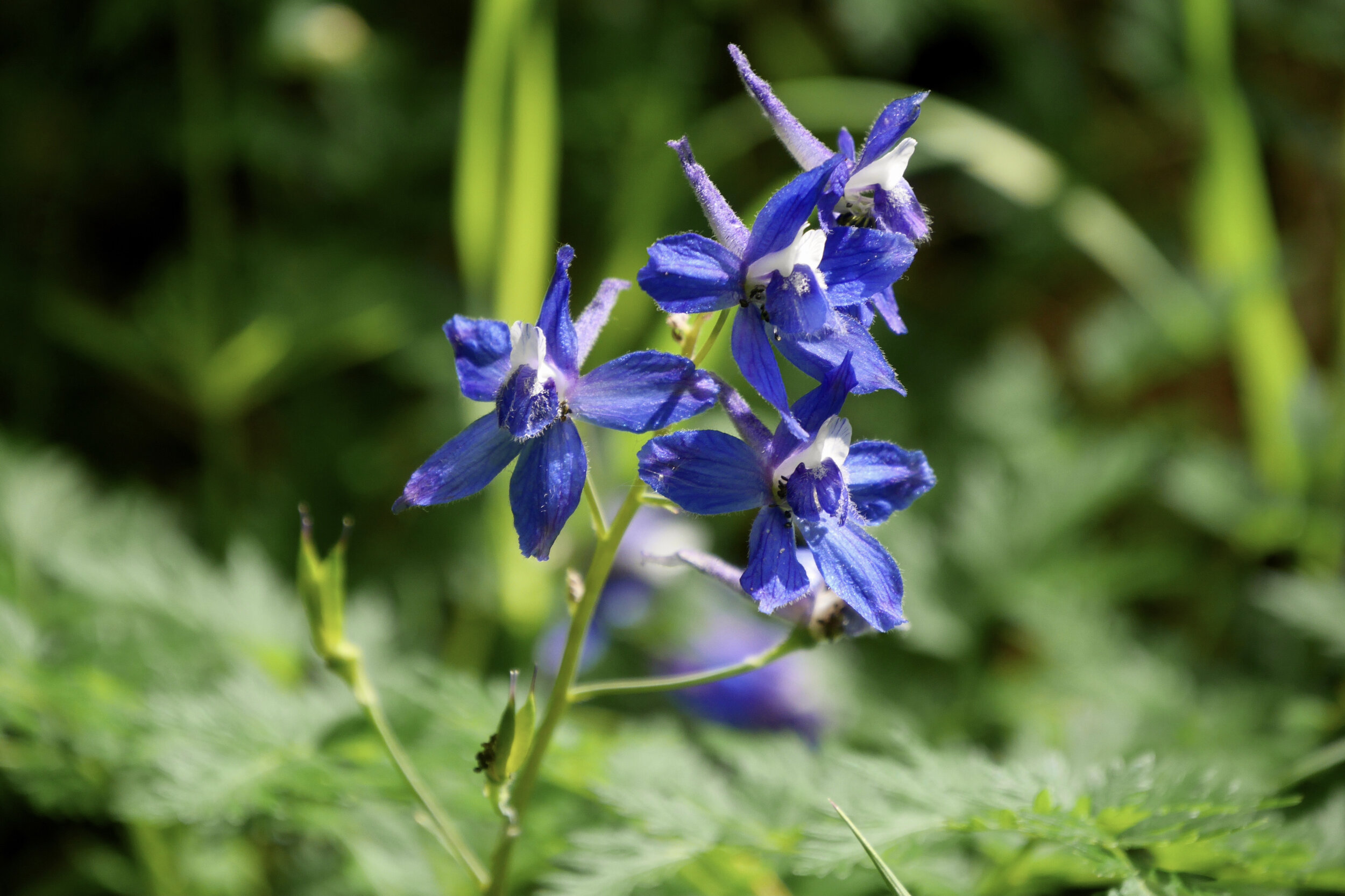
We worked our way back to the trail to get a look at Rodney Falls proper, which had lots of great angles. We got to a fork and knew we wanted to go counterclockwise on the loop, so went to the right. After a long switchback, there was a lookout where we got good views of the basalt cliffs and the Columbia River, including Bonneville Dam. There were also a lot of wildflowers out: fireweed, checker lines, larkspur, and others. Next, we went through several very short ones, quickly gaining altitude. There were a couple of other smaller viewpoints, some requiring a bit of scrambling.
The trail then went along near the top of Little Hamilton Mountain before turning into many switchbacks making the final climb to the top of Hamilton Mountain. We got to the top, but there was so much growth that we didn't get any view off the mountain. Figuring we would want a more picturesque spot to have lunch, we went along the ridge a bit and found a short spur that went up a bit higher and looked out towards the east, a good place to take a rest.
Instead of going back down the way we came, we went along the ridge, followed a couple of service roads, and returned to the car along the Hardy Creek. Even though it was a longer route, it wasn't as steep, always nice for the knees on the way down.


Catherine Creek Arch
Catherine Creek Arch Loop—20-May-2021, 2.25 mi, 515 ft gain
For our off day on the Columbia River Gorge trip, we did a quick loop to Catherine Creek Arch. After parking, we got out of the car to wind so extreme that we tried to only have one door or the hatch opened at a time to prevent things from flying around the car. We debated how much of our hiking gear to take and decided that boots and poles wouldn't be too overkill, so went with that.
Some of the trip reports for this trail reported that the beginning of the trail is somewhat tricky to find, and we had a couple of false starts. It did help to have live maps which helped us to correct pretty quickly. Once we were on the right path, we crossed Catherine Creek and quickly got to the arch.
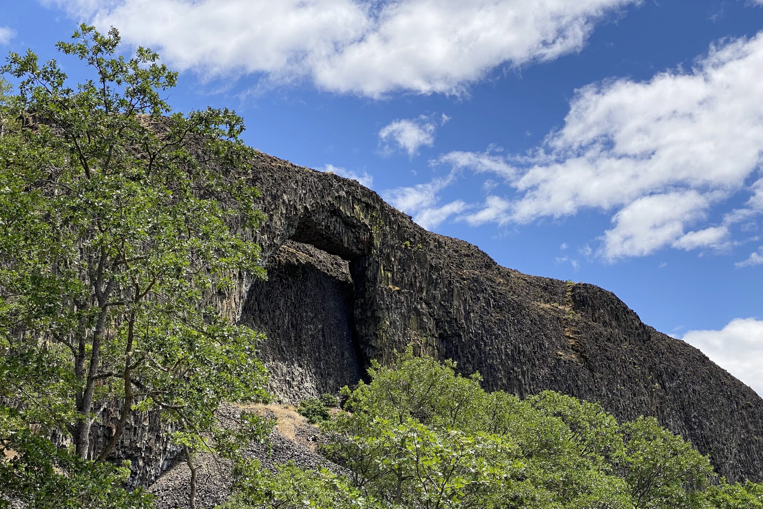
The Catherine Creek Arch isn't like what you would see at, say, Arches National Park. It looks like a big, vertical slab of rock with a hole towards the top. At first, it seems like a hole in the rock rather than an arch, but if you look closely, you can see there's more rock behind where the arch is. When the light is right, and it was for us, you can see the back rock lit up, showing that there's a gap and there's an actual arch.
Continuing on the trail, we proceeded to loop around to the top of the hill behind the arch. Wayfinding was a bit tricky there, too, as the trail that the map indicated seemed to be closed off. We wandered a bit on some of the other trails, but after not seeing how it would loop back, we went ahead on the trail on our map and ended up at the right place. While we were above and behind the arch, we could only see the gap between the arch and the rock we were on, but not the actual hole. People used to be able to go up to see the hole, but there's now railing both for safety and because the area is a sacred Native American site.
Leaving the top of the arch, we got more views of the Columbia River, worked our way down to re-cross a footbridge over Catherine Creek, and back to the car. Fortunately, the wind had died down during our hike.


Dog Mountain
Dog Mountain—21-May-2021, 7 mi, 3,000 ft gain
The other major hike we had planned for the Columbia River Gorge was Dog Mountain, probably one of the most popular hikes in the area. We drove by the parking lot on our way to Hamilton Mountain, and there were still several spots remaining. However, that was on a Wednesday, and we were going on Friday, so we tried to head out not too late. Good thing; the lot was already ⅔ full when we arrived at 8:15. Of all the trails in the area, this one had the most warning about poison oak, so we made sure to put the prevention gel on.
The numbers of this hike look daunting, with 2,800 feet of gain in 3 miles, but we managed to find a good pace. After the first ½ mile, there's a sign that points to the new trail (“Difficult”) and the old trail (“More Difficult”). We went to the new trail since that way would give us views of the Columbia River.
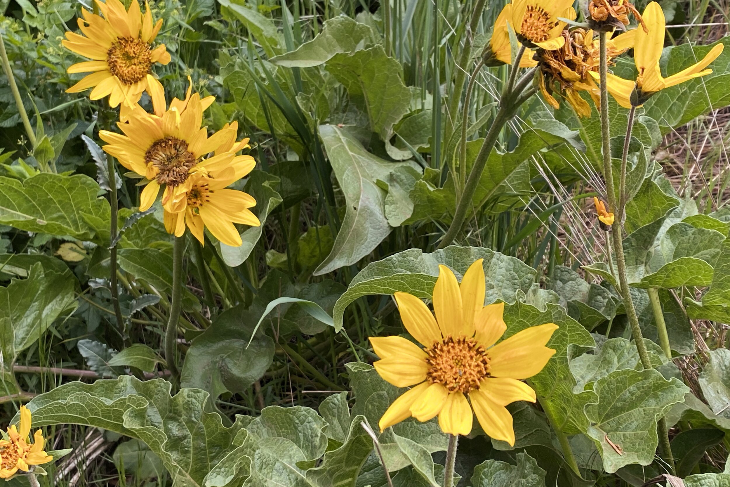
After even more climbing, we came to a clearing called Puppy Dog which gave us our highest view of the Columbia River yet. Since the viewpoint was so exposed, the wind was quite extreme, so we ended up putting on an outer layer since it was a chilly wind. Several people were on the trail (not surprising given the parking lot), so there were several of us admiring the view at the same time. Not only were we looking at the river, but also the flowers; from where we were, the mountain was covered almost to the top with balsamroot, and it got denser as we continued.
In addition to the views, a light rain started up, but it was light enough that our hats kept us dry enough for the final push to the top. Once we got there (close enough; it was pretty wooded for the final few feet to the actual peak) we saw several people eating lunch on the slope. It was still early, but we found a seat and snacked while we admired the view. Unfortunately, we were high enough that most the view was mostly obscured by fog, but we did see some birds seemingly motionless against the wind.
We worked our way off the peak and into some light hail. We were happy that was short-lived and switched to light rain. After getting off the peak, we turned north to the connector to the Augspurger Trail, a longer but less steep way down. There was more tree coverage, with the understory being extremely green.
Partway down we found a small clearing with a couple of women having lunch. They were just finishing up so we waited and sat down to have our lunch. After we continued, it wasn't too long before we came out of the trees and started seeing glimpses of the river again.
Back at the car, we put things away and saw that the parking lot was still full, but cars were starting to leave with others filling most of the newly empty spots. As we were driving away, we saw several cars parked along the road, so we were happy we started when we did.


Dirty Harry's Balcony and Museum
Dirty Harry's Balcony—13-Jun-2021, 6.5 mi, 2,075 ft gain
It was back to the Snoqualmie Pass area for what ended up being our only hike in June. Melody had been here before, but this was my first time.
Most people just go to Dirty Harry's Balcony, which itself gives a great view. However, if you continue on the trail to Dirty Harry's Peak, there's a boot trail that goes into the forest which takes you to Dirty Harry's Museum. That was going to be our destination.
Even though we didn't leave extremely early, we were able to grab one of the spots in the parking lot. There was a chance of drizzles and the skies were overcast, so we weren't sure what kind of views we were going to get. Nevertheless, we started.
The beginning is a short trail that takes you to a road where you cross the South Fork Snoqualmie River. We saw someone fly fishing in the river, but not far away the water seemed to be rushing quite quickly around a bend. The trail picked back up on the other side of the bridge.
The trail started mostly level, then we started gaining altitude at a pretty good clip. There were several peekaboo views, but there was enough fog that we had a hard time even seeing the hills across, but McClellan Butte stood out since it was so close and prominent.
We finally got to the turnoff for Dirty Harry's Balcony, and the view was still pretty obscured. There were several people eating lunch there, but we decided to press on, figuring we didn't have too much further to go to the Museum.
There are no signs to indicate where to turn to get to Dirty Harry's Museum, but our live maps let us know that we were nearly there when we got to a river that crossed the trail. In reality, there was also water coming downhill on the trail itself, but we took the museum cutoff at that point.
We were glad to have the live maps since there were a couple of places where we had to double-check which way to turn. After a little more, we could see the rusty truck and knew we found it.
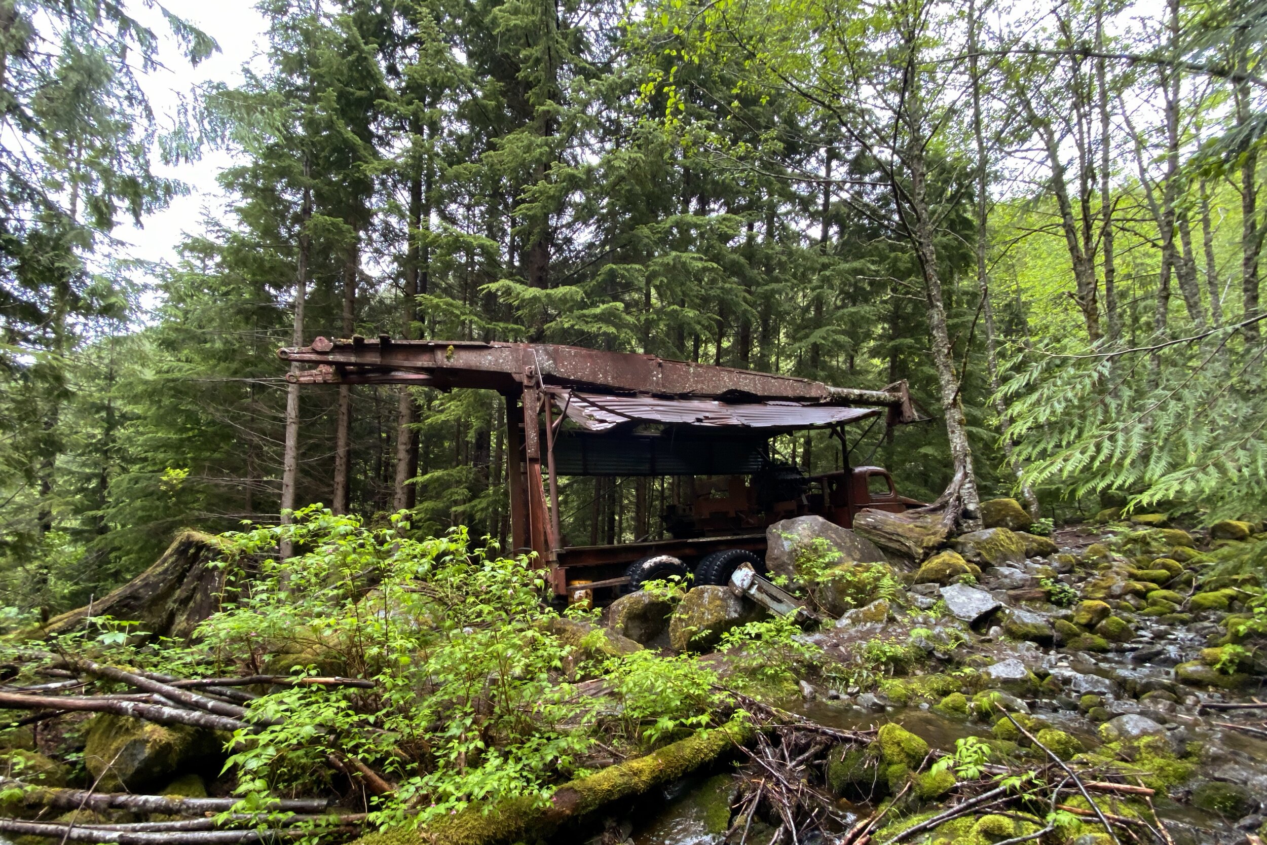
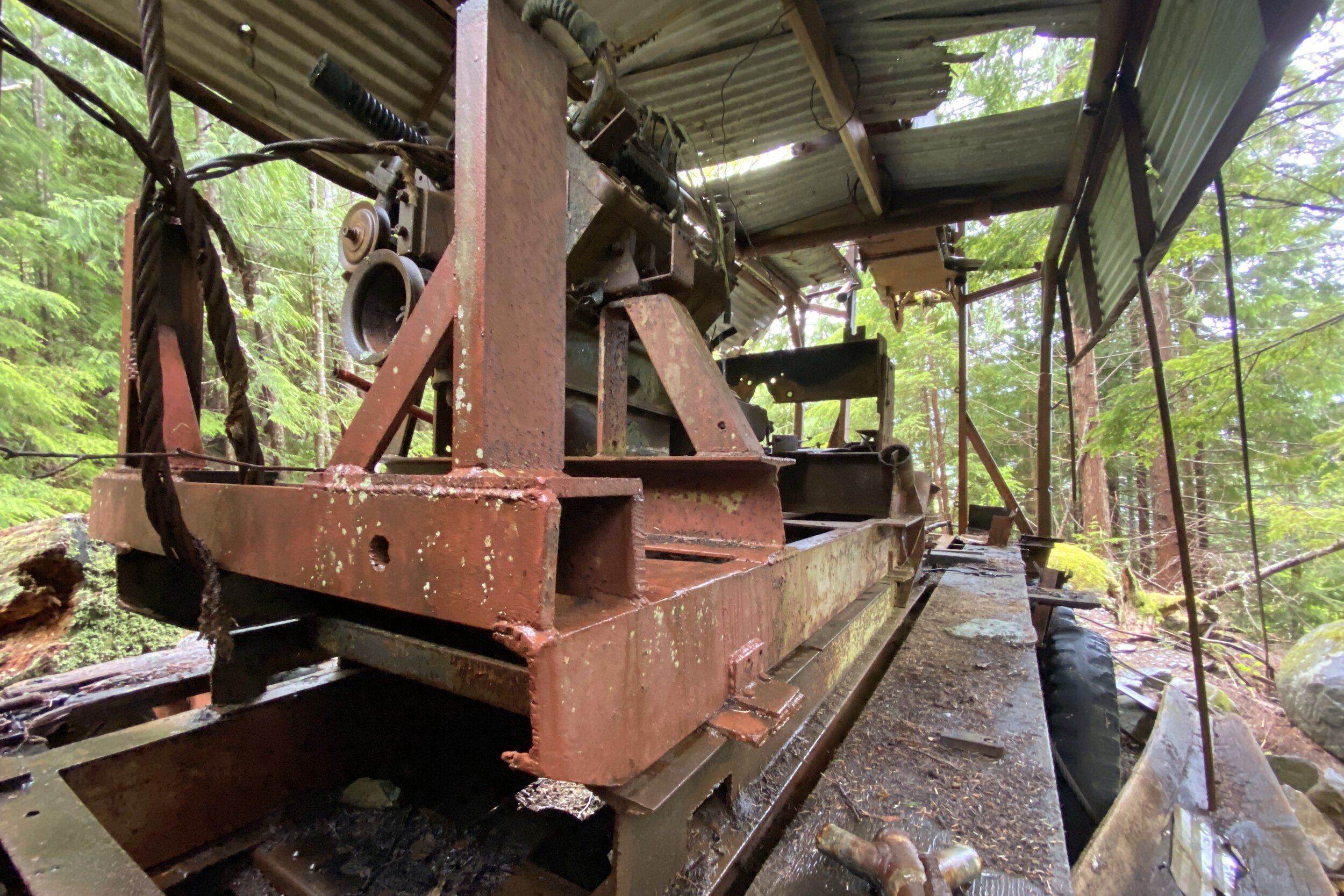
It's called Dirty Harry's Museum, the contents being an old logging truck that had been abandoned. Just who was Dirty Harry? That would be Harry Gault, a logger who would harvest trees in places other loggers thought were too remote and inaccessible. He took a GMC CCKW “Deuce and a Half” (2½ ton), 6×6 truck, and built the logging mechanism onto it. It looks like the truck got a lot of use before being abandoned in the woods.
We walked around the truck, noticing the radiator cast off to the side and the rubber eroded off some of the tires revealing wood inside. The driver door stays conveniently open so you can view the cabin, too.
This seemed like a better place to have lunch than the balcony, so we found a log and started eating. We then got up, looked around the trick a bit more, then started working our way back. We saw another group of people looking for the truck on our way out to the trail; they were at the first turn, and we were able to point them in the right direction.
The hike back was uneventful, although some of the fog had cleared. We decided to not check out the balcony again but did enjoy the clearer glimpses of McClellan Butte. There seemed to be a few more cars in the lot, but it still wasn't full.