

Hikes May–September 2022
Our spring and summer hiking went in spurts, then we did several during a week-long road trip. We even made it to Idaho for the last hike.
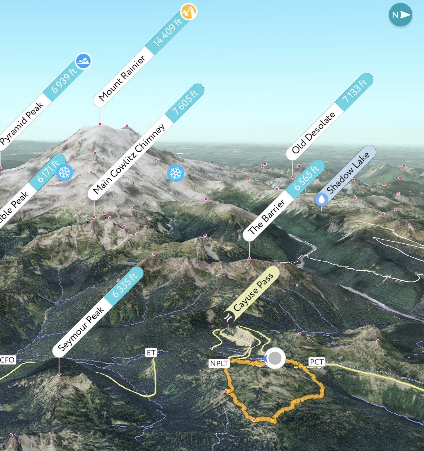
The image of the hiking track shows is a 3D rendering, with our route in orange (the grey/white circle with the blue arrow is our starting point). The graph shows our altitude (the top one) and our pace (the bottom line). It also shows both distance (white numbers at the bottom) and where we were at the various hour markers (black numbers at the top).
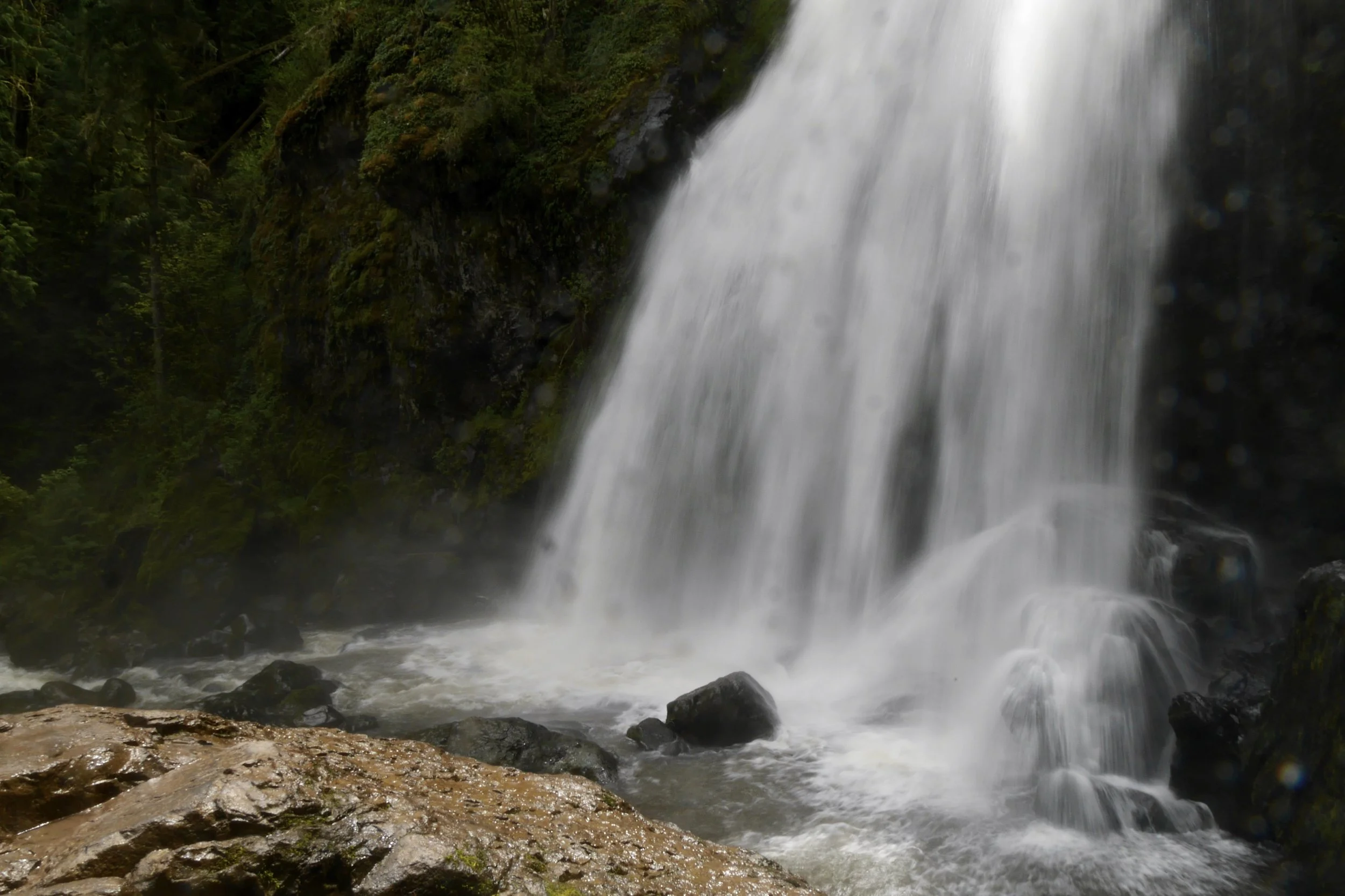
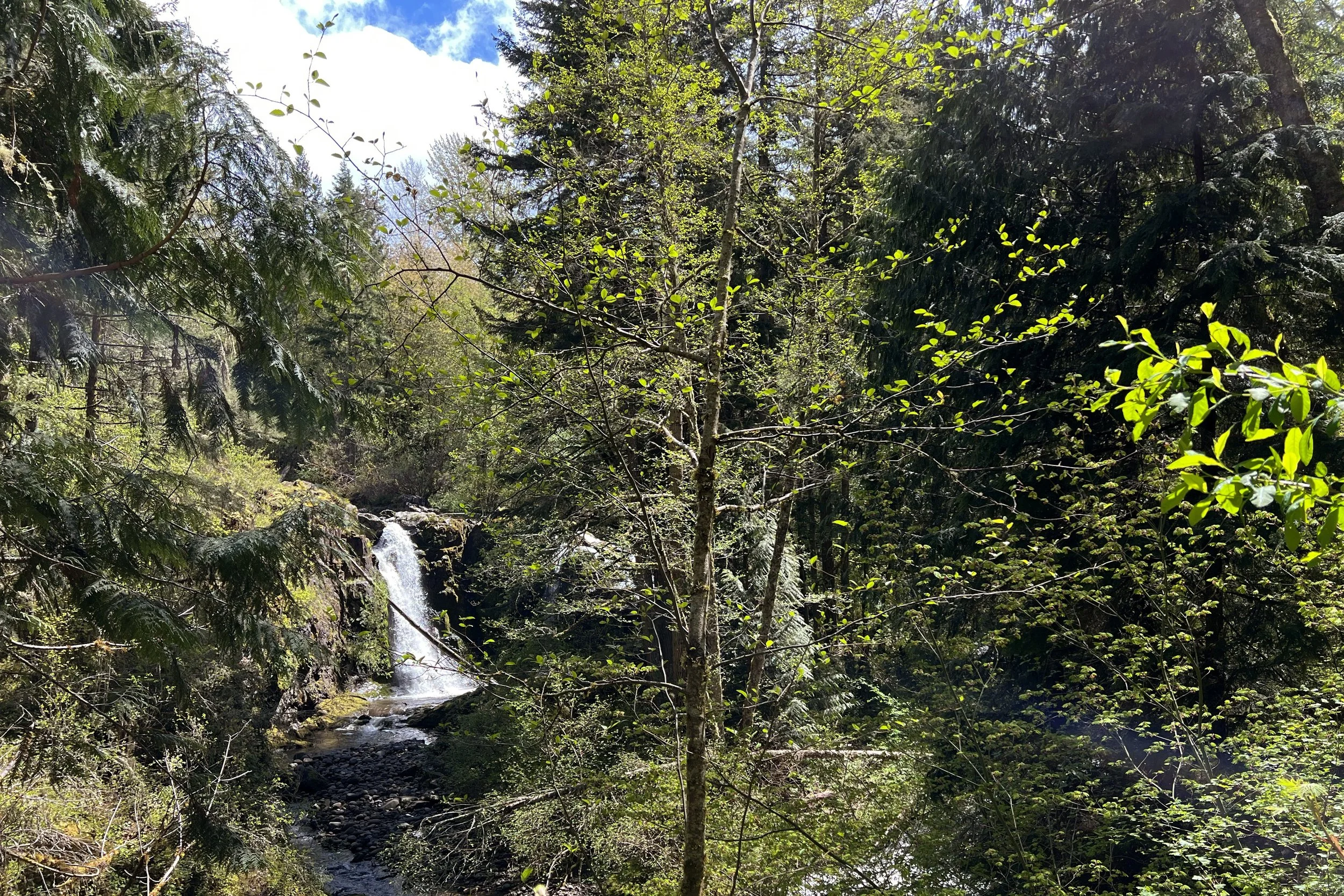
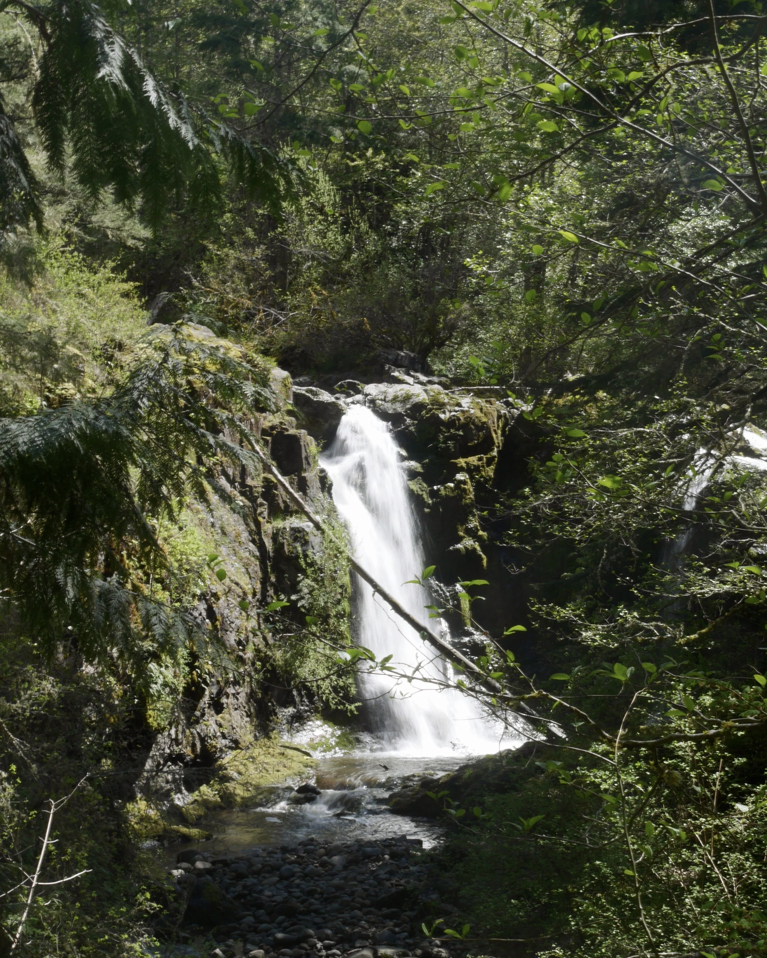
Little Mashel Falls
14-May-2022
5.3 miles, 750 ft gain
We went on this hike mostly for looking at the falls. It was also good for the first hike of the season (our last time out was snowshoeing in early March) because of the mild elevation gain.
When we pulled up to the parking area, it ended up there was a gathering going on, so we were waved further down the road than we originally would have been. After going to the gate which indicated where the hike began, we turned around (it was very muddy, so we were glad we wouldn’t be parking there) and found a parking place not too far down the road. Of course, after we left the car, we realized we had forgotten to put out our pass, so we went back to do that.
After walking past the gate, we continued on a road until we saw a painted rock that indicated the turnoff for the falls. However, we continued on the road to try to catch a peek at Tom Tom falls, which you can’t see from the trail.
Backtracking a bit, we followed the trail down and turned off towards the middle falls. We were able to see them both from the top and the bottom and had a great view from both locations. We then went back to the main trail to head down to the lower falls, but that part of the trail was closed.
By this time we were ready for lunch, so we circled back to a bench near the middle falls to do so. After that, we decided to take a look at the view of the upper falls, but it was pretty obscured.
The way the trails are set up, you end up doing a lot of backtracking and looping around to get to all the viewpoints. We saw some of the same people several times. There were so many people that we were wondering if some of them came from the road down the hill from the lower falls.


Oyster Dome and Lily Lake
20-Jun-2022
6.5 mi, 1,325 ft gain
It had been a while since we went on this hike. This time, we only went out to Lily Lake, rather than also going to lizard Lake.
Having parked, we saw a trail and started heading out. However, we would have started going counterclockwise, but we wanted to go clockwise, so we doubled back and found the trail at the other end of the parking lot.
The weather was overcast, which made it nice when climbing up the dome. Fortunately, the clouds were high enough that we still got good looks at the Skagit Valley and Samish Bay on the way up, but we couldn’t quite see Lummi Island (let alone Orcas or Vancouver Islands). Several people were eating their lunch on the dome, but we opted to continue.
Just before getting back to the loop, we took the short spur to Lily Lake, where we found a place to have lunch. Ends up, we ate lunch at the same place last time we were on this trail. There were people at the other end of the lake and one person in a boat, presumably fishing.
Back at the loop, we made quick work of working our way down the hill, and before too long we were back on the part of the trail we had started on, which meant we were close to the car.


Mason Lake
7-Jul-2022
6.8 mi, 2,350 ft gain
This is another trail we had done before, but last time, we weren’t able to get all the way to the lake. We were able to get up to the ridge just fine, but the path down to the lake still had snow and looked too slick since we didn’t have microspikes. This time, we knew we would have good weather and trail conditions.
Early on the trail is a large log bridge where you get a great view of a waterfall. It’s a popular photo spot in both directions.
As we started on the way up, we got several views of three peaks, the Duke of Kent, Mount Kent, and McClellan Butte. Their shapes definitely stand out.
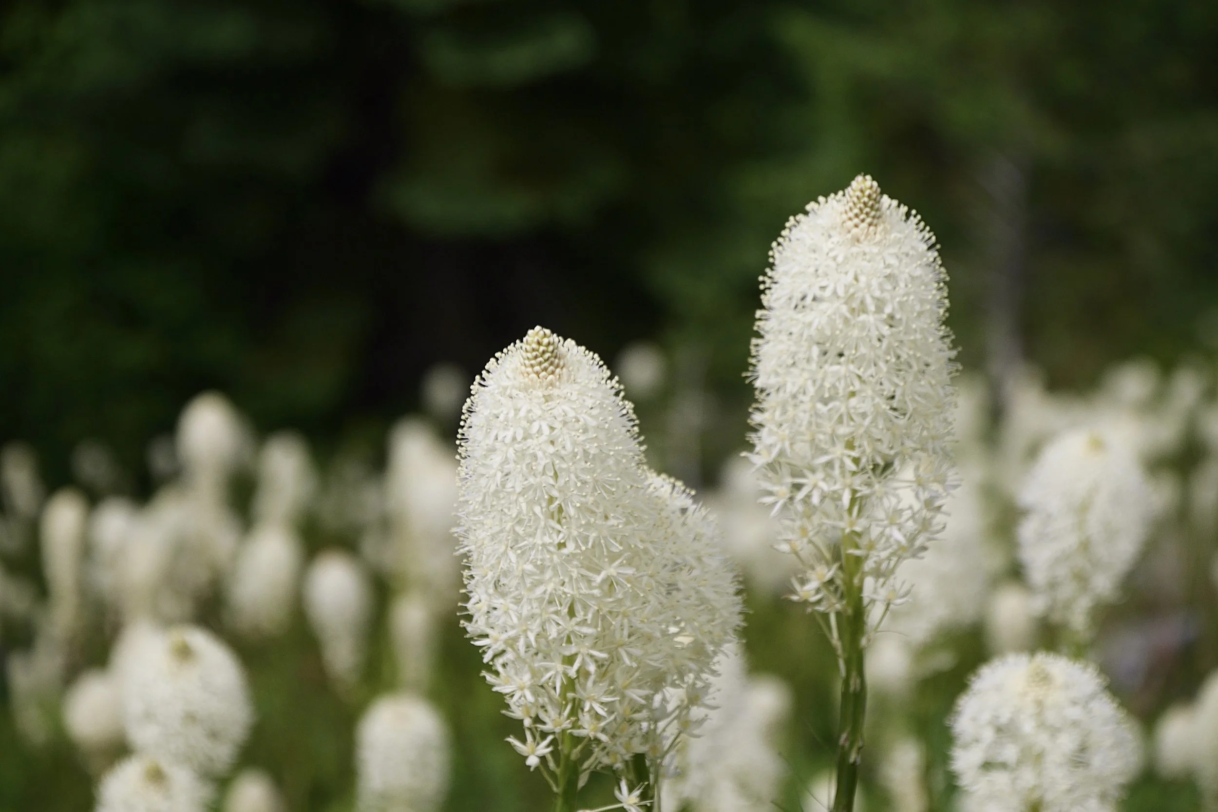
The hill we were walking along was quite steep, and before too long we saw a burst of beargrass. Probably the last time we saw so much of the flower was in Glacier National Park.
Even though we knew the trail wouldn’t have snow on it, we were still relieved when we got over the ridge and started down to the lake on a snow-free path. There were a couple of wet spots, but other than that, it was bare and dry.
The trail reaches the lake where water exits, so we ended up doing some rock hopping. We found a place with a great lake view to have our lunch, then we walked around the lake for a little bit before turning around and heading back.
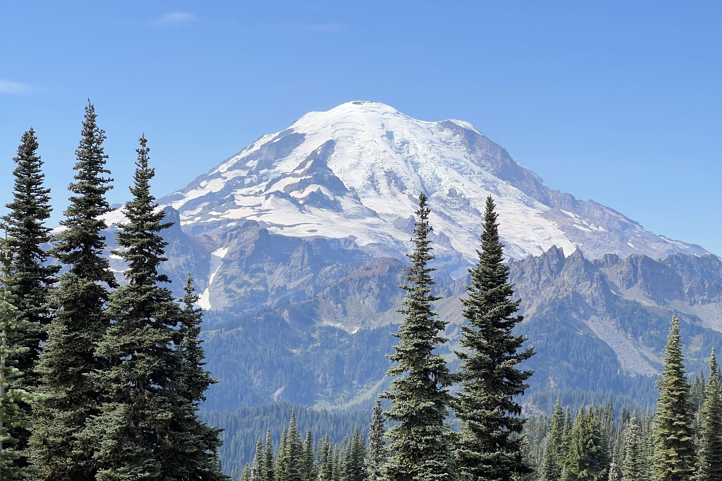
On the way back, the clouds had cleared enough for a view of Mt. Rainier. On the way up, we had kind of squinted to try to find it and even got out a mountain location app to check where it was. It was nice to get confirmation of Rainier’s location on the way down.


Skyline Loop
19-Sep-2022
5.6 mi, 1,250 ft gain
We were in Mt. Rainier National Park for a few days with Melody’s sister Celeste, so we tried to pick some hikes that would be representative of various areas. Because of driving times, we concentrated on the Paradise and Sunrise areas, as well as trails on the way out towards Yakima. The Skyline Loop was our Paradise hike.
Since we were driving from Seattle, the parking lot was full, but we were able to score a stop in the overflow lot.
The beginning of the loop is paved. It ended up being more difficult to go up a paved slope than if there were rocks and steps, but the pavement is probably to make Glacier Vista more accessible. On the way, we saw a deer mere yards away just minding its own business.
We could see Mt. Rainier from the beginning of the trail, and it only got bigger as we approached the vista. Once we got up there, the trail turned to dirt and soon turned east around the mountain.
With all of the cars, we weren’t sure how busy the trail would be. After seeing several people near the beginning, we figured it would start to taper off after Glacier Vista. it did, for a while, but then we saw several people working their way up to Panorama Point. We joined dozens of people who were having lunch and enjoying the view of Rainier and the Nisqually Glacier. We weren’t able to see Mt. St. Helens, Mt. Hood, or Mt. Adams, however, they are supposed to be visible on a clear day.
After lunch, we continued on the loop and started to lose elevation. We saw where there would be a trail through a snow field but that was closed off. We heard Sluiskin Falls but weren’t able to see it among the trees. We also saw the Stevens Van Trump monument, which commemorates the first documented Rainier ascent in 1870. There was a hiker content to rest in front of it, so we didn’t get a full view (or a picture).
There was another loop trail that went to Reflection Lakes, but we decided to not add 4 miles to our hike. We did, however, go down the short spur to look at Myrtle Falls. It was very popular with the selfie and video crowd, especially since Rainier was perfectly centered above them.
It was only about another half mile before we returned to the visitor center.


Mt. Fremont Lookout
20-Sep-2022
6.7 mi, 1,100 ft gain
This hike out of Sunrise on the eastern side of Mt. Rainier has been on my list for several years, although Melody has done it before with her mid-week hiking group.
Since we were staying relatively close to Sunrise, we had no trouble parking close to the trailhead.
Once we started, we pretty quickly started going up to Sourdough Ridge towards Mt. Fremont. After going past Frozen Lake, we got to a crossroads and turned to start climbing along Mt. Fremont.
We gained altitude at a pretty good clip until we turned around the corner and caught our first sight of the lookout in the distance. From there, the trail was pretty level until we did a bit of climbing again to get to the lookout. We worked our way around the lookout and turned around to a view of both the tower and Mt. Rainier. Normally you could go up the stairs and stand on the tower’s deck, but there was someone doing paint maintenance, so we weren’t able to do that.
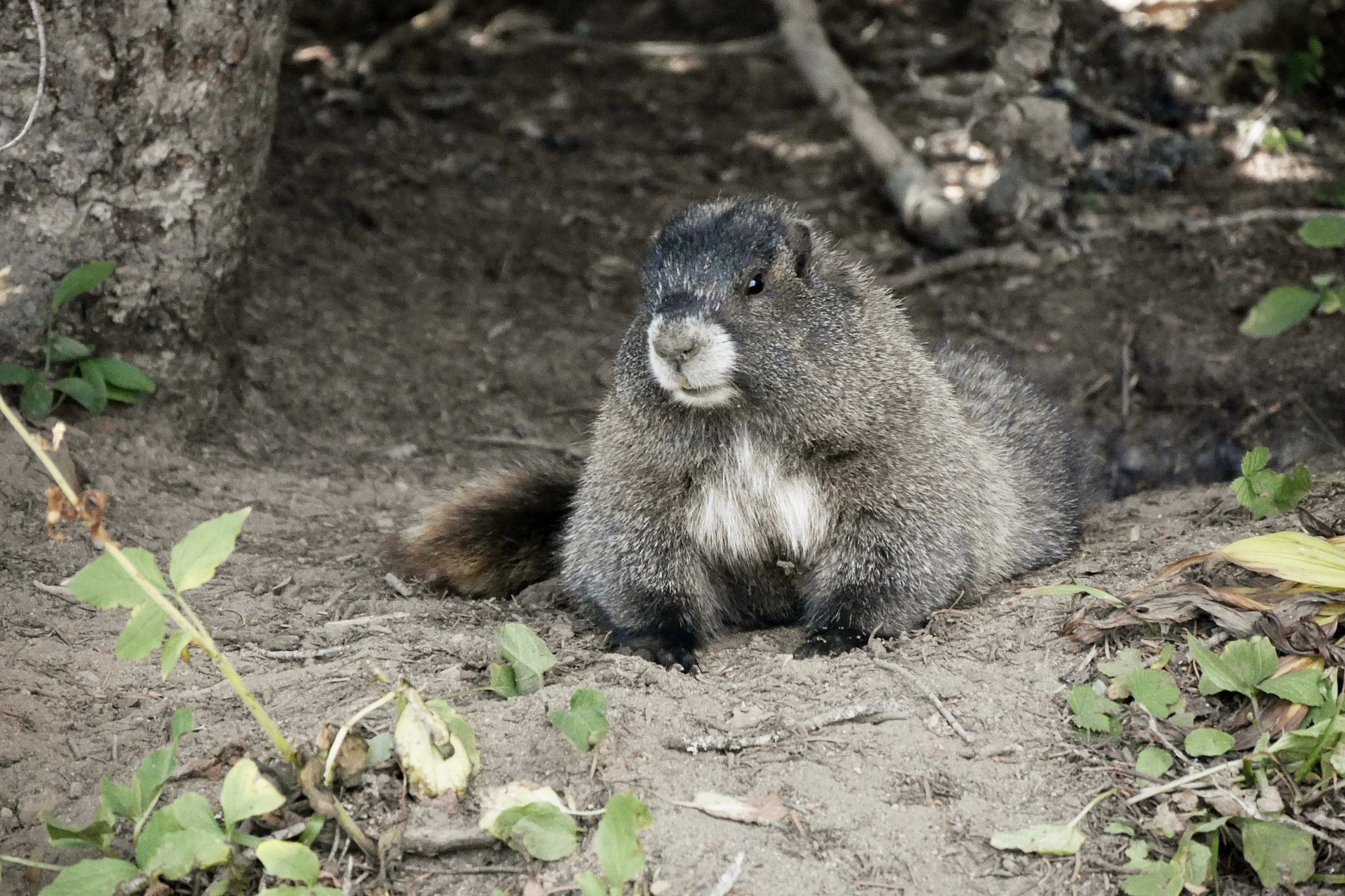
The far side of the tower was a good place to grab some lunch. Chipmunks were running all over the place, and one even jumped into Celeste’s lap.
Done with lunch, we started working our way back around and down Mt. Fremont, then back to Frozen Lake. Instead of going back to the trailhead, we went straight towards Sunrise Camp. Just past that we went down to Shadow Lake, walking all the way around before continuing back to Sunrise.


Silver Falls Loop
21-Sep-2022
2.9 mi, 300 ft gain
This was one of two shorter hikes we did on the same day on our way to Yakima. This trail was practically all in the trees, so we weren't expecting any views of Mt. Rainier.
Starting out, we walked by some hot springs. By the trail, the water spreads out over some rock so you don't feel a lot of warmth.
About halfway around the loop, we came across Silver Falls. A bridge across the Ohanapecosh River gave us a great head-on view of the falls. After crossing, we took a short detour to see the falls from the side. After that, it was a pretty straightforward hike back to a road where we re-crossed the Ohanapecosh River to get to the car.


Naches Peak Loop
21-Sep-2022
3.6 mi, 740 ft gain
Melody had heard about this hike, and it was on our way out, so we stopped to check it out. The parking lot was small, but there were still plenty of spaces.
Starting out, you immediately get to Tipsoo Lake. The loop starts there, and we decided to go clockwise, so we took a left at the lake. The climb started right away, and before we knew it we were crossing the road on a bridge we would later drive under. After that, we were ready to start going around Naches Peak.
The view of the mountains was great, and before long we were at a small pond that had large rocks which made a great place to have lunch. Having eaten, we continued around the peak.
Once we passed the far end of the loop, we caught a glimpse of Dewey Lake. After going over a small ridge, we started seeing views of Mt. Rainier that just kept getting better as we went along. We came across several hikers who were amazed at the view. One couple had come up counter-clockwise and were almost at the best view of the mountain. The husband went past us, but the wife was asking how close they were to good views. We reassured her that where her husband was standing was as good as it gets.
Eventually, we made a final turn and said goodbye to the Rainier views. We started losing altitude pretty quickly, and soon we were back at the road. After crossing, we went past a field, then were soon on the other side of Lake Tipsoo, which meant we were just about back to the car.


Mineral Ridge
24-Sep-2022
3.4 mi, 835 ft gain
We wanted to do a bit of hiking around Coeur d'Alene Lake, and this hike around Mineral Ridge looked like a good option.
After driving past the city of Coeur d'Alene, we continued along the north side of the lake, driving around Wolf Lodge Bay until we got to the small parking lot. We were early enough that there were only a few cars in the lot, so that was good.
The first part of the hike was working our way up to the ridge. We would normally do the steep climb first (easier on the knees than doing the steep part going down) but the trail was designated as one-way, so we took the gradual way up.
Once on the ridge, we left the loop trail to go the other way on the ridge. We came to a point where you got a great view of the bay in both directions. We continued to see the bay on our way back to the main loop.
As we continued along the ridge, we also started seeing into Blue Creek Bay, on the other side of I-90 from Wolf Lodge Bay. Once we got to the end of the ridge, we could see a good part of the main lake, but nowhere near all of it (the lake is quite large). Several other people were enjoying the view, so we hung around until after everyone else had started down.
The trail down to the parking lot was pretty steep, with tight switchbacks, but didn't seem as exposed as on the way up. Before too long, we got where the trail split into a loop, and were quickly back at the car.
All along the trail were markers that were meant to go with a trail guide, but there weren't any left at the trailhead. It's not clear how often they restock them.


